Read next
The latest news, updates and expert views for ambitious, high-achieving and purpose-driven homeowners and property entrepreneurs.


This article will take you step-by-step through the process of preparing your planning drawings that will increase your chances of getting planning permission.
It not only shows you how to craft your planning drawings, it explains what resonates with development projects and why. You'll get examples of great planning permission drawings examples and an explanation of why they work so well.
Best get started with it the definition of planning drawings...
Planning drawings are the architectural drawings our clients have to submit as part of any planning permission application they want to make. They are an essential tool for architects and clients to communicate their vision so that planners can understand how their project fits into the landscape as a whole.
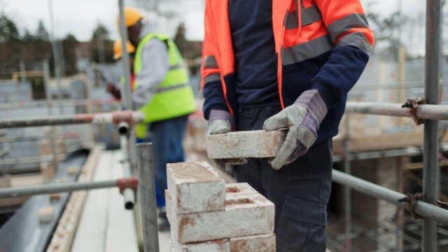
The truth is these drawings need skill, experience and precision in their execution to correctly convey the project’s dimensions and scale to the planning officer, so that they approve the application as a whole. Later on, these planning drawings are key for the construction and fit-out of the project.
Planning permission applications mainly entail written descriptions of the development to take place - a complex task by itself - but planning drawings give a necessary overall impression of what the project looks like in relation to its surrounding buildings. Given that many council planners are often overworked and stressed, these planning drawings can present visual information in a format that is quicker to understand in terms of project's general layout, massing and context.
This is a really useful and efficient way for the planners to get an initial impression of the project and see how it fits into its surroundings, before they examine the details of the project in the extended written section.
Given their need to quickly transmit spatial and contextual information to the planner evaluating your case, planning permission drawings are different from those you might find in other, later stages such as Building Control. At this early point, planning drawings don't need to be overly detailed as building regulations drawings (and indeed, sometimes it is better not to give the planner something to pick holes in!) but they should provide an accurate impression of the effects the project will have on the immediate surrounding on scale of ranging from 1:1250 to 1:50.
Now you know what planning permission drawings need to do, below we’ve listed some planning permission drawings examples that you'll need in your application to help you understand why they're so important, as well as the differences between the various kinds.
Let's get started...
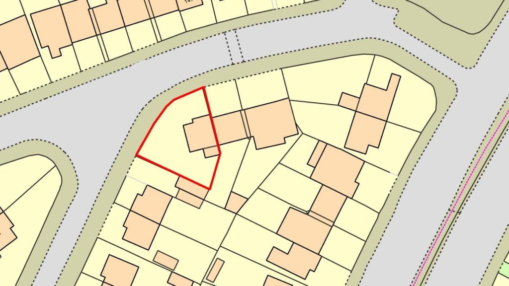
Basically, A site location plan is a map base that shows the location of the application site in relation to neighbouring roads, buildings and other land. These plans give an idea of the density of an area and help to judge whether an extension or new development is appropriate to the surroundings. Site location plans should:
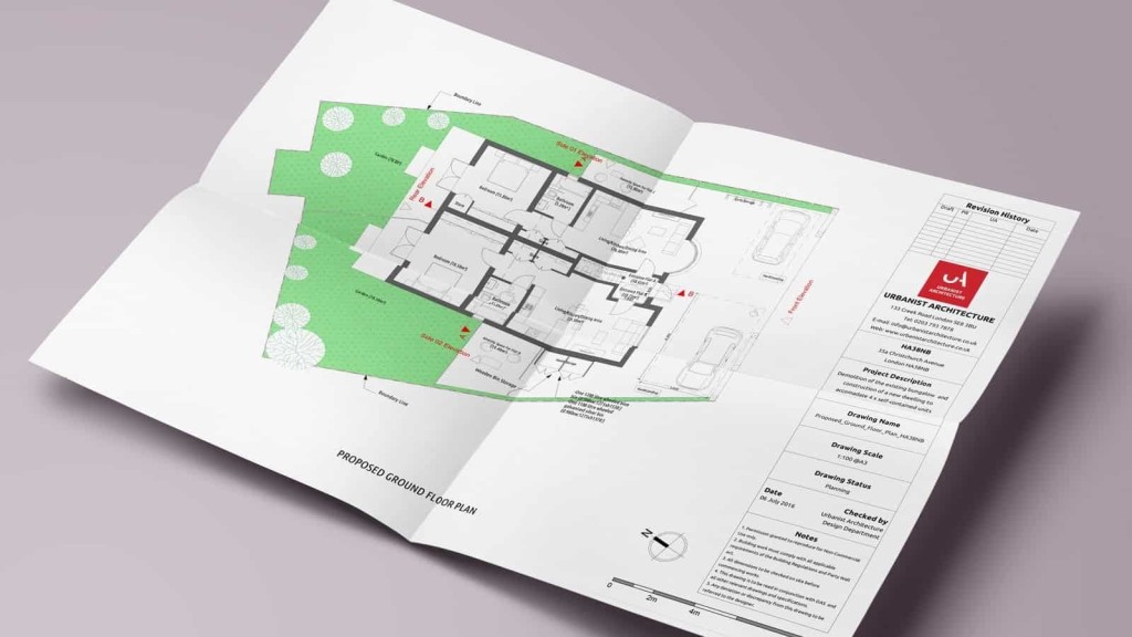
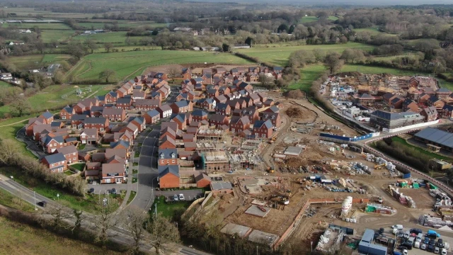
A site layout plan is more detailed in scale, and shows a more comprehensive layout of your particular site. It specifies the relationship of the proposed works with the property boundary, nearby roads and neighbouring buildings.
Given this need for detail, these drawings are often time-consuming, but this is where our expertise comes in and where our services are of most value to you. Most applications should include an existing site layout plan as well as a proposed site layout plan. For simple applications the existing and proposed site can be combined and shown on one plan as long as what is existing, what is proposed and what is to be demolished is highlighted and annotated clearly. In addition, site layout plans should also:
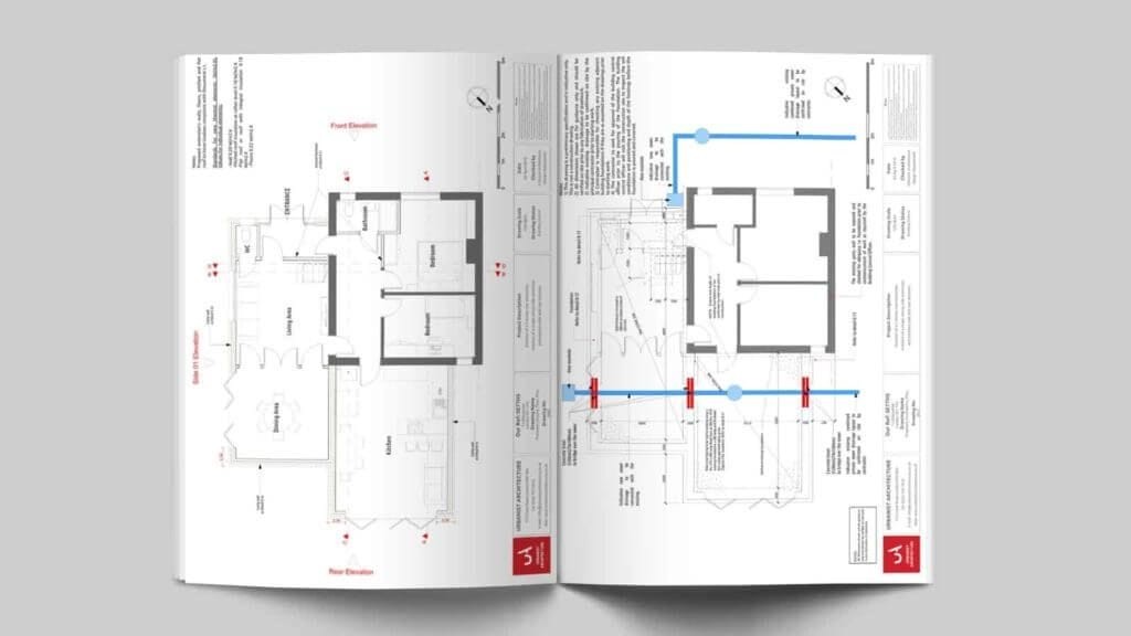
Elevations are essential planning application drawings as they show what a building will look like from the outside before and after development - these plans focus on the general 'massing' of the building project as a single unit rather than within its surroundings.
But one thing’s for sure: In most cases, two separate sets of elevation drawings will be required, “existing” elevations showing the building as it is now and “proposed” elevations showing how the building will look, after the works have been carried out. As a key piece of planning applications, elevations need to convey a lot of information in a generally accepted way, and should:
Remember: You need to describe what the roof covering, wall facing and window frames and doors will be made of in addition to their design, e.g. “double roman concrete tiles”, “roughcast render” etc. If the proposed materials will be an exact match for those on the existing dwelling, this may be stated on the plans.
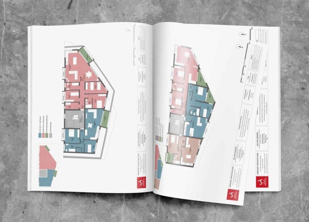
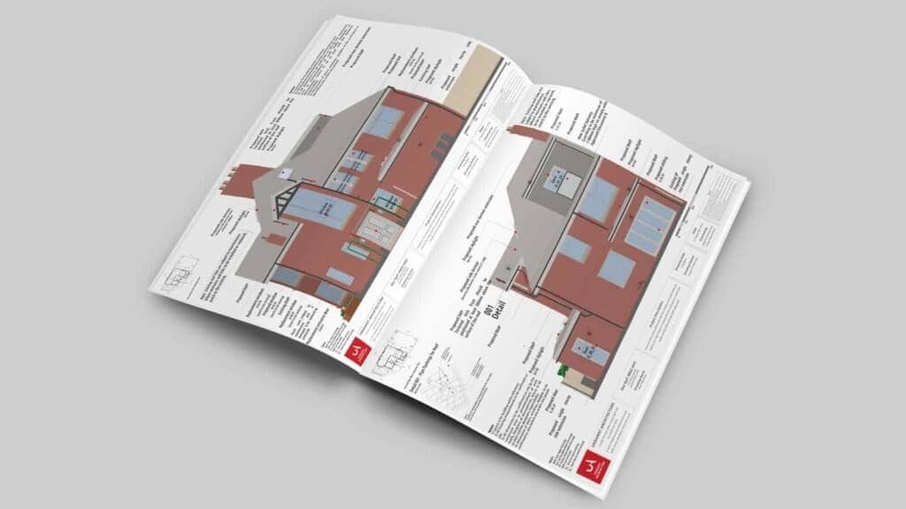
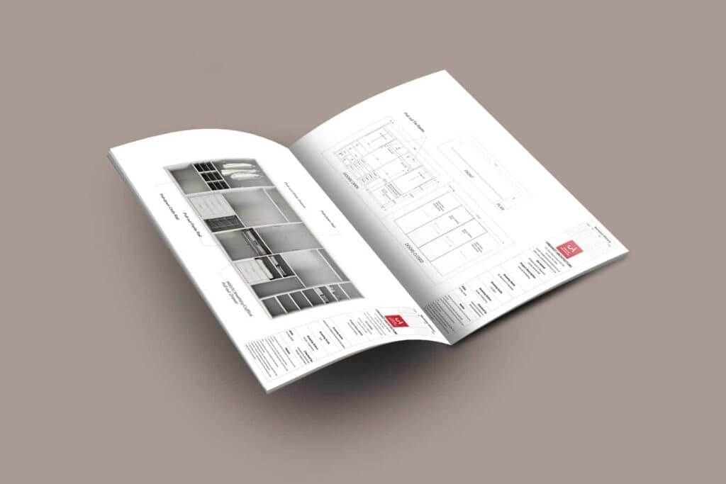
After having an idea of what the outside of our project looks like, floor plans show the new layout of the building. In most cases, such as in a renovation or extension, two separate sets of floor plans will be required: existing floor plans showing the building as it is now and proposed floor plans showing how the building will look, after the works have been carried out. Here the planning officer is looking for floor plans that should:
Where a proposal involves a significant change in ground levels, illustrative drawings should normally be submitted to show both existing and finished levels. As you might expect, these drawings need to demonstrate how the proposed development would relate to or have an effect on the site levels and neighbouring development that currently exist.
Let’s dig a little deeper...
In the case of householder development, the levels may be evident from floor plans and elevations, but in the case of sloping sites you’ll need to show how proposals relate to existing ground levels or where ground levels outside the extension would be modified. Level drawings should:
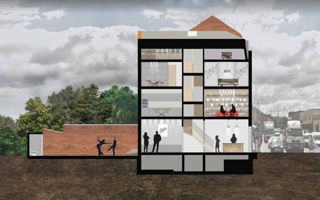
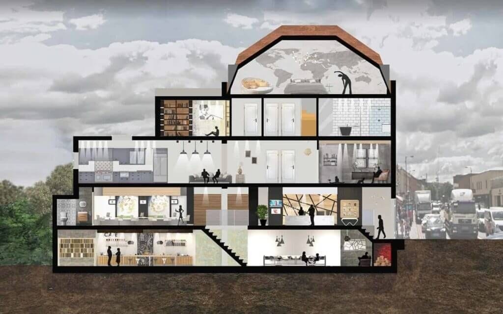
Section drawings should:
This kind of planning permission drawings are normally required for works that will be visible from the road, and are needed under several sets of circumstances.
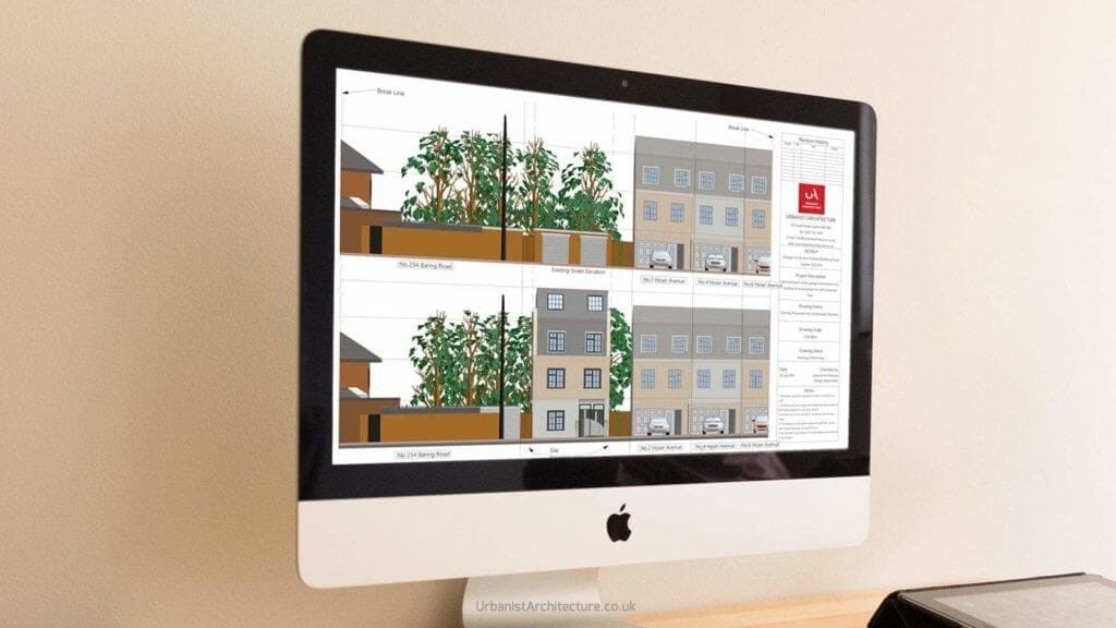
For example, they are especially important for new buildings or large side extensions that will be near to the their parcel boundary or to the neighbouring building, and also where there is a notable difference in height between the proposed works and the existing neighbouring dwellings or buildings. As usual, these planning drawings have their own set of standards, and street scenes or contexts plans should:
These planning drawings should be drawn to a scale of 1:50 or 1:100 and are used to show the shape of the roof, particularly when development includes changes to its appearance and shape. They should show the position of all ridges, valleys, dormer windows, roof lights and other features such as chimneys or raised parapets. Details such as roofing materials and their location are typically specified on the roof plan.
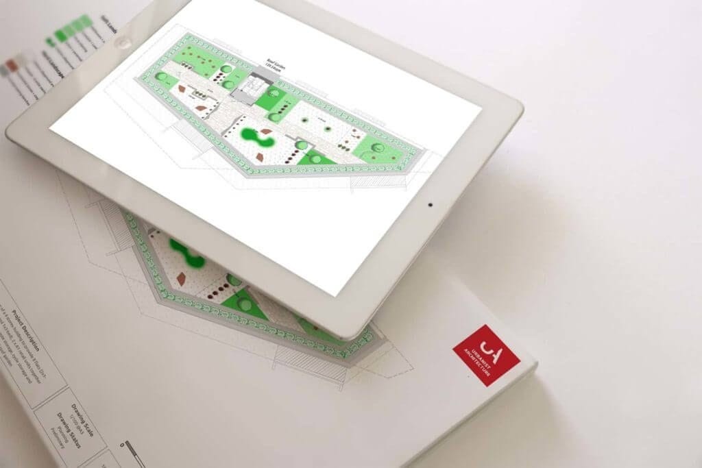
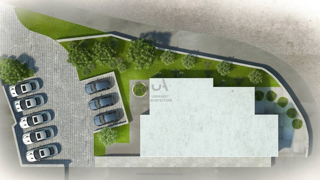
Given the growing importance of green infrastructure and architecture, landscaping plans have become a key part of many housing schemes, especially those involving roof gardens in the city (like the one above) or in suburban or Green Belt projects. As part of a wider package of planning application drawings, landscaping plans should accurately show:
In many instances the submission of landscaping details can be a condition of the planning permission. In some cases specialist detail - for example, a tree survey or detailed design - may be required when submitting landscaping schemes. I'd recommend that your architects to discuss with officers the scope and detail required prior to submission.
When drawing up plans for planning permission with listed building consent for listed building alterations, an essential part of the application are joinery drawings that detail exactly what fixtures and fittings are to be replaced.
By way of an example, Jacobean panelling or sash windows need specific drawings to ensure that they are being replaced like-for-like. As a key part of the heritage in a listed building planning application, these drawings should be highly accurate and comply with the following standards:

Photomontages are an important part of planning application drawings as they provide both the client and planner with an idea of how a project fits into the nearby landscape. Whether we're talking about an extension project or a new build development, the benefit of photomontages is that they give a more immediate idea of the proposal's scale and massing in terms of its size, and of how the building interacts with its immediate surroundings, also known as its context.
Don’t forget: These drawings should be clearly labelled on the front of each image (not the back) with a title that explains what is shown and the exact location from which is was taken. This is best achieved by showing the location on an associated map.
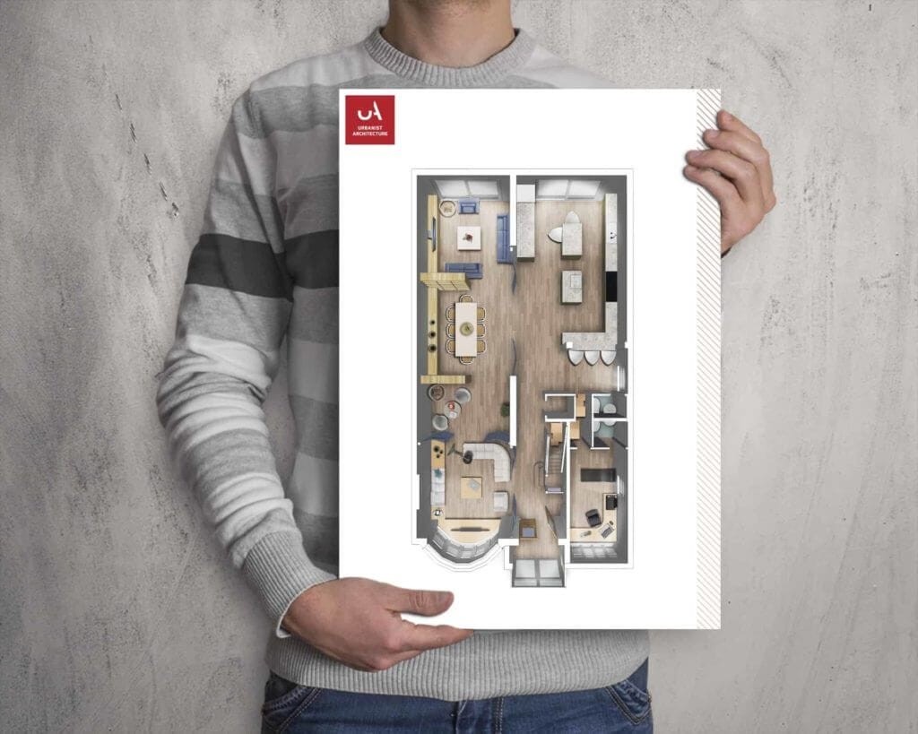
3D floor plans aren't necessarily a requirement for architects' drawing for planning permission, as they function on a more intimate scale, but are - of course - an essential part of our interior design projects. The idea behind these is to provide our clients with a clear visualisation of their home in terms of flow, furniture location and to give a truer sense of the scale of the space, as compared to the bare dimensions of the 2D floor plan.
As part of our full service provision, we have seen how a better idea of a home's potential set-up influences our clients' vision both in terms of architectural design and in later decisions on furniture and layout. These should be clearly labelled on the front of each image (not the back) with a title that explains what is shown and the exact location from which is was taken. This is best achieved by showing the location on an associated map.
There’s no reason why you can’t do the drawings yourself, but experience shows us that these have an extremely low success rate, as generally the person submitting has little experience with CAD programmes, and so the ‘home-made’ or "online-ordered" planning drawings generally don’t have the level of accuracy or features planning officers are accustomed to. So stop thinking that...
Clients have come to us after attempting these planning drawings, and have then requested us to ‘fill in’ the details, but this often ends up being more expensive than getting an architect to do the planning drawings in the first place. Similarly, we have often come across 'stand-alone' drawings in our projects that lack the necessary detail for them to be truly useful to us - here are some reasons to avoid these, too.
Let me say this straight: In these cases our clients have focused excessively on the product instead of considering the 'full service' aspect we offer in architectural services. If we do the drawings from the outset, we know how detailed and precise they need to be at each stage, and don't require redrafting or multiple measurements to be taken. As a fundamental basis for your project, investing in good-quality architectural planning drawings is a key part in getting a good return on investment that will save you stress, issues and cost in the long run.
This concept relates to how the building relates to its neighbours and surroundings in terms of its size. It the extension completely outsized compared to its accompanying house? Is the development three-storey townhouses amid bungalows? Or a small bijou cottage in the middle of six- and seven-story blocks of flats? If that’s the case, getting planning permission is unlikely. Appropriate scale is an important idea to consider in your design.
This rather vague term describes the basic 3D ‘shape’ of the building, whether a cube, a box, and its texture, smooth or irregular. In this sense, Big Ben might be considered a cuboid with a larger cuboid and a pyramid on top - which might be considered elegant.
A planner will be looking at these to see whether they complement or contrast with the surrounding buildings and how appropriate they are in their context. This is especially important with listed buildings or in conservation areas, as planning officers will, as a rule, expect the materials to blend in or match with the existing ones.
Naturally, the planner wants to see a carefully thought-out design that maximises the potential of the living space and provides a idea of the relationship between the different spaces.
Each council will have differing ideas on this particular concept, but there generally needs to be some sort of study into whether parking provision is needed on a particular project, where it will be if so, and how it will affect the existing traffic - which is what the neighbours may well object to.
This is a similar idea to scale in that a building does not exist in isolation - and certainly not in urban settings. Context looks at a building’s surroundings and how it responds to the neighbouring area in terms of building materials and architectural style.
All these concepts must be conveyed by the architectural drawings presented in a planning application for the officer to be able to comprehend the design and use of a project, as well as its relationship to its surroundings.
Here we wanted to make the importance of planning drawing clear and to show the various types needed to make a well-rounded, well-researched judgement on the visual aspects of a planning application.
In essence, planning drawings should not, however, be the only tool used to evaluate a project. We have seen rash, unfavourable decisions being taken by extrapolating from a contextless image - so we understand that the drawings need the statements and vice versa to convincingly describe and justify the need for your project.
Like good art, planning drawings are apparently simple in their execution, but both the architect providing the drawings and the planner viewing them are looking for specific details that might not be obvious to the untrained eye.
Can you really afford not to have great planning drawings to increase your chances of getting planning permission?
We look forward to learning how we can help you. Simply fill in the form below and someone on our team will respond to you at the earliest opportunity.
The latest news, updates and expert views for ambitious, high-achieving and purpose-driven homeowners and property entrepreneurs.


We specialise in crafting creative design and planning strategies to unlock the hidden potential of developments, secure planning permission and deliver imaginative projects on tricky sites
Write us a message