Read next
The latest news, updates and expert views for ambitious, high-achieving and purpose-driven homeowners and property entrepreneurs.



A new planning policy always arrives with a promise. In this case, the promise is clearer support for homes and mixed-use development around well-connected stations.
Yet the real test begins when a proposal meets a station entrance, a severed walking route, a flood map, an infrastructure programme and the judgement of a planning officer. Policy can create a stronger starting point without making the land simple.
Even among qualifying stations, the development opportunity can vary significantly. A site may appear close but be cut off by railway land, a major road or a missing crossing, while flood risk, heritage, infrastructure or land assembly may still prevent a policy opportunity from becoming a deliverable scheme.
This article follows those hidden tests through 83 station and place pairs. It then ranks the 20 locations where transport eligibility meets an identifiable planning opportunity, while stating the principal uncertainty that remains at each one.
Under the NPPF 2026, councils are required to support suitable housing around qualifying train, tram and Underground stations. The policy is designed to give these proposals a “default yes”, meaning the starting point should be support rather than resistance in principle. This opens a materially more promising route to planning permission for new homes around stations.
Importantly, this opportunity does not stop at settlement boundaries. It extends into land beyond existing settlements and even into the Green Belt where the station-led exception and relevant safeguards are satisfied. The policy therefore creates new possibilities in places where housing development may previously have been much harder to justify.
However, that stronger policy position is only the beginning. The station must pass the national eligibility test, while the land must be genuinely accessible on foot and capable of following the relevant policy route. Site-specific planning, design, infrastructure and delivery constraints must still be resolved.
This significant policy shift, presented by the government as the default “yes” for tens of thousands of new homes near train stations, prompted us to look beyond the headline and investigate where the new rules could make a practical difference. Rather than treating every qualifying station as a development opportunity, we examined where station eligibility, genuine walking accessibility, identifiable land, planning policy and delivery potential begin to align.
The 20 locations you are about to explore emerged from a detailed assessment of qualifying stations where the NPPF 2026 could make the greatest practical difference. Each location was scored out of 100, covering eligibility and land opportunity, walking accessibility, policy and constraints, infrastructure, demand and delivery realism.
The ranking shows where to investigate first, rather than the likelihood of securing planning permission. It reflects evidence available in August 2026 and takes account of the principles set out in the draft Design and Placemaking Planning Practice Guidance (PPG). To reflect differences between the locations, the shortlist is divided into two tiers: the ten strongest current opportunities and ten promising locations where material uncertainties remain.
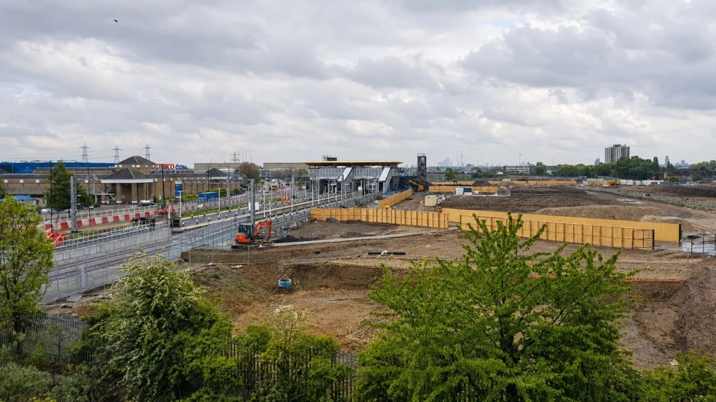
These ten locations combine a qualifying station with identifiable land and a comparatively credible planning or delivery structure. Seven are in Greater London or its immediate commuter belt, while Bristol Temple Meads is the leading non-London case.
Meridian Water railway station lies within the top-ranked London Travel to Work Area. Greater Anglia operates at least two weekday daytime trains an hour towards Stratford, satisfying the one-direction element of the NPPF station test.
Enfield’s council-led mixed-use programme identifies development land beside Meridian Water railway station that may benefit from Policies S4 and L3. However, flood management, strategic infrastructure, industrial relocation and land assembly must still be addressed through each phase.
Stevenage railway station lies within a top-80 Travel to Work Area. Its Great Northern and Thameslink weekday services comfortably exceed four trains an hour, including fast connections to London King’s Cross and St Pancras International.
The council’s development agreement supports mixed-use redevelopment around Stevenage railway station through Policies S4 and L3. However, detailed masterplanning, coordination between public and private landowners and long-term funding remain unresolved.
Abbey Wood railway station lies within the London Travel to Work Area. Elizabeth line and Southeastern services comfortably exceed the NPPF frequency requirement and provide direct connections to central London.
The adopted Opportunity Area framework supports growth on accessible land around Abbey Wood railway station through Policies S4 and L3. However, railway and road severance, indirect walking routes, flood risk and the need for further transport improvements constrain the wider opportunity.
Gallions Reach DLR station lies within the London Travel to Work Area. Its frequent services comfortably exceed the NPPF threshold and connect through Canning Town to Canary Wharf, the City and central London.
Newham’s emerging allocation identifies land for mixed-use development, but only areas genuinely accessible on foot from Gallions Reach DLR station may benefit from Policies S4 and L3. Wider growth depends on the proposed Beckton Riverside DLR station and must also address flooding, ecology, utilities and industrial interfaces.
Slough railway station lies within the high-ranking Slough and Heathrow Travel to Work Area. Its combined Elizabeth line and GWR services comfortably exceed four trains an hour and provide direct connections across central London.
The emerging town-centre strategy and regeneration framework support redevelopment around Slough railway station through Policies S4 and L3. However, the final package of sites, land assembly, infrastructure provision and viability must be resolved through the new Local Plan and subsequent delivery process.
Southall railway station lies within the London Travel to Work Area. Its frequent Elizabeth line services exceed the NPPF threshold and provide direct connections to Heathrow, the West End, the City and Canary Wharf.
The Opportunity Area framework and emerging Local Plan support growth around Southall railway station through Policies S4 and L3. However, much of the available land is already committed, while remaining proposals must address contamination, air quality, employment retention, infrastructure and the outcome of the Local Plan examination.
Welwyn Garden City railway station lies within a top-80 Travel to Work Area. Great Northern and Thameslink provide at least four weekday daytime trains an hour towards London.
Broadwater Road West and the Wheat Quarter have direct connections to Welwyn Garden City railway station and may benefit from Policies S4 and L3. However, industrial heritage, Garden City character, building scale, highways constraints and a contested planning history require a disciplined design response.
Bristol Temple Meads railway station lies within the sixth-ranked Bristol Travel to Work Area. Its frequent intercity, regional and local services comfortably exceed the NPPF threshold and connect the West of England with major employment centres across the country.
The council-endorsed Temple Quarter framework supports redevelopment of accessible brownfield land around Bristol Temple Meads railway station through Policies S4 and L3. However, flood risk, major infrastructure requirements, railway operations, heritage and the long-term coordination of multiple landowners mean that the published regeneration ambition should not be treated as immediately available development capacity.
Barking Riverside railway station lies within the London Travel to Work Area. Its four-trains-an-hour London Overground Suffragette line service meets the NPPF threshold and provides interchange towards central London.
The Mayoral joint venture controls and services much of the consented regeneration area around Barking Riverside railway station, giving remaining parcels a potential route through Policies S4 and L3. Their capacity nevertheless depends on existing commitments, utilities, social infrastructure, flood-resilient design and the sequencing of future phases.
Basildon railway station lies within the top-80 Southend Travel to Work Area. c2c operates at least two weekday daytime trains an hour towards London Fenchurch Street, with interchange available at West Ham, satisfying the one-direction element of the NPPF station test.
Eastgate Shopping Centre and neighbouring town-centre land around Basildon railway station have an established history of proposed redevelopment through Policies S4 and L3. However, retail restructuring, replacement parking, viability, building scale and the current delivery position must be reassessed before relying on any previously published capacity.
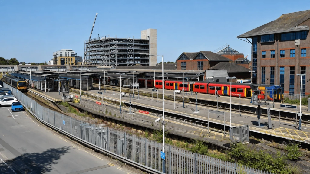
Each Tier 2 location passes the station test and has an identifiable opportunity. Ownership, infrastructure, viability, policy status or design evidence could still materially change the outcome.
Guildford railway station lies within the tenth-ranked Guildford and Aldershot Travel to Work Area. Its South Western Railway weekday services comfortably exceed four trains an hour, including frequent connections to London Waterloo, while GWR provides additional regional services.
The adopted allocation and town-centre masterplan support redevelopment of land around Guildford railway station through Policies S4 and L3. However, flood risk, operational railway requirements, land agreements, townscape considerations and the history of a contested development scheme may constrain its form and timing.
Purfleet railway station lies within the London Travel to Work Area. c2c operates at least two weekday daytime services an hour towards London, including direct trains to West Ham for onward connections.
Thurrock’s regeneration programme proposes a new town centre and the relocation of Purfleet railway station on physically related land. This may support development through Policies S4 and L3, and potentially Policy S5 at the settlement edge, but the railway bridge, flood risk, viability, infrastructure funding and revised delivery arrangements remain critical uncertainties.
Cambridge North railway station lies within the thirteenth-ranked Cambridge Travel to Work Area. Its combined Greater Anglia, Great Northern and Thameslink timetable provides at least four recurring weekday daytime departures an hour.
The relationship between Cambridge North railway station, Chesterton Sidings, Cambridge Science Park and North East Cambridge supports intensification through Policies S4 and L3. However, uncertainty over wastewater infrastructure has affected phasing, while water supply, industrial continuity, the River Cam and railway severance remain unresolved.
Cheshunt railway station lies within the London Travel to Work Area. Its Greater Anglia and London Overground Weaver line services comfortably exceed the NPPF frequency threshold and provide connections towards the City.
The adopted Local Plan and Cheshunt Lakeside masterplan support redevelopment beside Cheshunt railway station through Policies S4 and L3. However, business relocation, Network Rail land, station access, education infrastructure and the need for a coherent pedestrian connection remain important delivery tests.
Dartford railway station lies within the London Travel to Work Area. Southeastern’s recurring weekday Metro services provide at least four trains an hour, including direct connections to central London and interchange with the Elizabeth line at Abbey Wood railway station.
The adopted Dartford Plan supports growth on accessible brownfield land around Dartford railway station through Policies S4 and L3. However, road and railway severance, heritage, flood risk, site assembly and the emerging town-centre masterplan prevent a settled conclusion about development capacity.
Maidenhead railway station lies within the high-ranking Slough and Heathrow Travel to Work Area. Its Elizabeth line and GWR services comfortably exceed four trains an hour and provide direct connections across London and towards Reading.
The adopted Local Plan and Nicholsons Quarter programme identify walkable development land around Maidenhead railway station that may benefit from Policies S4 and L3. However, existing commitments, viability, replacement parking, ownership and the amount of land still available require a fresh assessment.
Redhill railway station lies within the top-80 Crawley Travel to Work Area. Its Southern and Thameslink services comfortably exceed four weekday daytime trains an hour, with direct connections to London Bridge, London Victoria and the Thameslink core.
Land around Redhill railway station and within the town centre has an established regeneration history and may benefit from Policies S4 and L3. However, the live appeal context, conservation-area setting, locally listed structure, flood risk, operational railway requirements and disagreement over building scale prevent any reliable capacity assumption.
Romford railway station lies within the London Travel to Work Area. Its Elizabeth line and Greater Anglia services comfortably exceed the NPPF threshold and provide direct access to Stratford, the City and the West End.
The adopted town-centre masterplan and Bridge Close programme support intensification around Romford railway station through Policies S4 and L3. However, heritage, townscape, active commercial uses, fragmented delivery and unfunded public-realm and transport improvements limit what can presently be assumed.
Epsom railway station lies within the London Travel to Work Area. Its combined South Western Railway and Southern services comfortably exceed four weekday daytime trains an hour and provide direct connections to London Waterloo and London Victoria.
The examined Local Plan identifies town-centre allocations within walking distance of Epsom railway station that may benefit from Policies S4 and L3. However, possible examination changes, conservation-area and heritage effects, surface-water risk, replacement parking and delivery capacity remain material uncertainties.
Crews Hill railway station lies within the London Travel to Work Area. Great Northern operates two weekday daytime trains an hour towards Moorgate, satisfying the one-direction element of the NPPF station test.
The submitted Local Plan and Policy GB7(1)(h) may create planning routes for qualifying Green Belt land around Crews Hill railway station. However, the plan remains unsettled, Enfield has withdrawn from the wider new-town process, pedestrian connections are weak, and substantial infrastructure and phasing questions remain unresolved.
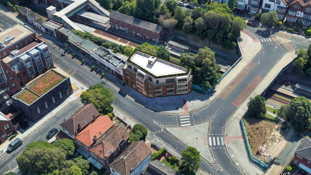
Read together, the 20 locations tell a clearer story than any single entry. Passing the national station test opens the policy door, but it does not determine which places rise to the top. The strongest locations combine transport eligibility with identifiable land, genuine walking accessibility and a credible framework for change.
The highest scores cluster around land already expected to evolve. Station gateways, ageing shopping centres, public car parks, obsolete industrial layouts, railway land and public regeneration holdings recur throughout the ranking. By contrast, open land that merely falls within a nominal 800-metre radius barely features.
The NPPF 2026 requires a station to be within one of the top 80 Travel to Work Areas ranked by 2023 gross value added, as defined in Annex B. It must also provide at least four services an hour during normal weekday daytime hours, or at least two an hour in one direction. A future service can qualify only where there is a reasonable prospect of it being achieved.
Every shortlisted station received full marks for NPPF eligibility. The ranking therefore changes only when land, walking, policy, infrastructure, demand and delivery are considered.
Walking accessibility is particularly important. The policy normally refers to around 800 metres, but it tests the actual journey from a station entrance along an existing public route. Railway lines, major roads, rivers, gradients, cul-de-sacs and missing crossings can substantially reduce the land that benefits. Only the qualifying part of a site receives station-led support.
Our research did not reward proximity in isolation. It favoured places where transport, planning and urban form begin to align. A public body may already control the land, a local plan may identify a mixed-use quarter, or the street network may offer a credible route to the station. Just as importantly, an organisation may already exist to coordinate infrastructure, land assembly and delivery.
This is a pro-development conclusion, but not a speculative one. Brownfield sites within an Opportunity Area, allocation or regeneration agreement usually begin with a clearer urban proposition. Open land with a better timetable may still be weaker if no one has established how it connects, functions or can be delivered.
Within settlements, Policy S4 provides general support, while Policy L3 establishes minimum densities across the net developable area of qualifying residential or mixed-use sites. Outside settlements, Policy S5(1)(h) applies where land is physically well related, supported by infrastructure and does not prejudice comprehensive development.
In the Green Belt, Policy GB7(1)(h) can treat qualifying station-led development as not inappropriate. Major housing must also satisfy the Golden Rules. Metropolitan Open Land is a separate designation and should not be treated as Green Belt.
These routes strengthen the principle of development, but they do not guarantee planning permission. Flood risk, heritage, ecology, access, infrastructure, land assembly, viability, townscape and design remain material. Policy L3 provides density floors, not capacity estimates.
Viewed through architecture and planning together, the lesson is straightforward. Policy can establish where growth should be supported, but design and technical evidence determine whether that growth can become a coherent, connected and deliverable place. The ranking is therefore a research agenda, not a claim that any location is developable or likely to receive permission.

The ranking identifies where to investigate first. It does not replace property development due diligence. Before a land value, density or unit number is fixed, the transport claim must be translated into a site-specific planning and design position.
The first task is not to draw a large scheme. It is to establish which part of the land qualifies and how that land relates to its surroundings. An entrance-based walking survey is central to that exercise. It should be read alongside title, infrastructure, environmental and townscape evidence.
For our current projects near stations, our architects and town planners use the following seven-stage process to prepare the planning and design case, while reviewing and coordinating the legal, transport, infrastructure and technical evidence needed to respond to the NPPF 2026:
Where land straddles the walking boundary, its qualifying and non-qualifying parts should be planned together. The sustainable location case for one part should not be weakened by the layout of the other.
The NPPF 2026 is genuinely pro-development. It recognises that new homes are most useful when they connect people to jobs, services and public transport. This is an important shift, but it also asks the development industry to look beyond isolated sites and create complete, connected places.
Our research shows that qualifying stations offer the greatest development potential where land, policy and delivery already point towards change. The leading locations combine a qualifying station with public ownership or an established planning framework and an institution capable of supporting long-term delivery.
Meridian Water, Stevenage and Abbey Wood are therefore likely to provide some of the first test cases. In each location, land is already publicly owned or allocated for development. The immediate questions concern infrastructure, sequencing and design, rather than the principle of change itself.
Crews Hill is the honest outlier. It qualifies under the station test and has potential routes through both plan-making and Policy GB7(1)(h), neither of which depends on the land being Grey Belt. However, the Council has withdrawn from the wider New Towns process, while walking access, infrastructure and phasing remain unresolved. Green Belt station-led proposals may therefore remain exceptional during the early years of the NPPF 2026.
Bristol Temple Meads and Cambridge North provide a further lesson. Both out-score several London commuter-belt locations when assessed against the same criteria. Station-led development is not simply a London story. Its most successful examples may emerge wherever transport investment, brownfield regeneration, urban design and long-term delivery are considered together.
Planning policy can identify where growth should be supported, but architecture must test whether that growth can create a liveable neighbourhood. Density, access, public realm, townscape and infrastructure cannot be resolved in separate rooms.
Our research brings these perspectives together by reading the timetable alongside the actual walk from the station entrance, examining allocations against the grain of streets and sites, and asking whether the delivery structure can achieve the quality of place promised by the policy.
An architectural feasibility assessment can then test realistic development intensity against flood risk, severance, heritage, contamination, parking and infrastructure. It may reveal significant potential, but it may also show that only part of a site qualifies or that the apparent opportunity is not yet mature enough to pursue.
The ranking therefore identifies where investigation should begin, not what a site-specific assessment will ultimately find. The next step is not automatically to prepare a masterplan for your planning application. It is to confirm the station test, walk the route, examine the title and map the constraints. Only then should development intensity, design and land value be discussed.
This article presents strategic research undertaken by Urbanist Architecture through a combined architecture and town-planning lens. It identifies locations where the NPPF 2026 station-led policy may coincide with an identifiable land opportunity, rather than cataloguing every qualifying station in England.
Based on evidence checked in August 2026, the ranking indicates where further investigation may be worthwhile. It does not confirm that a location is allocated, available, viable or likely to receive planning permission.
Each entry should be treated as a starting point for site-specific assessment, not a forecast or development capacity estimate. Any published land or housing figures are taken from the cited sources, whose links should remain alongside the relevant claims. The methodology and findings should be attributed to Urbanist Architecture.
PRESS ENQUIRIES: media@urbanistarchitecture.co.uk
The research began with 83 station and place pairs drawn from official timetables, ONS data, planning documents and public regeneration programmes. Each eligible location was scored across transport, walking, land, policy, infrastructure, employment access and delivery.
Each station was assigned to its 2011 Travel to Work Area and checked against the 2023 ONS total-GVA table (ONS GVA dataset, ONS TTWA boundaries). The research then tested the lower recurring weekday daytime frequency in operator timetables valid from 17 May 2026. Peak extras and live-departure snapshots were excluded. A station entered the ranking only when both parts of the Annex B test were confirmed.
Candidate land came from allocations, brownfield registers, Opportunity Areas, station gateways, town-centre frameworks and public regeneration agreements (Planning Data brownfield register). Our research then considered the real walking relationship from the station entrance. Railway land, major roads, rivers, gated sites and indirect routes reduced confidence where appropriate. Tier 1 contains the clearest combinations of land and delivery, while Tier 2 contains credible opportunities with greater uncertainty.
The research gives greatest weight to the NPPF 2026, ONS datasets, operator timetables and direct public-sector planning records. Land and housing figures are reported only as the relevant source presents them. Emerging plans, live appeals, news releases and consultation documents retain their procedural and temporal qualifications.
Flood, environmental and heritage screening used the Environment Agency’s Flood Map for Planning, the long-term flood-risk service, Defra’s MAGIC mapping and Historic England’s National Heritage List map. Desktop review identified the principal known constraint, not every issue that could affect a proposal. It did not replace site surveys, title review, utilities enquiries or detailed technical work. Walking assessments were entrance-based desktop judgements and were not presented as surveyed catchments.
We look forward to learning how we can help you. Simply fill in the form below and someone on our team will respond to you at the earliest opportunity.
The latest news, updates and expert views for ambitious, high-achieving and purpose-driven homeowners and property entrepreneurs.






We specialise in crafting creative design and planning strategies to unlock the hidden potential of developments, secure planning permission and deliver imaginative projects on tricky sites
Write us a message