Read next
The latest news, updates and expert views for ambitious, high-achieving and purpose-driven homeowners and property entrepreneurs.


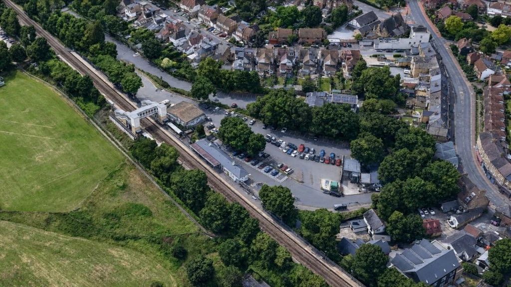
Under the NPPF 2026, housing around well-connected train, tram and Underground stations will benefit from a “default yes”, including some proposals in the Green Belt. The policy applies to homes and mixed-use schemes within reasonable walking distance of qualifying stations and sets new minimum expectations for density.
At first glance, the opportunity may appear simple. Draw an 800-metre circle around a railway station and almost every site within it may look suitable for housing.
But a circle measures proximity, not accessibility. A site may fall within 800 metres yet remain difficult to reach because of a major road, steep gradient, indirect pedestrian route or station entrance on the opposite side of the tracks. What appears close on a map may not provide a reasonable walking route in practice.
In this article, I explain how the station-led policies work, which sites may benefit and how to prepare a stronger planning application while further guidance is awaited and key provisions may face inconsistent interpretation or local resistance.
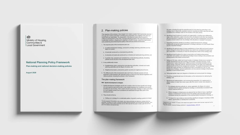
The NPPF 2026 requires councils to support suitable housing around qualifying stations, opening a more promising route to planning permission for well-located sites.
Importantly, this opportunity is not confined to existing settlements. It extends beyond settlement boundaries and even into the Green Belt where the station-led exception and relevant safeguards are satisfied.
As set out in the Government’s press release, the new rules form part of its wider drive to deliver 1.5 million homes. This stronger policy support is already prompting developers, landowners and investors to reconsider the potential of land around qualifying stations.
The strong early response to our research into qualifying stations and the best locations for new homes near stations suggests that the development industry is moving quickly to understand where future development opportunities may be concentrated.
However, each scheme must still demonstrate that the station qualifies, the walking route works in practice and the surrounding infrastructure can support the proposed growth. Its density, layout and height must also be justified through evidence and good urban design.
Outside a defined settlement boundary, Policy S5(1)(h) supports residential and mixed-use development near railway stations where the land is within reasonable walking distance of a well-connected station.
Unlike the separate unmet-housing-need route under Policy S5(1)(j), this route does not depend on the council being unable to demonstrate a five-year housing land supply or recording a Housing Delivery Test (HDT) result below 75%.
Within settlements, Policy S4 provides the broader support for development, while Policy L3(2)(a) expects residential and mixed-use schemes to increase the density of the surrounding area unless this is clearly inappropriate or impossible.
The station-density floors under Policy L3(2)(c) have a wider reach. They apply to qualifying station sites within settlements, beyond settlement boundaries and in the Green Belt.
Policy GB7(1)(h) provides a separate route for residential and mixed-use development near qualifying stations in the Green Belt. This route does not depend on the land being Grey Belt or on evidence of unmet housing need.
However, the proposal must still satisfy the station-related criteria under GB7(1)(h). Where major housing development is proposed, it must also comply with the Golden Rules under Policy GB8.
The new framework places station-led housing on a much firmer national footing. However, our experience of securing planning permission for developments benefiting from new planning rules shows that a favourable policy starting point does not determine the outcome. The strength of each proposal will depend on how convincingly it meets the relevant policy requirements.
For new housing and mixed-use schemes near stations, these can be grouped into the following seven core criteria and assessment requirements.
Well-connected station: the station must be within a top-80 Travel to Work Area by gross value added and normally provide at least four services an hour overall, or two an hour in one direction, unless a planned improvement gives a credible prospect of meeting that threshold.
Reasonable walking distance: the site, or the qualifying part of it, must normally be within around 800 metres by a route that people can realistically use, with a shorter distance where route quality, topography or physical barriers discourage the walk.
Density around stations: qualifying residential and mixed-use schemes must normally achieve at least 35 dwellings per hectare across their net developable area, rising to 45 where services meet twice the minimum frequency.
Net developable area: the density calculation must include housing and directly associated land within the residential layout, excluding only land that genuinely falls within the national definition of unsuitable or strategic land.
Vision-led transport: the transport case should begin with sustainable movement outcomes and test reasonable future scenarios, mitigation and monitoring.
Maximum parking standards: parking provision should respond to the location, nature and connectivity of the development while supporting sustainable travel and efficient use of land.
Connectivity Tool: the Tool should be used alongside other quantitative and qualitative evidence when accessibility and connectivity are assessed.
The NPPF 2026 establishes these requirements in broad terms, while the principles set out in the draft Design and Placemaking Planning Practice Guidance (PPG) provide a useful indication of how walking and wheeling catchments, net developable area and density requirements may be mapped and assessed. Their application will nevertheless depend on site-specific judgement.
In the rest of this article, I examine the key requirements for station-led development and explain how they may affect the preparation of a successful planning application for development near train stations.
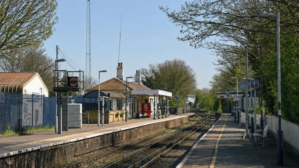
Under the NPPF 2026, a station must pass two tests. First, it must be within one of the top 80 Travel to Work Areas in England, ranked by 2023 GVA data. Second, it must normally have at least four trains or trams an hour during the weekday daytime, or at least two an hour in one direction. Both tests must be met, no matter how close a potential housing site is to the station.
For current decisions, Annex B uses the 2023 total-GVA data until the day after the 2028 data are published, when the later dataset takes effect. The ranking includes only Travel to Work Areas wholly or partly in England. In our research of qualifying stations under the NPPF 2026, we used this dataset to identify locations within the top 80, then checked the relevant boundary and qualifying service frequency for each station.
We then assessed 83 station and place pairs in more detail and identified 20 locations for station-led development, taking account of walking accessibility, development land, planning constraints and delivery potential. This shows where the policy may have the greatest practical effect, while remaining distinct from any official Government list.
Lord Banner asked whether the Government would publish a definitive list of qualifying stations. In its answer of 15 September 2026, the Government said that decision-makers must determine whether the criteria apply to a given station and that a published list could not be definitive; the Department had therefore not published one.
Until that position is clarified, applicants should still be prepared to demonstrate why the particular station they rely upon satisfies the Annex B definition.
One of our most important findings concerns the circular relationship between housing growth and improved rail services. A station may fall within the qualifying economic area but still fail the frequency test, even where additional development could itself strengthen the case for better services.
The “reasonable prospect” route is intended to address this, but it still requires credible evidence.
Applicants relying on a future service improvement should be able to identify the proposed upgrade, operator commitment, funding route and likely delivery programme. An aspiration for more trains is unlikely to carry the same weight as a funded scheme or a firm agreement with the operator.
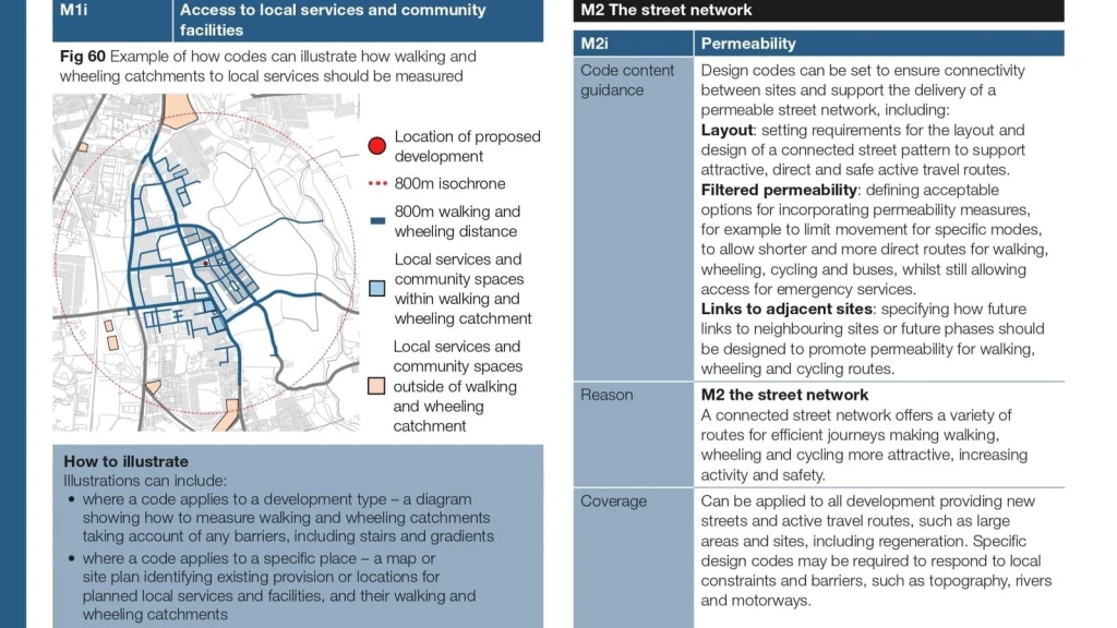
Under the NPPF 2026, reasonable walking distance means around 800 metres, or around ten minutes where topography, poor walking routes or physical barriers would discourage the walk. Only the part of a site within that distance qualifies, so an 800-metre radius alone is not enough.
Although the framework does not prescribe a single measurement method, Figure 60 of the draft PPG illustrates the practical difference between an 800-metre isochrone and the area accessible through the actual walking and wheeling network.
This matters because only the part of a site within reasonable walking distance benefits from the policies S5(1)(h), L3(2)(c) or GB7(1)(h). On a large or irregular site, the walking catchment may cut through the landholding, leaving different parts with different policy, density and development implications.
Most people see an 800-metre threshold in planning policy and reach for a map. What they often overlook is permeability: whether the street network allows people to make that journey conveniently, safely and confidently. Our experience of working on sites near stations shows that permeability matters just as much as proximity when assessing whether a site is a sustainable location.
An 800-metre walk through a connected urban street network may offer several routes, active frontages and safe crossings. The same distance in a suburban or rural setting may be severed by cul-de-sacs, railway lines or major roads, or depend on an unlit verge, private path or road without a continuous footway. Urban does not automatically mean accessible, nor does rural mean unsuitable.
These differences can be decisive, particularly where accessibility depends on future works. Further guidance should clarify when a new station entrance, crossing or footway may be taken into account and how its delivery and long-term use should be secured. Where the walking boundary crosses a site, the qualifying and non-qualifying land should be planned together.
A proportionate walking-route audit should record:
the station and site entrances future residents would realistically use;
the actual publicly accessible route, distance and typical walking time;
crossings, gradients, steps, dropped kerbs, lighting, surveillance and personal safety;
physical barriers and any restrictions on access;
proposed improvements and how they will be delivered and maintained; and
the qualifying part of the site where the boundary crosses the landholding.
This evidence will not remove professional judgement, nor should it. It should, however, prevent the 800-metre benchmark from becoming a crude circle that ignores how places function. The strongest station-led schemes will demonstrate more than proximity: they will improve permeability and make the journey to the station genuinely easier.

Under the NPPF 2026, qualifying residential and mixed-use sites near stations must normally achieve at least 35 dwellings per hectare across the net developable area, rising to 45 where services are at least twice the minimum frequency for a well-connected station.
The main exceptions are traveller sites and smaller developments where the standard can be shown to be inappropriate or impossible. For major development schemes, design or character concerns do not automatically justify a lower density.
Policy L3 also expects these minimums to be exceeded where possible, particularly in highly connected locations. They should therefore be treated as floors rather than targets or ceilings, with higher housing density explored through the design process.
L3 of the NPPF 2026 expresses the national density floor in dwellings per hectare, but that figure does not tell the whole story. Local authorities and design teams may also use measures of occupancy, floorspace, built form or overall development intensity.
As residential architects, we believe these alternative metrics can provide a more accurate picture of how a scheme will function. However, further guidance is needed on when they are appropriate and how they should relate to the L3 minimum. Until then, they should supplement the national calculation, not replace it.
In our own planning applications we prepare and manage, we will lead with the L3 dwellings per hectare calculation, then use additional metrics where they provide a clearer picture of the scheme’s occupancy, floorspace or built form.
This is particularly important for mixed-use schemes and housing types where similar dwelling numbers may produce very different levels of floorspace, occupancy and built form. Alternative metrics should clarify whether the policy has been met, not obscure it.
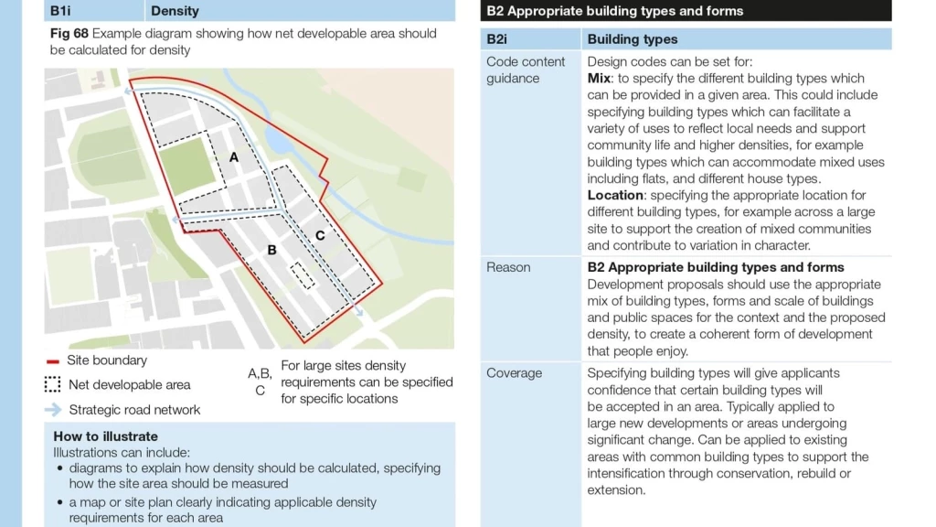
Annex B includes housing and directly associated uses within the net developable area. This covers access roads, hard landscaping, private gardens, ground-floor amenity space, ground-level parking and incidental open space.
Figure 68 of the draft PPG illustrates this distinction by separating the net developable area from the wider site boundary. It also shows how strategic infrastructure may be excluded and different density requirements applied to separate parts of a large site.
By allowing genuine landscape, drainage and habitat infrastructure to be excluded, the framework avoids penalising schemes for providing essential environmental features. However, it also creates a familiar loophole in planning arithmetic: reducing the net developable area lowers the number of homes required to meet the minimum density.
If ordinary landscaping, verges, ponds or incidental open space are treated as significant exclusions, a low-intensity scheme may appear compliant without providing more homes. This approach has recently appeared at a station-led site in Theydon Bois, where ponds were excluded to support a stated density of 50 dwellings per hectare.
The problem is not sustainable drainage or biodiversity gain, both of which are essential. It is whether these features become an accounting device for shrinking the denominator and meeting Policy L3 on paper. Further guidance should define what makes an exclusion “significant” and distinguish genuine infrastructure from land forming part of the residential layout.
We advise our clients to take a transparent but commercially robust approach by presenting the gross site area, qualifying walking-distance area, net developable area and resulting density side by side. Every exclusion should be mapped and justified against Annex B. This protects legitimate development capacity without relying on assumptions that may not withstand scrutiny.
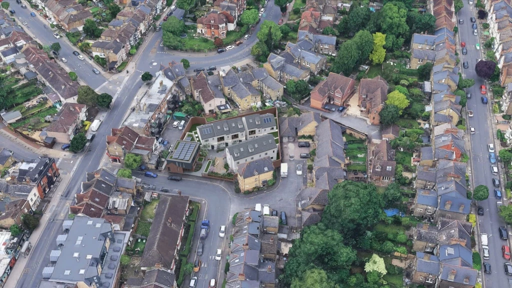
Station qualification and transport acceptability are related but separate questions. A station may meet the top-80 and timetable tests while the site still fails to offer safe access, sustainable movement or an acceptable effect on the transport network.
TR3 of the NPPF 2026 requires proposals to support sustainable patterns of movement, make the most of transport infrastructure and mitigate significant network or safety effects through a vision-led approach. Policy TR6 then requires proportionate transport evidence, reasonable future scenarios and a travel plan where significant movement would arise.
On paper, the vision-led approach appears straightforward. When applied to real sites, however, applicants, highway authorities and local planning authorities may disagree over the intended vision, which future scenarios are reasonable and how much mitigation is enough. Further guidance is needed to establish a more consistent method.
Rather than simply forecasting existing car use and providing additional road capacity, the assessment should begin with the outcomes the place is intended to achieve. For station-led housing, this means connecting land use and density with street design, walking, wheeling, cycling, public transport, servicing and parking.
A credible assessment should agree the scenarios with the relevant authorities, explain the measures required under each one and identify responsibilities, funding and monitoring triggers. It should also include fallback measures if the expected changes in travel behaviour do not occur. Without this structure, “vision-led” risks becoming an attractive label attached to a conventional transport assessment.
Consistency will be particularly important at appeal. One authority may accept planned mode shift and monitored interventions, while another may continue to prioritise conventional peak-hour traffic forecasts. The government should clarify the evidence requirements without delay, while retaining enough flexibility for the approach to work across different locations.
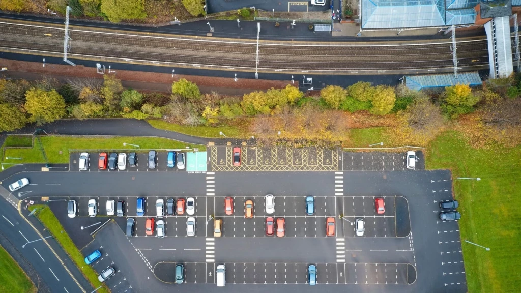
TR2 of the NPPF 2026 is a plan-making policy. It says development plans should set maximum car-parking standards where these would encourage sustainable and shared transport, optimise density in well-connected locations or help manage the road network.
For an individual application, Policy TR4 requires a suitable number of spaces that reflects the location, nature and connectivity of the development, locally set standards and provision for electric vehicles and other modes. A station-led scheme is therefore not automatically car-free, nor should a suburban standard be applied without considering the actual transport choices available.
The difficult question is not whether parking should be lower near stations, but how low it can reasonably go. A central site with frequent services, controlled parking and several travel options presents a very different case from a suburban station where residents may still depend on cars for everyday journeys.
For our station-led development sites, our approach is to base parking provision on how the location actually functions. We will assess local car ownership, station accessibility, blue-badge and cycle provision, servicing, overspill risk, parking controls and the effect of parked vehicles on density and public space.
We also believe that a maximum standard should operate as a ceiling, not a target. Equally, proximity to a station should not by itself justify car-free development. Lower provision is most persuasive when it follows from a credible movement strategy, rather than simply creating more developable floorspace. The aim should be to support sustainable travel and efficient land use without transferring the parking problem to neighbouring streets.
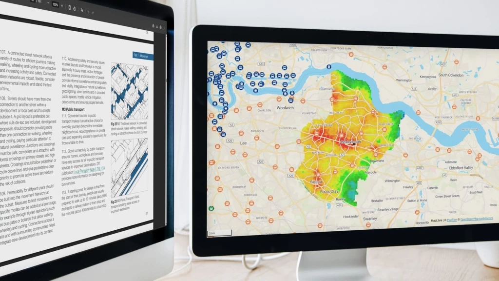
The Department for Transport's Connectivity Tool can help describe how well a place is connected, but it cannot make the planning judgement. Under Policies L3 and TR3 of the NPPF 2026, its results should be considered alongside other evidence, not used as a separate test of whether a station qualifies as well connected.
The Tool cannot override the top-80 and service-frequency tests, nor can it show whether the actual journey from a site to the station is safe, accessible or attractive. The same score may have very different implications in a connected urban neighbourhood, a fragmented suburb or a rural settlement with limited travel choices.
DfT already publishes Connectivity Tool guidance, most recently updated on 3 July 2026, together with methodology and advice on interpreting scores. Further planning guidance is still expected, but this is distinct from the existing Tool guidance.
For an application, record the Tool version, date, geography and assumptions, then consider the result alongside the timetable, actual walking route, local services, cycle connections and infrastructure. It should inform the planning judgement, not operate as a stand-alone station-qualification or permission test.

Green Belt land near a qualifying station has a freestanding route under Policy GB7(1)(h) of the NPPF 2026. It is different from Grey Belt and should not be blended with it merely because both routes appear in the same policy.
The site must be within reasonable walking distance, physically well related to the station or its settlement, capable of being supported by existing or proposed infrastructure and must not prejudice long-term comprehensive development. Major housing must also comply with the Golden Rules in Policy GB8.
A site does not need to qualify as Grey Belt to rely on GB7(1)(h). Grey Belt turns on how land contributes to specified Green Belt purposes and requires an evidenced unmet need. The station exception turns on walking distance, physical relationship, infrastructure and comprehensive development.
The two routes may overlap, but they may also produce different answers. A parcel that strongly performs a Green Belt purpose may still have a station-led case. A weakly performing parcel may pass the Grey Belt test but fail the station route because the walking connection is poor or the station does not qualify.
Policy S5 does not itself apply in the Green Belt. The Design & Access Statement should therefore identify GB7 and GB8 as the decision route, then address the relevant positive balance only after showing the proposal is not inappropriate development.
Policy GB3(4) serves a different purpose. Where the development plan's spatial strategy has identified suitable land around well-connected stations, exceptional circumstances are not required to alter the Green Belt boundary.
That is a plan-making mechanism for strategic release, not a test that determines a live application. Landowners should choose the route that matches their decision stage and avoid presenting a plan-making provision as if it grants application-level support.
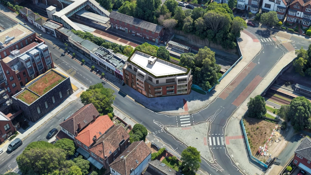
Density is a numerical measure, but good station-led development is a spatial outcome. The NPPF 2026’s Policy DP3 requires well-designed places to address context, liveability, climate, nature, movement, built form, public space and identity, while Policy TR4 places walking, wheeling and cycling first.
A scheme that reaches 35 or 45 dwellings per hectare but fails those principles has satisfied one policy test while weakening the overall planning case. The most persuasive proposals show how greater intensity improves the route to the station, reinforces the local centre and creates a coherent place.
The opportunity is especially important in high-demand commuter belts, where development near train stations may make more efficient use of underused land, although townscape, heritage, parking and infrastructure pressures are often acute.
The final thresholds are 35 and 45 dwellings per hectare. The consultation proposed different, higher minimums; the operative figures are those in final Policy L3. These remain minimum expectations, subject to the specified exceptions, and should be exceeded where possible.
Meeting the numerical threshold is only the starting point. L3 does not override design, daylight, heritage, landscape or living-condition policies. The practical lesson from designing new-build housing is that density must be designed into a place, not imposed as a spreadsheet target. If a scheme can meet the minimum only by creating unacceptable harm, the design, housing mix, developable boundary or planning strategy needs to change.
The reverse is also true. Existing low density should not become an excuse for underusing land around a well-connected station. Policy L3 requires development to respond to local character, but character should guide growth rather than prevent an area from realising its potential.
Good new build housing begins with movement. In our schemes, the main route connects clearly to the station and local centre, while quieter streets, courtyards and mews create a comfortable transition towards homes.
Permeability must also form part of the planning case through continuous footways, safe crossings, lighting, seating and accessible gradients. A gated layout or single indirect entrance may undermine the walking-distance case on which the station-led policy depends.
Active ground floors work only when they respond to how people will use the place. In our schemes, we position entrances and active uses along the routes people will naturally follow. Where there is genuine demand, commercial, community or shared spaces can strengthen the local centre and animate the station approach.
This means that mixed use should respond to demand and management reality, not become decorative floorspace added to suggest activity. The ground-floor plan, servicing strategy and public realm need to work together from the first design stage.
An experienced chartered architect would use additional height strategically rather than applying the same envelope across an entire site. Taller elements can mark a station approach, prominent corner or local centre, while stepped massing creates a more sensitive relationship with neighbouring buildings.
Equally, an experienced architect would test these decisions against verified views, street proportions, heritage settings, daylight effects and the experience at ground level. Existing character should inform how a place develops, not freeze every site at its current intensity.
Policies L2, L3 and DP3 of the NPPF 2026 support higher housing density where appropriate, but require it to be reconciled with good design and acceptable living conditions. The draft PPG is not itself final policy, but can help illustrate relevant design principles where consistent with the framework. Neither station-led policy nor the draft guidance removes the need to assess daylight, sunlight, outlook, privacy and usable amenity for neighbours and future residents.
Together, these principles favour layouts where public space supports movement and daily life, benefits from natural surveillance and integrates landscape, drainage and biodiversity. Density should therefore emerge from these elements working together, rather than from fixing the unit count first and fitting everything else around it.

The early NPPF 2026 appeals show how support for housing near stations is being applied. Inspectors are testing whether stations qualify, walking routes are suitable and the proposed development can be accommodated with adequate infrastructure, acceptable design and good living conditions.
At Doggett Road, Catford (6004929, allowed 11 September 2026), permission was granted for nine flats and a commercial unit beside Catford Bridge station. The inspector gave substantial weight under L2 and L3 to higher-density redevelopment in an accessible urban location. Stepped massing and a recessed upper floor helped accommodate the additional height. The decision supports intensification beside stations, although it did not expressly apply the station-specific density floor.
Eden Grove, Staines (6007619 and 6007620, allowed 25 September 2026) demonstrates how accessibility may justify lower parking. The linked appeals reduced residential parking across an existing 489-home development from 341 to 247 spaces. Referring to TR2(2), the inspector considered station access, buses, cycle provision and a car club alongside actual parking demand. Connectivity Tool scores and highway evidence reinforced the case.
At Stocksmoor, Huddersfield (3375000, allowed 1 October 2026), 50 homes were approved despite the nearby station failing the definition of a well-connected station. The scheme succeeded under S4, with the site considered within the settlement. Failure to qualify for the station-led route therefore did not remove support available through other policies.
The unsuccessful cases reveal where station-led arguments lose force. At Longdene House, Haslemere (6006581, dismissed 17 September 2026), the proposed 14 homes satisfied S5(1)(h). The inspector accepted station qualification, reasonable walking distance, the relationship with the settlement and the infrastructure position. Nevertheless, considerable harm to the National Landscape and its setting substantially outweighed the benefits. Passing the station-led criteria did not guarantee permission.
Warren Lane, Hurst Green (6004144, dismissed 17 September 2026) distinguishes a pleasant walk from a qualifying one. Although the routes were usable, the station journey was approximately twice the distance and time identified in the glossary. The proposal for up to 132 homes failed GB7(1)(h), but satisfied the separate Grey Belt route. Unresolved odour effects from neighbouring wastewater treatment works ultimately prevented approval.
At Oakdene Crescent, Hatton (6006637, dismissed 23 September 2026), a station approximately 350 metres away failed the service-frequency definition. The connecting route also lacked meaningful pedestrian facilities and presented safety constraints. The 28-home affordable housing scheme failed the Grey Belt route because the location was not sufficiently sustainable and necessary infrastructure improvements were unsecured.
Together, these decisions show why station-led development requires more than proximity. Applicants should verify qualifying services, audit the walking route and demonstrate how infrastructure, parking and design will support an acceptable scheme.

Before buying a development site, agreeing its land value or fixing the unit number and layout, applicants should test whether the station-led policies apply and what development capacity the site can realistically support.
This is particularly important where the walking catchment covers only part of the land, Green Belt policy routes overlap or higher density requires careful transport and townscape justification.
The early appeals reinforce the value of resolving these questions before committing to a scheme. Each planning application near a station should demonstrate qualification, explain its assumptions and calculations, and show how the proposed development addresses the site’s constraints.
For the station-led pre-applications and planning applications we are currently preparing, we bring the following evidence together from the outset:
Station qualification note: This confirms the relevant top-80 Travel to Work Area, normal weekday service frequency and any credible evidence of a planned upgrade.
Walking-distance plan and audit: This measures the publicly accessible route, assesses physical barriers and identifies the part of the site within the qualifying catchment.
Area and density schedule: This presents the gross site area, qualifying area, net developable area, exclusions and L3 density calculation, followed by any useful supplementary metric.
Vision-led transport assessment: This defines the intended movement outcomes, tests reasonable future scenarios and identifies mitigation, responsibilities, funding, monitoring and fallback measures.
Connectivity evidence: This records the Connectivity Tool result, date and assumptions, then compares it with timetables, walking conditions, accessibility, local services and infrastructure capacity.
Parking and servicing strategy: This relates car, cycle, blue-badge, electric-vehicle, delivery and refuse provision to the wider movement strategy and public realm.
Infrastructure statement: This assesses public transport capacity, highways, utilities and social infrastructure, including any improvements needed to support the proposed development.
Design and townscape response: This tests street hierarchy, permeability, active frontages, height, massing, daylight, amenity, landscape and public space as one coordinated design.
Green Belt policy statement, where relevant: This identifies the correct policy route and addresses the Golden Rules where major housing development is proposed.
At Urbanist Architecture, we use these workstreams to shape the scheme from the outset, rather than to justify a design after it has been fixed. Planning, transport and architectural services progress together. The walking audit may influence the entrance and street layout, while density, parking and infrastructure evidence will shape the massing and public space.
Where the policy or transport position remains uncertain, a focused pre-application can test it before the design advances too far. The fundamental assumptions should be settled by the end of RIBA Stage 3.
The objective is not to generate more paperwork. It is to build a planning case that the decision-maker can follow and verify. Even an early finding that a site does not qualify may be valuable if it prevents unrealistic assumptions about land value or development capacity.
I have long supported new homes near train stations because locating housing around transport infrastructure can reduce car dependence and help sustain local services. It should not be treated as a numerical density exercise. Done well, it can create some of the most sustainable housing growth the planning system enables.
Proximity to a station does not, by itself, create a successful place. Higher intensity needs clear street hierarchies, direct walking routes, active ground floors and well-defined public space. Height and massing must respond to context, while daylight, amenity and townscape quality remain fundamental.
When these elements reinforce the station route and local centre, the density feels intentional and the planning case becomes stronger. When proximity is used simply to justify more floorspace, resistance is predictable.
The NPPF 2026 moves the policy in the right direction. Widening its reach to the top 80 Travel to Work Areas brings more productive locations within scope, while the tiered density floors of 35 and 45 dwellings per hectare are more workable than the single higher figure proposed in the draft. I support both changes.
The retained service-frequency test remains a weakness. A funded and deliverable service improvement, backed by a credible programme and genuine operator commitment, should carry comparable practical weight to a station that already meets the threshold. Otherwise, the policy may exclude locations where housing growth could help make better services viable.
The government must now publish guidance quickly to protect the policy from inconsistent interpretation. It should prevent net developable area from being used to lower housing numbers, ensure alternative density metrics do not obscure L3 compliance and confirm that the Connectivity Tool supports rather than replaces site-specific judgement.
Worked examples should cover an urban interchange, a suburban commuter station, a constrained partial site and a Green Belt location. The objective should be consistent reasoning across different settings, not a rigid national template that ignores how places actually function.
We look forward to learning how we can help you. Simply fill in the form below and someone on our team will respond to you at the earliest opportunity.
The latest news, updates and expert views for ambitious, high-achieving and purpose-driven homeowners and property entrepreneurs.



We specialise in crafting creative design and planning strategies to unlock the hidden potential of developments, secure planning permission and deliver imaginative projects on tricky sites
Write us a message