Read next
The latest news, updates and expert views for ambitious, high-achieving and purpose-driven homeowners and property entrepreneurs.


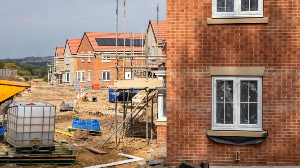
England does not simply have a housing shortage. It has a delivery problem.
For years, local planning authorities have been expected to support new homes in principle while too often struggling to identify enough realistic, deliverable sites in practice. That gap between ambition and delivery is exactly where five-year housing land supply, often shortened to 5YHLS, becomes so important.
Labour’s planning reforms have brought this issue back into sharp focus. A central part of that shift is the return of mandatory housing targets, reversing the more flexible approach that followed the move towards advisory targets in 2023.
Councils are no longer being judged only on whether they support housebuilding in theory. They must be able to show, with evidence, where the homes their areas need will actually be built.
For many authorities, that is uncomfortable territory. It means revisiting delayed local plans, questioning whether enough brownfield and urban land is genuinely available, and, where housing need cannot be met within existing settlements alone, facing the difficult question of whether they need to review their Green Belt boundaries.
The December 2024 NPPF has made this even more significant. It reinforces the need to boost housing supply, strengthens the consequences for councils without enough deliverable sites, and introduces a clearer route for some Grey Belt development where the relevant policy tests are met.
From 1 July 2026, some councils will also face an additional 20% buffer for decision-taking where their adopted housing requirement is 80% or less of the latest standard method figure.
Across England, 157 local planning authorities and plan areas are currently reported as having less than a 5YHLS. The list below shows where the pressure is being felt most sharply. I then explain what 5YHLS means, why it can change the outcome of planning applications and appeals, and how landowners and developers should assess it before making decisions about a site.

Based on the latest available published and appeal-derived housing land supply positions, the English local planning authorities and plan areas currently reported as having less than a 5YHLS are listed below in alphabetical order:
The above list, which shows English local planning authorities and plan areas reported to have less than a 5YHLS, is accurate as of June 2026, when this article was re-edited and republished. However, 5YHLS positions can change quickly, so it should be treated as an indicative snapshot rather than a complete national register.
That is why proper due diligence is essential. Before drawing conclusions about the development potential of any site, the starting point should always be a review of the latest council position statement, housing trajectory, Housing Delivery Test result, appeal decisions and local plan status.

A five-year housing land supply (5YHLS) is a supply of specific, deliverable housing sites that a council can realistically expect to deliver over the next five years.
It is measured against the authority's housing requirement set out in up-to-date strategic policies, or against its local housing need figure where those policies are more than five years old, with a buffer added on top. The buffer is normally 5%, rising to 20% where the council has significantly under-delivered against the Housing Delivery Test.
But, identifying land on paper is not enough. To meet its 5YHLS obligation, a council must show that each site is genuinely deliverable, meaning homes will realistically come forward within the period.
The NPPF treats sites with detailed permission as deliverable unless there is clear evidence to the contrary, while sites without permission require clear evidence that they will deliver homes within five years. This is where most disputes begin.
A council may insist it has enough land. A developer may argue that key sites in the trajectory are delayed, constrained or unrealistic, or depend on infrastructure, land ownership, viability or developer commitment that has not yet been secured.
In practice, 5YHLS arguments turn less on whether land exists and more on whether the council can prove that homes will genuinely come forward in time.
A council that cannot demonstrate a five-year housing land supply is in a much weaker position when resisting housing development.
For decision-taking, where a council cannot demonstrate a 5YHLS including the appropriate buffer, footnote 8 of the NPPF deems the policies most important for determining the application out of date. This engages paragraph 11(d), the presumption in favour of sustainable development, commonly called the tilted balance.
Permission should then be granted unless a protected designation gives a strong reason to refuse, or the adverse impacts of granting it would significantly and demonstrably outweigh the benefits.
This does not mean every housing application must be approved. Sites can still be refused where there are strong reasons against them.
Green Belt harm, harm to designated heritage assets and flood risk fall within the protective policies that can defeat the presumption outright. Other concerns, such as poor design, landscape impact or highways safety, are weighed in the overall balance rather than ruling a scheme out from the start.
What changes is the weight. A lack of 5YHLS shifts the balance in favour of housing, making need and delivery far more powerful considerations, particularly where the site is sustainable and the adverse impacts are limited. The refusal bar also rises, because decision-makers now need strong reasons to say no, not merely clear ones.
For developers and landowners, this can create a stronger case for:

Five-year housing land supply matters more in 2026 because several planning pressures are now converging.
The revised standard method has increased housing need figures in many parts of England, while councils are under renewed pressure to plan positively for new homes. At the same time, many local plans remain delayed, withdrawn, paused or out of date, leaving authorities more exposed to challenge where they cannot show a credible supply of deliverable housing land.
But this pressure is not evenly distributed. Indicative figures published by MHCLG show that London, the South East and the East of England together account for more than half of England’s total indicative local housing need. London alone accounts for 24%, followed by the South East at 19% and the East of England at 12%.
The London figure is especially striking. Although London’s indicative need is lower than it would have been under the previous standard method, it still stands at almost 88,000 homes per year, around two-and-a-half times recent average annual delivery. In every other English region, the new standard method produces a higher local housing need figure than the previous method.
This helps explain why 5YHLS has become such a live issue. The revised method does not simply increase national housing numbers. It changes where the greatest planning pressure is felt.
At the same time, Grey Belt policy has created a new decision-making route for some housing proposals within the Green Belt, making housing need, land supply and site sustainability even more important in planning decisions.
The result is that 5YHLS is no longer a dry monitoring exercise. It has become one of the main pressure points in the English planning system.
A further change takes effect from 1 July 2026.
The NPPF requires local planning authorities to identify and update annually a supply of specific deliverable sites sufficient to provide at least five years’ worth of housing, including the appropriate buffer.
In summary, the NPPF provides for:
Importantly, the 20% buffer will not be cumulative. Where a council is already required to apply a 20% buffer because of significant under-delivery, it will not need to add a second 20% buffer on top.
Even so, the practical effect could still be significant. Some councils that appear relatively safe on a standard five-year calculation may become more vulnerable once the relevant buffer is applied.
For applicants, this could change the appeal risk profile of marginal housing refusals in the second half of 2026, especially where the council’s housing trajectory already depends on delayed strategic sites, optimistic build-out rates or uncertain infrastructure.
That does not mean every housing scheme becomes acceptable. But in authorities close to the line, the 1 July 2026 buffer could make the difference between a council being able to defend its housing position and an applicant being able to argue that the tilted balance should apply.
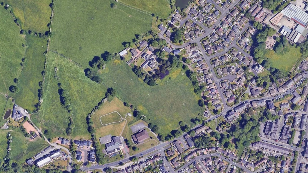
Green Belt authorities are often at the centre of 5YHLS debates because many face high housing need while having limited non-Green Belt land available for new homes.
But the picture is not as simple as urban versus countryside. The new standard method still places the largest share of indicative local housing need in the most urban authorities, with almost two-thirds of need falling within areas classed as urban. However, the remaining need is spread across intermediate urban, intermediate rural and majority rural authorities.
This matters because some authorities with substantial open countryside may still be classed as urban where most of their population lives in towns or cities. Equally, a housing need figure applies across the whole local authority area. It does not mean every part of that area is automatically suitable for development.
For Green Belt and edge-of-settlement sites, the key question is therefore not simply whether the council needs more homes. It is whether the site represents one of the more sustainable, lower-harm and deliverable ways of meeting that need.
The NPPF continues to attach great importance to Green Belts. It confirms that the fundamental aim of Green Belt policy is to prevent urban sprawl by keeping land permanently open, and it identifies the purposes of the Green Belt.
However, the NPPF also makes clear that Green Belt boundaries may be altered where exceptional circumstances are fully evidenced and justified through the preparation or updating of plans. Those exceptional circumstances include, but are not limited to, situations where an authority cannot meet its identified need for homes, commercial or other development through other means.
This is the key point.
A housing shortfall does not automatically release Green Belt land.
But where a council cannot meet its housing need through urban land, brownfield sites, higher densities or neighbouring authorities, Green Belt release may become much harder to avoid.
That is why 5YHLS matters so much. It forms part of the wider evidence picture. It helps show whether the council’s housing strategy is working, whether housing need is being met and whether additional land may be required.

Grey Belt policy has made the relationship between housing need and Green Belt land more nuanced.
Under paragraph 155 of the NPPF, the development of homes, commercial and other development in the Green Belt should not be regarded as inappropriate where all the relevant tests are met.
In summary, the proposal must:
These tests are important because Grey Belt is not a free-standing release mechanism. It is a decision-making route that only works where the land, the location and the proposal all satisfy the relevant policy requirements.
The early Grey Belt appeal examples are already showing this in practice. A significant number of Grey Belt schemes have been approved by inspectors, and in many housing appeals, the lack of a five-year housing land supply has been a key driver.
Where a council cannot demonstrate a 5YHLS, including the relevant buffer, or has a Housing Delivery Test result below 75%, that can help demonstrate unmet housing need for the purposes of paragraph 155.
That means 5YHLS is no longer relevant only to the tilted balance. In the right circumstances, it can also support the Grey Belt route by showing that a proposal responds to a recognised housing shortfall.
However, this is not a shortcut to permission.
A weak land supply position may help open the door, but the site must still qualify as Grey Belt, be in a sustainable location and avoid fundamentally undermining the remaining Green Belt across the plan area. The scheme must also meet the Golden Rules where applicable and be acceptable in design, highways, landscape, ecology, heritage, infrastructure and overall planning terms.
So the opportunity is real, but conditional. The emerging Grey Belt examples show that inspectors are willing to approve well-evidenced schemes, but the quality of the site-specific planning case still decides whether the proposal succeeds.

A 5YHLS shortfall can become a powerful planning argument for developers and landowners. It may be used to support planning applications on sustainable unallocated sites, strengthen planning appeals where councils have refused housing schemes, or promote omitted sites through the local plan process.
In each case, the argument is broadly the same: if a council cannot demonstrate enough deliverable housing land, its housing policies may carry less weight and the benefits of new homes may become more difficult to resist.
This is particularly important at appeal.
Where a council turns down a housing application but cannot demonstrate a 5YHLS, the presumption in favour of sustainable development may become a key factor. Under paragraph 11(d) of the NPPF, planning permission should be granted unless the adverse impacts of doing so would significantly and demonstrably outweigh the benefits, subject to the wider policy tests.
That can materially change the planning balance and give applicants a stronger basis for challenging refusals.
In the Green Belt, the case needs to go further. A 5YHLS shortfall does not automatically secure planning permission to build in the Green Belt, but it can form part of a very special circumstances case where the benefits of housing clearly outweigh Green Belt harm.
This is particularly relevant where councils cannot provide enough land for housing, local plans are out of date or under review, and the proposal can demonstrate genuine public benefits, such as affordable housing, infrastructure improvements and a sustainable location.
Grey Belt has also created a separate route in some cases.
Where a site qualifies as Grey Belt and meets the paragraph 155 tests, the proposal may not be treated as inappropriate development in the first place. In those cases, a lack of 5YHLS can help demonstrate unmet housing need, but the scheme still needs robust evidence on Green Belt performance, sustainability, deliverability, design, access, ecology, infrastructure and overall planning harm.
The strongest cases are not built on housing shortfall alone; they show why that particular site is a credible, lower-harm and deliverable answer to the council’s housing problem.
A strong 5YHLS or Grey Belt case should usually start with evidence, not enthusiasm.
The following information is often critical:
This is where many speculative cases fail.
They rely on the headline housing shortfall but do not do enough work on site-specific planning harm.
Not every 5YHLS shortfall has the same planning value. A modest shortfall in a highly constrained authority may carry different weight from a severe shortfall where the council’s trajectory depends on delayed strategic sites, uncertain infrastructure or unrealistic build-out rates.
A council’s weak 5YHLS may open the door. It does not carry the application through the door on its own.
For applicants, whether landowners or developers, 5YHLS housing land supply is one of the first tests to consider when assessing development potential.
A site that once looked too difficult may become more interesting where the council cannot demonstrate a 5YHLS supply, the local plan is out of date, housing delivery is poor, or the site is well related to an existing settlement.
There may also be a local plan opportunity. Where inspectors have questioned a council’s reliance on windfalls, urban capacity or insufficient housing land, land promoters may have a stronger case for omitted sites. In those situations, the best evidence is not simply that the council needs homes. It is why this site is deliverable, lower harm and capable of helping the plan become sound.
But a 5YHLS shortfall is not a planning permission in waiting. It creates opportunity, but also risk.
The strongest applications still need to show that the site is sustainable, deliverable, well designed and technically sound, with a credible response to access, infrastructure, ecology, drainage, affordable housing and any Green Belt or Grey Belt issues.
This is especially important in sensitive locations. Planning officers and inspectors will still test the full planning balance, including whether the site is suitable, whether harm can be managed and whether the proposal genuinely helps address the council’s housing shortfall.
In other words, a weak land supply position may open the door, but it does not remove the need for a carefully evidenced planning strategy.

For councils that cannot demonstrate a five-year housing land supply, the message is clear: delay is no longer a strategy.
A five-year housing land supply shortfall is not just a technical weakness in a monitoring report. It is a sign that the local housing strategy is not producing enough deliverable homes. It means the council cannot show, with sufficient confidence, that enough specific sites will come forward over the next five years to meet local housing need.
That matters because housing need does not disappear when difficult decisions are postponed. It simply reappears elsewhere: through speculative applications, planning appeals, omitted sites, local plan examinations and inspector-led pressure for more land.
The new plan-making system, in force from 25 March 2026, expects authorities to prepare plans within a 30-month process from Gateway 1, with stronger discipline around progress and intervention where plans stall. In that context, a weak 5YHLS position is no longer something councils can treat as a temporary inconvenience. It is a warning sign that the plan-led system is not working properly in that area.
This is where the politics of housing supply needs to be confronted more honestly.
Good planning must protect what is genuinely important: heritage, landscape, design quality, biodiversity, infrastructure capacity, settlement character and the identity of existing places. But there is a difference between legitimate planning scrutiny and reflexive NIMBYism.
When every housing site is treated as the wrong site, every local plan becomes politically difficult, every housing target is challenged, and every infrastructure concern becomes a reason to say no, the result is not better planning. It is planned under-delivery.
That is the uncomfortable truth behind many five-year housing land supply failures. In some authorities, the issue is not simply that there is no land. It is that the local political system has become highly effective at delaying, diluting or resisting the decisions needed to identify enough deliverable housing sites.
This is not sustainable.
Housing growth should be directed towards the places where the housing gap is greatest. In other words, where the difference between assessed housing need and realistic deliverable supply is most acute, the planning system should be more focused, more proactive and more honest about the need to find suitable sites.
That does not mean forcing development into unsuitable locations. It means recognising that councils with large housing shortfalls, out-of-date local plans and weak deliverable supply cannot rely on broad local opposition as a substitute for a credible housing strategy.
The same principle applies to infrastructure.
Councils and local objectors often argue that new homes will put pressure on roads, schools, GP surgeries, public transport and local services. Those concerns can be legitimate, and they must be tested properly. But they become much less persuasive where councils are also holding large sums of unspent Community Infrastructure Levy and Section 106 money collected from previous developments.
Developer contributions are meant to be part of the social contract of planning. New homes are approved, contributions are secured, and infrastructure is delivered to support growth. When that money is not spent quickly, visibly and transparently, public trust breaks down.
Residents see development without the promised improvements. Developers see obligations without delivery. Applicants then face the same infrastructure objections on future schemes, even where previous developments have already contributed money to address those pressures.
This creates a damaging cycle. Local communities oppose new housing because they do not believe infrastructure will follow. Councils point to infrastructure pressure as a reason to resist further growth. Meanwhile, unspent CIL and Section 106 funds sit in council accounts rather than being converted into school places, transport improvements, open space, healthcare capacity, affordable housing or public realm upgrades.
For councils failing to meet their housing supply requirements, this is a serious credibility problem.
A council cannot argue indefinitely that an area cannot absorb more housing because of infrastructure pressure while also failing to spend the infrastructure money already collected from development. If infrastructure is the reason for resisting new homes, then infrastructure delivery must be treated with the same urgency as housing delivery.
Epsom & Ewell shows how these pressures can play out in practice. The council submitted a local plan that met only 47% of the then standard-method housing need. During the examination, the Inspector required further work on both Green Belt sites and additional urban sites.
The council then identified 13 extra urban sites alongside further Green Belt options. In other words, the housing shortfall did not disappear because the plan sought to avoid difficult choices. It reappeared at examination, under far greater scrutiny.
That is the wider lesson for councils without a five-year housing land supply. Avoiding difficult choices may be politically easier in the short term, but it does not solve the housing shortage. If the numbers do not align with land, delivery and infrastructure, the pressure simply moves elsewhere.
The planning system is becoming less forgiving. The revised standard method, mandatory housing target environment, July 2026 buffer, local plan examination pressure and Grey Belt policy all point in the same direction. Councils need to plan positively for more homes, and where they cannot meet their housing need in full, they need persuasive evidence rather than broad assertions about constraint.
That evidence should not only explain why development is difficult. It should explain what the council is doing to close the housing gap.
That means looking at land allocations, brownfield intensification, Green Belt review where justified, Grey Belt assessment, stalled sites, public land, delivery monitoring, infrastructure planning and the use of unspent developer contributions.
For landowners and developers, the opportunity is not simply owning land in an authority with a weak 5YHLS. The real opportunity lies in showing why a particular site is one of the more logical, lower-harm and deliverable ways of helping to close the local housing gap.
That means going beyond the headline supply figure. The strongest cases will understand the size of the housing shortfall, the council’s housing trajectory, local plan status, Green Belt evidence, Grey Belt potential, site constraints, infrastructure context, unspent CIL and Section 106 position, and realistic delivery prospects.
It is also worth watching local plan examinations closely. Where inspectors question a council’s reliance on windfalls, urban capacity or insufficient housing land, there may be a live opportunity for well-evidenced omitted sites.
In other words, 5YHLS is not just about housing numbers. It is about planning risk, political realism, infrastructure accountability and the ability to identify where housing growth is most urgently needed and most capable of being delivered.
The councils that succeed will be those that stop treating housing growth as something to be delayed, diluted or displaced. The strongest planning authorities will be those that combine honest land supply evidence, proactive infrastructure delivery and mature political leadership.
The weakest will be those that continue to resist development, delay plan-making, hold back infrastructure spending and hope that the housing shortage can somehow be managed without making difficult choices.

At Urbanist Architecture, we work with landowners, developers and homeowners on complex planning sites, including Green Belt, Grey Belt, countryside and edge-of-settlement land.
We assess whether a site has realistic planning potential by looking at the full policy picture, not just one headline number. Through detailed feasibility studies and assessments, we explore the development potential of land by considering housing need, five-year housing land supply, Green Belt and Grey Belt policy, site constraints, local plan status and the realistic prospects of securing planning permission.
For larger or more complex sites, especially where affordable housing, infrastructure contributions, viability or Golden Rules requirements may affect deliverability, early viability input can also be important. The strongest strategies bring planning, design, technical evidence and viability together from the outset.
If you own land in an authority under housing supply pressure, the most important first step is to understand whether the opportunity is real.
A carefully prepared planning strategy may reveal a route forward. A weak, rushed or generic case may simply expose the site to refusal. That is why evidence matters. And that is where the right planning advice can make all the difference.
We look forward to learning how we can help you. Simply fill in the form below and someone on our team will respond to you at the earliest opportunity.
The latest news, updates and expert views for ambitious, high-achieving and purpose-driven homeowners and property entrepreneurs.


We specialise in crafting creative design and planning strategies to unlock the hidden potential of developments, secure planning permission and deliver imaginative projects on tricky sites
Write us a message