Read next
The latest news, updates and expert views for ambitious, high-achieving and purpose-driven homeowners and property entrepreneurs.


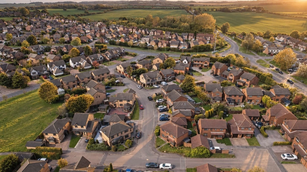
A vacant building beside a station may look capable of taking another storey. Nearby development suggests one housing density; access to public transport supports testing another. For a landowner or developer, the challenge is establishing how much of that potential can secure planning permission.
The NPPF 2026 gives applicants stronger reasons to explore higher housing density on suitable land. Turning that support into an achievable scheme means working through the details: usable rooms, well-arranged buildings and spaces, and acceptable relationships with neighbours.
Recent appeals show what this means in practice. At Hesketh Bank, an inspector granted permission in principle for up to four homes on approximately 0.14 hectares on 24 September 2026.
Applying the new density and design policies, the inspector found that varied surrounding plot sizes offered flexibility for a suitable scheme. Its detailed design remained to be assessed, but existing character did not prevent the site’s potential being explored.
Four days later, an inspector dismissed a proposal to replace three houses with 23 apartments at New Road, Peterborough.
The block’s bulk and massing related poorly to neighbouring homes, while overlooking, overbearing effects and unresolved servicing added to the harm. Those shortcomings reduced the weight given to increased density.
For anyone assessing a site, these decisions make the policy opportunity more tangible. Familiar assumptions about density may be challenged, provided the design and supporting evidence make a convincing case for the capacity proposed.
In this article, I will explore what stronger support for growth means for the question that matters most to landowners and developers: how much can your site realistically accommodate?
I will begin with NPPF 2026’s approach to making effective use of land and explain how expectations differ inside and outside settlements. I will then examine station-led density and clarify which parts of a site count towards the calculation.
Finally, I will show how architectural decisions turn that potential into a scheme capable of securing planning permission.
Making effective use of land is central to the NPPF 2026 approach to housing delivery. The aim is to unlock more homes on suitable land by making better use of existing buildings and infrastructure before directing development pressure elsewhere.
To support national housing targets, the framework strengthens the case for higher density through building upwards, reusing vacant or underused buildings and intensifying low-density sites. Well-connected locations offer particular opportunities to accommodate more homes.
For qualifying sites near well-connected stations, the framework sets a minimum of 35 dwellings per hectare (dph) across the net developable area, rising to 45 dwellings per hectare (dph) where services are more frequent. These are starting points: the policy expects them to be exceeded where possible, particularly in highly connected locations.
For landowners and developers, this creates a stronger basis for testing more ambitious schemes. Well-designed terraces, courtyard housing or apartment buildings may unlock capacity beyond what the density of neighbouring properties initially suggests.
Realising that opportunity means ensuring that additional homes also create good places to live. Making effective use of land requires buildings that respond appropriately to their surroundings, supported by access, infrastructure, landscape and public space.
Density and design therefore need to be considered together. For an individual site, that leads to a series of practical questions:
The important distinction is therefore between using land more intensively and making effective use of land.
A larger building or higher dwelling count may demonstrate greater intensity, but it only represents the site's true development potential where that additional capacity can be designed, justified and ultimately delivered. The first step is therefore to establish how much development the site can realistically support.
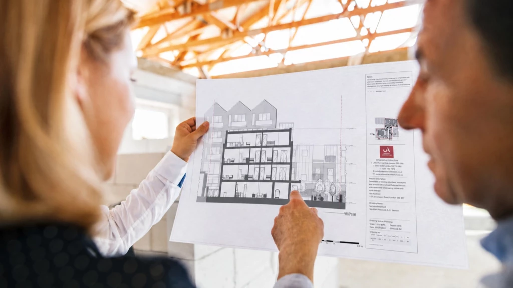
Understanding a site’s capacity starts with a clear picture of its buildings and boundaries, neighbouring development, access, landscape and infrastructure. This gives us the basis for exploring its full development potential.
As part of an architectural feasibility assessment or before progressing to RIBA Stage 3, we examine the opportunities offered by planning policy. We assess whether L2 supports reuse, infill or building upwards, and whether L3 supports greater density, including any applicable station-led minimum.
In other words, where several approaches are possible, we test different ways of achieving higher density that respond to the particular site.
For example, one option might concentrate homes in taller, compact buildings, while another might use terraces or courtyard layouts to accommodate more homes across the land. The forms we explore will vary, but each option aims to make the best use of the site. Comparing them helps identify the strongest combination of capacity, design quality and deliverability.
We then refine the strongest approach. Adjusting building positions, massing, orientation and internal layouts may unlock further capacity while creating good homes and successful relationships with neighbours. The aim is to bring the support in L2 and L3 together with DP3’s design principles to deliver an ambitious scheme that makes the most of the site.
The first question is whether the proposal is within a settlement and falls within L2’s support for building upwards or developing within an existing curtilage.
For development above a shop or elsewhere within an existing plot, that support is not unconditional. Safe access, acceptable daylight and sunlight, privacy and external amenity space still need to be maintained. The relationship with the street scene also remains important, subject to the policy’s stated circumstances for larger buildings, development that is not visible from the frontage and changes already anticipated by a development plan design code.
Development within residential curtilages introduces a more specific capacity test. L2 ordinarily limits new development to no more than twice the footprint of all buildings existing on the site on 17 August 2026 and requires at least half of the previously undeveloped curtilage to remain undeveloped. More may be accommodated where the policy’s no-harm qualification is satisfied, taking account of infrastructure and the sustainability of the location.
Those figures establish the outer parameters of the national policy test; they do not establish an entitlement to that amount of development or the site's acceptable planning capacity . Neighbouring amenity, trees, access, drainage, landscape and the usability of the remaining gardens may all reduce what can realistically be built.
Before asking how much development a site can accommodate, first establish whether it falls inside or outside a settlement for the purposes of the NPPF glossary and the relevant development plan.
The presence of nearby houses does not answer that question. Annex B includes allocated or permitted land that will form part of the built-up area, but generally excludes hamlets and scattered houses unless the development plan provides otherwise. Villages within the Green Belt are also excluded where they are defined as Green Belt in the development plan.
Within settlements, L3(2)(a) expects residential and mixed-use proposals to increase the density of the area unless there is clear justification that this would be inappropriate or impossible. Read alongside S4, DP3 and living-condition requirements, that creates clear support for intensification. But the acceptable number of homes still has to emerge from a workable design rather than from density policy alone.
Outside settlements, including certain edge-of-settlement sites, the position is different. L3(2)(b) asks whether the development footprint makes the best use of the site’s potential, but density cannot by itself establish that housing is acceptable in principle. The applicant’s team must first identify the relevant S5 category, Grey Belt policy or other route capable of securing Green Belt planning permission.
Housing need can become particularly important under S5(1)(j). The latest Housing Delivery Test (HDT) results are relevant where an authority scores below 75%, because NPPF 2026 treats that as evidence of unmet housing need. That may strengthen the principle-of-development case, but it does not determine the density or design capacity of the site.
Once the principle of development is established, the focus returns to realistic capacity: landscape, access, infrastructure, character, amenity and design. A site may therefore have substantial physical capacity while supporting a more limited planning capacity.
Sites that cross a settlement boundary need particular care. The applicant’s team should assess the respective parts against S4 and S5, together with any relevant Green Belt or Grey Belt tests, before reaching an overall view. A single density figure should not obscure the fact that different parts of the same site may be subject to different policy treatment.
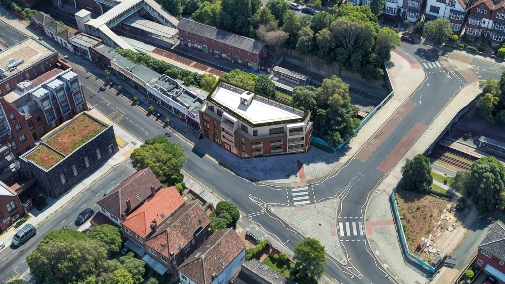
The new ‘default yes’ for development near railway stations requires qualifying residential and mixed-use development within reasonable walking distance of a well-connected station to achieve at least 35 dwellings per hectare (dph) across the net developable area. This rises to 45 dwellings per hectare (dph) where services reach at least eight per hour overall or four in one direction.
Exceptions are limited to non-major development where the minimum is inappropriate or impossible, and Gypsy and Traveller development. These are minimums to be exceeded where possible, informed by accessibility evidence including the Connectivity Tool, not a grant of permission or a maximum site capacity.
The minimum has to be tested in the layout. Entrances, circulation, servicing, landscape and amenity space all need room, while the building must maintain an acceptable relationship with its neighbours. If meeting the minimum weakens those relationships, the calculation has exposed a design problem. That is why the scheme must work in section as well as on plan. Daylight is a good example.
The 2024 framework encouraged flexibility where daylight and sunlight guidance constrained the efficient use of land, provided acceptable living standards were achieved. That direction has not been carried into the NPPF 2026. Policy P3 instead requires adequate light for occupiers and no unacceptable effects on neighbours. An extra storey or deeper floorplate may therefore increase the yield on paper while producing rooms that are harder to light or a poorer relationship with adjoining properties.
Equally, the policy minimum should not be mistaken for the site’s optimum capacity. L3 expects it to be exceeded where possible, particularly in highly connected locations. Our research into station-led locations identifies places where a more ambitious masterplan may be worth testing, but the appropriate density still has to emerge from a convincing design rather than from the numerical target alone.
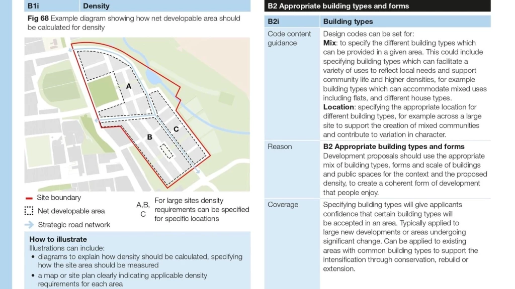
The boundary used for the calculation can change the stated density without changing the scheme. Thirty-six homes across one hectare amount to 36 dwellings dwellings per hectare (dph). If 0.2 hectares properly falls outside the net developable area, the same 36 homes amount to 45 dwellings per hectare (dph). No homes have been added; the land counted has changed. That boundary needs a defensible basis.
Annex B counts land used for housing and directly associated uses, including access roads, hard landscaping, private gardens, ground-floor amenity space, ground-level parking and incidental open space.
It excludes land unsuitable for built development, such as strategic infrastructure, parks and public squares, and open space that contributes to the wider green infrastructure network through significant biodiversity or drainage features. A verge or minor swale is not excluded merely because it is green or carries water.
Make the calculation visible in a site plan and a reconciled schedule:
Finally, test the exclusions against the design. Land set aside for drainage or landscape must have enough space to perform that function once buildings, access and levels are resolved. If that area changes, recalculate the housing density.
On complex sites, floorspace, habitable rooms, height and building coverage can give a fuller picture of development intensity. Once the calculation is sound, the next question is whether the development needed to achieve that density works in design terms.
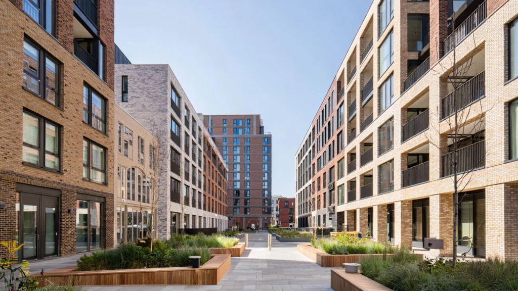
DP3 of the NPPF 2026 identifies seven principles of a well-designed place. They are best considered together rather than as separate tests, because a single design decision will often affect several at once. Building orientation, for example, can influence both liveability and climate performance, while the position of entrances can shape movement, public space and identity.
The principles relevant to the nature and location of the proposal should therefore be considered in combination:
Liveability: healthy, mixed and durable places that function for residents over time; the quality of a flat and its shared spaces matters as much as its count.
Climate: orientation, massing, materials and landscape that conserve resources and reduce overheating and climate risk.
Nature: accessible green infrastructure, trees, habitats and sustainable drainage that form part of the layout.
Movement: connections and transport choices that prioritise walking, wheeling, cycling and public transport.
Built form: buildings arranged to define streets and spaces, use land compactly and distinguish public from private areas.
Public space: safe, inclusive, accessible routes and places for meeting and play, overlooked by entrances and windows.
Identity: a visually coherent and distinctive place shaped by appropriate materials, features and planting.
These seven principles are explored in more detail in the draft Design and Placemaking Planning Practice Guidance (PPG), published for consultation in January 2026.
The PPG remains draft guidance rather than final policy, but it provides useful detail on how the seven features of well-designed places can inform development proposals and planning decisions where consistent with the final framework.
The weight given to each principle will depend on the scheme. A small roof conversion may turn mainly on liveability, built form and identity, while a substantial redevelopment may also need to resolve movement, landscape, nature and public space.
For applicants, the important point is that these principles should be visible in the design rather than simply listed in a planning statement. Plans, sections, elevations and views should show how the proposal responds to them.
The more a development changes the scale, density or character of its surroundings, the more clearly the design should demonstrate how its height, massing, movement, landscape and relationship with public space make that change coherent and justified.
The practical question is therefore not whether all seven principles have been mentioned, but how they shape the density, form and character that the site can realistically support.
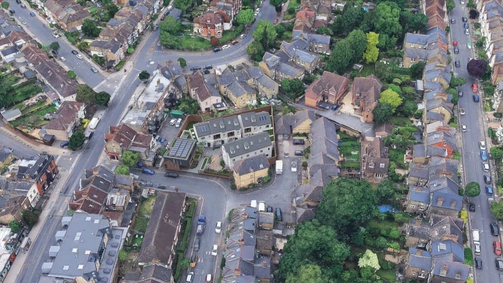
L2 and L3 create the opportunity to test more homes; DP3 asks whether the resulting architecture makes sense in its setting. For an architect, character is more than the height or appearance of the nearest building. It includes plot rhythm, entrances, street enclosure, roofscape, trees and the relationship between buildings, gardens and public space.
Two schemes can achieve the same housing density but produce very different places. One may concentrate homes in a deep block with poorly lit rooms and servicing dominating the frontage; another may use a shallower form with more entrances, better overlooking and room for landscape. The difference is revealed through the plans, sections and ground-floor arrangement, not the dwellings-per-hectare figure.
This is why site plans, floorplans and sections should be tested together before the unit count is fixed. Additional mass may help define a street or corner in one location but become overbearing beside neighbouring windows or gardens in another.
Entrances, cycle storage, refuse, deliveries, daylight, outlook and ventilation all compete for space, and a change in footprint, orientation or housing mix may recover capacity where the first arrangement fails.
The judgement becomes especially important where a site sits between different streets or character areas. One edge may support a stronger built form while another requires a quieter transition. The appropriate response is therefore not necessarily to reproduce the nearest building, but to establish where greater scale can be absorbed and where it should step down.
Height is often where that judgement becomes most visible.
Start with the street rather than the nearest building. Building lines, plot rhythm, roofscape, street width, views, landscape, heritage and the wider pattern of change will usually tell you more about whether additional height can be absorbed.
A three or four-storey corner building beside two-storey terraces may work if it completes an urban edge, marks a junction and steps down towards rear gardens. The same height on a constrained backland plot may simply dominate its neighbours. Calling either scheme “out of character” does not explain why.
The site appraisal should distinguish three possible design moves:
Reinforce: Continue a valuable pattern of plot widths, cornice lines or landscape where that pattern gives the street its quality.
Repair: Address a gap, poor frontage or severed route, with evidence of how the proposal improves the wider sequence rather than simply filling the available envelope.
Change deliberately: Establish a justified transition or new character in an area identified for growth or where existing form is weak. Explain the new place on its own terms and its relationship with what remains.
Each approach needs to bring architectural ambition together with good living conditions, workable access and a considered response to heritage and neighbouring buildings.
A contemporary London vernacular building may achieve this through proportion, massing and materials without imitating its neighbours. Those choices can give a building its own identity while establishing a convincing relationship with its setting.
The good news is that DP3 explicitly supports this architectural ambition. It gives substantial weight to outstanding or innovative design where it promotes high levels of sustainability or helps raise design standards more generally, provided its form and layout are consistent with the area’s overall character.
For applicants, this creates an opportunity to make design quality an active part of the case for development, showing how a distinctive proposal can improve the place.
Start by checking how the design code was adopted, where it applies and what it requires. Explicit design standards forming part of the development plan can materially shape what is acceptable under DP3. Because the policy gives substantial weight to compliance with relevant development plan design policies, demonstrating that compliance can strengthen the case for a proposal’s height, form and density.
Not every document called a ‘design code’ carries that status. Supplementary guidance may still be a material consideration, but it does not necessarily carry the same weight as a development plan standard.
The code’s content matters just as much as its status. Alongside requirements for building lines or frontage treatments, it may anticipate taller corner buildings, additional storeys or roofline changes. These provisions can offer a clear basis for exploring development that an applicant might otherwise assume would be difficult to justify.
Older local policies also need careful examination where they impose a ceiling on development now supported by national policy. Annex A provides that a development plan policy, or the relevant part of it, should receive very limited weight where it is materially inconsistent with a final NPPF 2026 decision-making policy. The exception is where the plan was examined and adopted, or made, under the 2026 Framework.
Age alone does not establish that inconsistency. The project team must identify the specific policy conflict and explain its relevance to the proposal, with section 38(6) remaining the statutory starting point.
Before buying a development site, understanding what the applicable code requires and where it supports change may reveal more about the site’s potential than simply counting nearby buildings.

Yes. Stronger support for making better use of land still requires a convincing design. Under DP3, a proposal should be refused where, without clear justification, it conflicts with the relevant contextual requirements, design principles or explicit development plan design standards.
Terms such as ‘overdevelopment’, ‘too bulky’ or ‘out of character’ only become meaningful once they are translated into a physical effect that can be located on a drawing.
The objection might concern a new wall beside a neighbour’s window, the depth of a block, a roof form visible from the street, usable garden space or the ground floor lost to access, refuse and servicing.
That is where the architectural analysis should begin.
Treat ‘overdevelopment’ as a diagnosis to be tested, not as a design conclusion.
Locate the affected window, garden, route, roofscape or public space; identify the relevant policy and measure the effect. Correct a false premise, defend an acceptable effect with evidence, or redesign a harmful relationship.
On housing projects, the decisive constraint is often surprisingly small. A first capacity plan may look convincing until a neighbour's principal window is plotted accurately, a refuse vehicle is tracked through the entrance, the roof section is dimensioned or the amount of usable ground-floor frontage is calculated. One of those relationships can determine whether the extra unit is genuine capacity or simply an optimistic line on a schedule.
The skill lies in knowing which of those relationships is likely to become decisive before the scheme is too developed to change economically. That requires architectural judgement and planning logic to operate together: understanding not only what can physically be drawn on the site, but which parts of that design are likely to survive policy scrutiny, consultation and detailed technical testing.
That suggests a useful sequence for contested schemes:
identify the element most likely to be challenged and the viewpoint, room or space from which its effect will be experienced;
establish the policy or adopted standard that gives that concern significance;
test whether a modest adjustment to depth, orientation, roof form, landscape or internal planning resolves it; and
only then decide whether retaining the additional capacity justifies the remaining planning and appeal risk.
This is where chartered architects and town planners working together can add the greatest value. The objective is not simply to make the proposal smaller whenever an objection arises, but to recognise which parts of the scheme can be defended, which should be redesigned and which apparently minor change may unlock a materially stronger development.
Pre-application advice or design review becomes more useful once those choices have been worked through. Asking for a general reaction to unresolved massing often produces general comments in return. Showing two properly developed alternatives and asking a precise question about height, frontage, access or neighbour impact is far more likely to produce advice that can inform the next drawing.

Enough to resolve the point on which the decision is likely to turn.
A planning submission should not be measured by the number of reports it contains. The useful question is whether the drawings and supporting evidence remove uncertainty about the critical design relationships.
For a mansard extension, that may mean a dimensioned section proving headroom and accurate roofscape elevations. For a small new build development scheme in London, it may require plans and sections testing access, privacy, daylight, amenity and neighbouring relationships. For a major redevelopment, the evidence may extend to a coordinated masterplan, tested views, movement and landscape strategies and design review.
An effective submission should therefore make five things legible:
A Design and Access Statement can bring those strands together. At Urbanist Architecture, we prepare one for every planning application we handle, including applications where it is not formally required. Its purpose is not to compensate for unresolved drawings. It should explain the logic of a design that has already been worked through.
That distinction becomes even more important after permission.
Policy DP4 brings design quality into the delivery stage, particularly on larger or more sensitive schemes. Materials, façade depth, landscape, architectural features or other elements may have contributed directly to the acceptability of the approved design.
If those are later stripped out through value engineering, the project may not merely become less attractive; it may undermine part of the planning case on which permission was granted. The amount of evidence needed to secure that quality should, however, remain proportionate to the scale of the proposal.
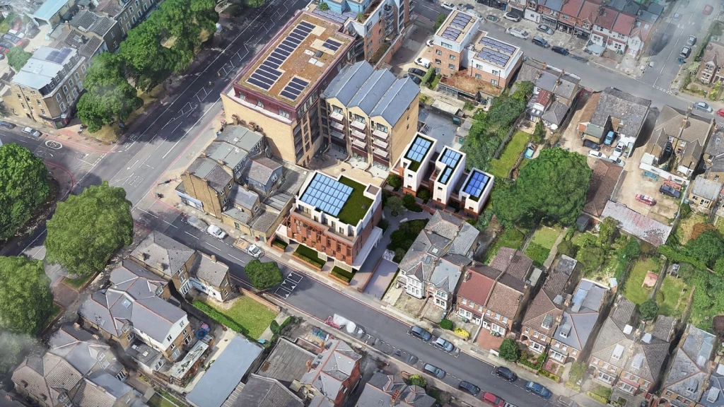
The architectural test does not become easier because the project is smaller. What should change is the amount of evidence needed to answer it.
The NPPF 2026 defines medium housing development as 10 to 49 homes inclusive on a site of up to 2.5 hectares. It remains a subset of major development, while DM2 expects validation requirements to distinguish appropriately between major, medium and other applications and to remain proportionate to scale and impact.
That proportionality matters. A single additional flat should not require the report package of a 40-home redevelopment. But a small application can still fail because one critical dimension, window relationship or roof form is wrong.
In other words, proportionate evidence does not mean relaxed design standards. It means using the least amount of information necessary to demonstrate the important things convincingly. At the other end of the policy spectrum, one route depends on exceptional design rather than ordinary compliance with DP3.
Yes. The former Paragraph 84 route now sits within policy HO11. Its exceptional design provisions allow an isolated countryside home to be supported where the architecture and its relationship with the setting meet a demanding standard. The site may lie within or outside the Green Belt, but that distinction determines whether a further policy test applies.
Under HO11(1)(e), the design must be truly outstanding, reflect the highest standards in architecture, help raise standards of rural design, significantly enhance its immediate setting and respond sensitively to the defining characteristics of the local area. This is an exception to the policy restriction on isolated countryside homes, with requirements that go well beyond demonstrating compliance with DP3.
The starting point is therefore the site itself. The strongest proposals bring architecture, landscape, topography and environmental performance together in a way that makes the house feel convincingly rooted in its surroundings. Expensive materials, unusual geometry or a visually assertive building cannot substitute for that relationship.
If the land is also within the Green Belt, HO11 does not provide an automatic route through its restrictions. It is not itself one of the Green Belt exceptions under GB7. Unless the proposal qualifies under an applicable GB7 category, it remains inappropriate development and requires very special circumstances under GB6.
The exceptional design and the benefits it delivers may contribute to that case, but the considerations in favour must clearly outweigh the harm arising from inappropriateness and any other harm. Passing HO11’s design test does not automatically satisfy that balance.
A rigorous design process may help demonstrate why the proposal deserves support. Independent design review and a clear account of how the scheme has evolved may substantiate its response to the site, but neither proves exceptional quality on its own. The resulting architecture still has to justify the claim.
Other countryside routes under S5 may be available and should be assessed separately. HO11 nevertheless shows how far a design argument may need to go: greater support for innovation does not lower the exceptional standard required for an isolated home relying on this route. How inspectors are assessing design quality in practice brings us to the first decisions under the new framework.

The early NPPF 2026 appeals show how support for greater housing density and making effective use of land is being applied. Inspectors are testing whether the proposed capacity can be accommodated through an acceptable layout, building form and standard of living conditions.
At Southminster (6005664, allowed 18 August 2026), outline permission for up to 110 homes was granted despite landscape change. The inspector considered the settlement extension sensitive and proportionate, with planting and open space mitigating its effects. Conditions secured the development framework and a two-storey height limit, providing credible parameters for the detailed design.
Mount Avenue, Chaldon (6006497, allowed 25 September 2026) reinforces the value of resolving layout and scale early. The scheme for up to 30 homes met the Grey Belt requirements, including the Golden Rules and sustainable-location test. With scale, layout and access determined, the inspector found that the homes would fit comfortably without appearing cramped or overdominant, or unacceptably affecting neighbours. Only appearance and landscaping remained reserved.
At Hesketh Bank (6007730, allowed 24 September 2026), permission in principle was granted for up to four homes on approximately 0.14 hectares. Applying L3 alongside DP3, the inspector found that varied surrounding plot sizes offered flexibility for a suitable scheme. Existing character should not prevent the site making the most of its potential, although detailed layout, parking and amenity space still required assessment.
23 Ronalds Road, Islington (6005904, allowed 24 September 2026) shows that limited design harm may be outweighed. An extension above a rear outrigger caused some harm, but its small scale, rear position and absence from the street frontage limited the impact. The inspector gave substantial weight under L2 to additional residential floorspace in a sustainable urban location and allowed the appeal.
The unsuccessful cases reveal where those arguments lose force. At Acton (6009929, dismissed 20 August 2026), catslide dormers harmed the roofscape, while insufficient measurements left the inspector unable to establish adequate headroom in the additional flat. That fundamental question could not reasonably be left to a condition.
At 512 High Road, Tottenham (6008944, dismissed 23 September 2026), the inspector acknowledged L2’s support for using airspace to provide additional homes. However, the net gain of two dwellings did not outweigh the mansard’s harmful effect on the locally listed building and Bruce Grove Conservation Area.
More recently, 75–79 New Road, Peterborough (6012642, dismissed 28 September 2026) directly connected density with design quality. Replacing three houses with 23 apartments would contribute to housing supply, but the block’s bulk and massing related poorly to neighbouring homes. Overlooking, overbearing effects and unresolved servicing added to the harm. Reading L2 and L3 alongside DP3, the inspector reduced the weight attached to increased density.
Together, these decisions suggest that greater capacity may be supported where its physical consequences are convincingly addressed. For developers and their project teams, the practical task is to test layout, scale, usable accommodation and relationships with neighbours before relying on a housing number in a site appraisal.
A developer may initially assume that a site supports sixteen homes, while a properly tested feasibility study reveals a credible route to eighteen or more. The additional value, however, lies not in the headline unit count but in demonstrating that the extra homes can be accommodated without creating disproportionate problems elsewhere in the scheme.
That is why capacity should be tested through competing design options rather than treated as a fixed number. Changes to the core position, building depth, unit mix, massing or approach to height can sometimes unlock additional floorspace while improving circulation, daylight, servicing and the relationship with the surrounding context.
As residential architects, we pay particular attention to what the last two homes require of the whole building. They may fit within the outline of a floorplan but need a larger circulation core, deeper rooms with less daylight or a servicing arrangement that weakens the ground floor.
The issue is not simply whether those homes fit, but what they require of the building. A more efficient core, shallower plan or different unit mix may accommodate them with little penalty; another solution may demand costly structure, façade treatment or compromises to living conditions. Their value should be judged accordingly.
Planning risk, architecture and buildability therefore need to be tested together. Extra floorspace should be valued with any structural, façade, landscape or infrastructure costs it triggers. On larger sites, the same applies to phasing: the infrastructure, drainage and open space needed to support that capacity must be fundable and deliverable when required.
An outline planning permission can establish the principle and key parameters while leaving appropriate details to reserved matters. The appraisal should reflect both the certainty secured at outline stage and the design and delivery questions that remain. In other words, the commercial appraisal should value the capacity likely to survive the planning and design process, not simply the maximum yield that can be drawn.

The NPPF 2026 has not lowered the design bar. What it does is make the relationship between growth and design more explicit.
That is useful. The planning system should be capable of accepting a building that is taller, denser or architecturally different where the site can support it. Character should not become shorthand for reproducing whatever happens to stand next door.
Equally, the desire to make better use of land should not turn housing density into a number that is fixed before anyone has properly designed the homes, ground floor or relationship with neighbours. The early appeals already demonstrate both sides of that proposition.
There are two areas I would still watch carefully.
The first is the relationship between national policy and the design guidance intended to support it. Where national policy is directive but the detailed guidance remains in transition, ordinary sites in authorities without strong local design documents may be exposed to inconsistent interpretation.
Greater certainty about the final guidance and the status of the documents it replaces would help both applicants and decision-makers.
The second is how density minimums are used in practice. 35 and 45 dwellings per hectare (dph) are floors, not design targets.
On a highly accessible site, stopping mechanically at the minimum may waste development potential. But beginning with the number and commissioning daylight, amenity and servicing evidence afterwards is the opposite mistake.
Before fixing the unit count or the land price, I would want three questions answered.
What part of the site's context genuinely needs to be preserved, and where is change possible?
What spatial and technical constraints determine the development envelope?
Can the homes, public realm and architectural qualities on which the planning case depends survive through detailed design and construction?
Those answers are more useful than a theoretical maximum. They reveal a capacity figure that can be designed, defended and, ultimately, built.
At Urbanist Architecture, we help developers establish a site’s true potential before its value, density or development strategy is fixed. Additional homes only create value if they can be designed well, secure permission and be built without disproportionate cost.
We combine our detailed understanding of the NPPF 2026 design and density policies with our own research into planning decisions, appeals and emerging development practice. Through our architectural services, we turn that analysis into alternative plans and sections.
We do this by testing height, massing, building depth, layout and housing mix alongside daylight, neighbouring properties, access, servicing, landscape and buildability. This reveals both where higher density may be justified and what form is most likely to make it acceptable.
Whether you are considering a purchase, preparing a planning application or revisiting a refused scheme, we can identify where additional capacity may be unlocked and which constraints are likely to determine the final yield.
Sometimes a different layout makes room for more homes. Elsewhere, the last few units introduce costs or compromises that outweigh their value. Knowing the difference early gives you a stronger basis for deciding what to pursue.
We look forward to learning how we can help you. Simply fill in the form below and someone on our team will respond to you at the earliest opportunity.
The latest news, updates and expert views for ambitious, high-achieving and purpose-driven homeowners and property entrepreneurs.





We specialise in crafting creative design and planning strategies to unlock the hidden potential of developments, secure planning permission and deliver imaginative projects on tricky sites
Write us a message