Read next
The latest news, updates and expert views for ambitious, high-achieving and purpose-driven homeowners and property entrepreneurs.



Imagine planning an outbuilding at the far end of your property. The drawings are complete, the building meets the permitted development height limits and the contractor is ready to begin. Then the council asks a question that changes everything: is the building actually within the domestic curtilage of the house?
Domestic curtilage is the land so closely associated with a dwellinghouse that it forms part and parcel of it. It may include the familiar garden, driveway and domestic outbuildings, but it does not necessarily extend to every field, paddock or structure shown within the same Land Registry title.
This distinction can determine whether a garden building, extension, swimming pool or driveway benefits from permitted development rights or requires planning permission. It can also affect the correct application route, site-coverage calculations, Green Belt policy and the protection of structures associated with listed buildings.
The difficulty is that domestic curtilage is rarely established by one document or a single boundary line. It must be identified from the property's layout, history, use and relationship with the dwellinghouse.
In this article, I explain what domestic curtilage means, how it is assessed, who decides where the boundary lies and what it can change before a residential project is designed or submitted.
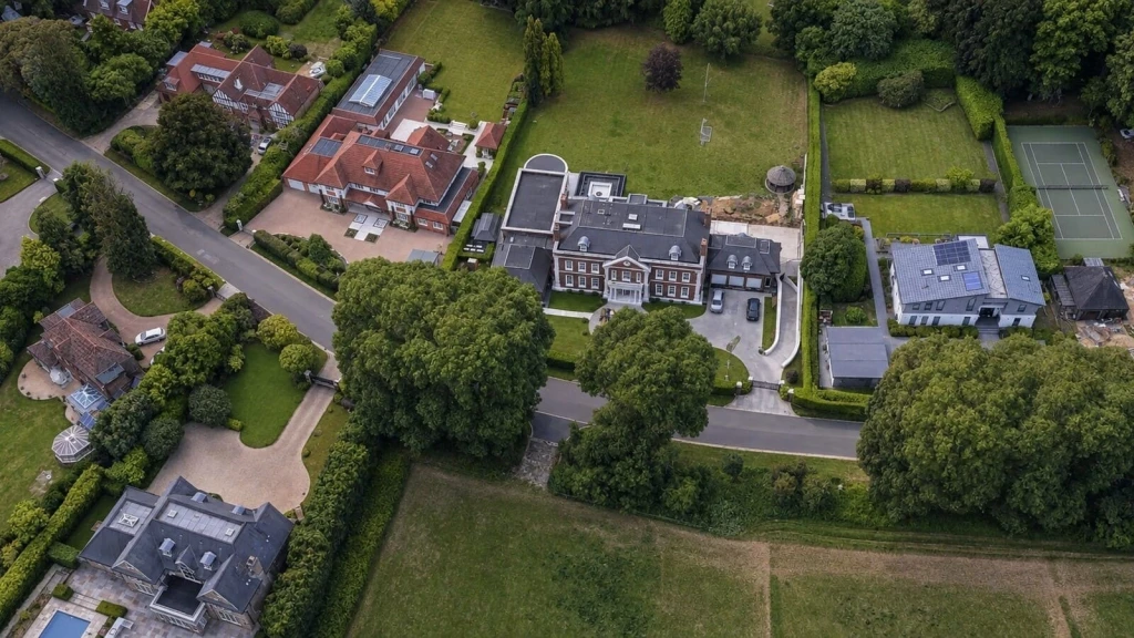
Domestic curtilage is the land closely associated with and serving a dwellinghouse, typically including its garden, yard and domestic outbuildings where these form part and parcel of the home.
However, domestic curtilage is narrower than the ownership boundary. The government’s permitted development guidance for householders explains that curtilage will often include the garden around a house, while wider grounds may extend beyond it.
As a result, a property owner may own fields, paddocks, woodland or other land surrounding a dwelling without those areas necessarily forming part of its domestic curtilage.
The modern legal test derives from Methuen-Campbell v Walters [1979] QB 525 and was confirmed in R (Hampshire County Council) v Secretary of State for Environment, Food and Rural Affairs [2021] EWCA Civ 398, commonly known as the Blackbushe Airport case.
In practical terms, the question is not simply whether the house and surrounding land form one property, estate, planning unit or ownership holding.
Instead, the relevant question is whether the particular area of land has a sufficiently close physical and functional relationship with the dwellinghouse to be regarded as part of it.
For that reason, the phrase “part and parcel” is important. Common ownership, shared occupation and operational convenience may all be relevant, but none is conclusive.
Ultimately, the land itself must have the necessary relationship with the house. It is not enough that the dwelling and the surrounding land merely form part of the same wider geographical or functional whole.
As residential architects and planning consultants, we regularly encounter properties where the land within a single ownership extends considerably further than the area that actually functions as the domestic curtilage.
A dwelling may, for example, stand within several acres of land held under one ownership while its domestic curtilage extends only to the house, forecourt, lawn, garden, garage, stable and other areas that function together as the domestic part of the property.
Beyond that domestic area may lie paddocks, open grassland, fields, woodland or land containing agricultural or animal-related structures. Those wider areas do not become part of the domestic curtilage simply because they are owned or occupied together with the house.
The physical arrangement of the land may help identify where one area ends and another begins. A fence, hedge, watercourse, tree belt, change in surfacing, change in vegetation or another internal edge may mark the transition from domestic garden to wider grounds.
Conversely, where the house, lawn, forecourt and domestic outbuildings form one coherent and continuous enclosure with no meaningful internal division, that may support their inclusion within the same curtilage.
The key point is that domestic curtilage is therefore a legal and planning conclusion drawn from the particular facts on the ground. It is not simply another name for a garden, ownership boundary, wider grounds, planning unit or application site.
The domestic curtilage boundary can change both the application route and the lawfulness of a proposal. It sets the limits of householder permitted development rights, fixes the area used in site-coverage calculations and helps determine whether a proposal counts as householder development at all.
Domestic curtilage is a gateway requirement for many rights under Part 1 of the General Permitted Development Order. A detached building under Class E must be within the curtilage and required for a purpose incidental to the enjoyment of the house.
This is where the distinction becomes important. The curtilage boundary provides the basis for the Class A and Class E 50% site-coverage calculations.
Domestic curtilage can determine whether the householder application route is available. That route includes specified development within the curtilage for purposes incidental to the enjoyment of the dwellinghouse, but a separate dwelling is not householder development merely because it is proposed within a residential curtilage.
The boundary can have additional consequences where:
An incorrect boundary can therefore produce an incorrect area calculation, the wrong application form, the wrong planning fee, incomplete heritage advice or a proposal which cannot lawfully rely on permitted development rights.
No. These concepts may overlap, but they answer different questions.
The registered title identifies ownership. It does not prove that every part of the land is in residential use or forms part of the house's curtilage.
The red line identifies the land to which a particular application relates. It does not necessarily establish the domestic curtilage before the application, or determine what that curtilage will be afterwards.
The planning unit is the unit of occupation and use considered for planning purposes. Even where land forms part of the same planning unit as a house, it does not follow that every part is so intimately associated with the building that it forms part of its curtilage.
Lawful residential or incidental use describes how land may be used. It does not, by itself, prove that the land is physically and functionally part and parcel of the dwellinghouse.
Words such as garden and grounds may describe the facts and provide relevant evidence, but they are not conclusive legal boundaries. The setting of a listed building is wider still: it describes the surroundings in which the heritage asset is experienced, not its statutory curtilage.
This distinction was decisive in Burford v Secretary of State for Communities and Local Government (2017) EWHC 1493 (Admin). Land around a dwelling had a Lawful Development Certificate confirming an incidental residential use and formed part of the same planning unit. Nevertheless, the inspector was entitled to find that a large, physically separated paddock area was outside the curtilage.
Curtilage is not a land use in itself. Nor is common ownership enough.

There is no universal measurement or formula for identifying domestic curtilage. The conclusion must be drawn from the combined evidence about the property and the relationship between the land and the dwellinghouse.
Although the Valuation Office Agency's detailed curtilage guidance was prepared for rating purposes and does not replace planning legislation or case law, its evidence-led approach provides a useful practical framework.
Taken together with the principles established through case law and our experience of assessing curtilage in planning practice, the following factors provide a useful basis for determining whether land forms part of the domestic curtilage. They should be considered collectively rather than in isolation.
Walls, fences, hedges, ditches, roads, drives, tracks, changes in level and the position of other buildings can all indicate where the land associated with the house ends.
A historic garden wall separating a farmhouse lawn from a working farmyard may be strong evidence. So may a public road, a separately accessed field or an intervening parcel in another use.
No single fence is automatically decisive. Some fences are installed for privacy, animals or security within an existing curtilage. The task is to identify the natural relationship between the house and the land, not simply to trace the newest enclosure.
Land and buildings closer to the house are generally more likely to fall within its curtilage. Distance is not an absolute test, particularly for a country house or historic estate, but the functional evidence normally needs to become stronger as the distance increases.
In Skerritts of Nottingham Ltd v Secretary of State for the Environment, Transport and the Regions [2000] EWCA Civ 60, a stable block approximately 200 metres from a country house could fall within its curtilage because of the layout, history, ownership and continuing subordinate relationship between the buildings.
That does not mean every large estate has an equally large curtilage. The Court of Appeal's later Blackbushe judgement confirms that an extensive site does not become curtilage merely because it and a building operate as one functional unit.
Historic conveyances, estate plans, Ordnance Survey mapping, aerial photographs, census material, planning records and evidence of occupation may show whether land or an outbuilding has consistently served the house.
Past and present ownership is relevant, but it is not conclusive. Two areas can remain in one title while having distinct physical and functional identities. Conversely, a later sale does not necessarily remove statutory protection which had already been attached to a curtilage-listed structure.
A domestic lawn, terrace, garage, kitchen garden or store used in a genuinely subordinate relationship with the house is more likely to form part of the curtilage than land used independently for agriculture or business.
The question is not simply whether the occupier finds the land useful. The relationship must be sufficiently intimate for the land to form part and parcel of the dwellinghouse.
The nature of the principal building matters. A mansion, country house or substantial former farmhouse may naturally have a larger curtilage and larger ancillary structures than a terraced or semi-detached house.
Relative scale remains relevant. A very large paddock, park or airfield will not normally become the curtilage of a comparatively modest building simply because both are owned and used together.
Shared drives, drainage, utilities and internal connections may support a close relationship. They rarely decide the issue alone, but can reinforce the wider evidence.
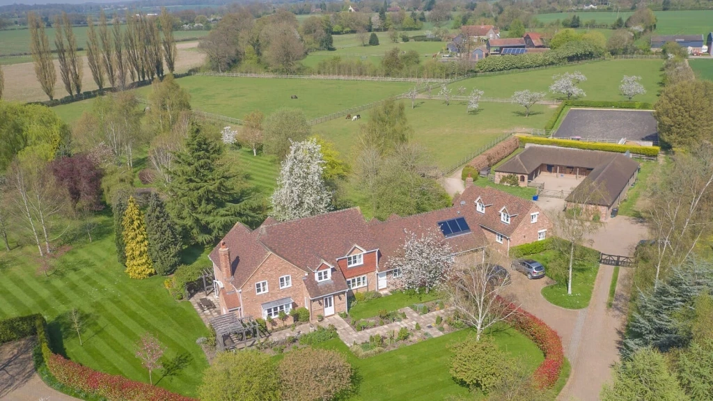
Yes. Domestic curtilage can change where the physical layout, use and functional relationship between the land and the dwellinghouse change in a material and lasting way.
That does not mean an owner can enlarge domestic curtilage simply by moving a fence, mowing a field or placing garden furniture on agricultural land. Those actions may be evidence of use, but they do not by themselves establish that the land has become part and parcel of the house. Extending domestic use into a paddock or field may also amount to a material change of use requiring planning permission.
The relevant date must be kept in mind. A present-day permitted development assessment will usually examine the current factual relationship between the house and the land.
Curtilage listing requires a different historical analysis because section 1(5) of the Planning (Listed Buildings and Conservation Areas) Act 1990 and Historic England Advice Note 10 require attention to the relevant structure, its date and its relationship with the principal listed building at the appropriate historic point.
A reliable domestic curtilage assessment requires evidence of the property's present layout, planning status, use and history, and should normally begin before the design is fixed. Depending on the property, we would review:
The analysis should then be shown on a plan. Where the conclusion is important to permitted development, the supporting statement should explain why the proposed boundary follows the facts of the site rather than merely presenting a coloured line.
The local planning authority will normally determine the extent of the domestic curtilage where this is necessary to decide a planning application, enforcement matter or Lawful Development Certificate.
That decision is not made by reference to a single definitive plan or document. Instead, the applicant identifies the curtilage boundary they rely on and supports it with evidence, while the decision-maker applies the relevant legal tests to the circumstances of the property as they exist at the time of the assessment.
This evidence-led approach is important because determining where domestic curtilage begins and ends is ultimately a matter of planning judgement rather than a fixed measurement exercise.
Your architect and planning consultant should therefore clearly define and justify the proposed curtilage boundary using site-specific evidence, helping the case officer understand the relationship between the dwelling and the surrounding land and reducing the risk of a decision being based on incomplete or incorrect assumptions.
Because the conclusion depends on planning judgement, it can also be reconsidered. If the decision is appealed, a planning inspector may reach a fresh conclusion based on the evidence before them.
A further challenge to the courts, however, will generally focus on whether the correct legal approach was applied, rather than asking the court to redraw the boundary simply because another factual conclusion may have been possible.
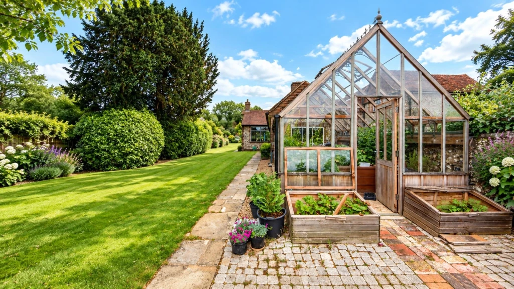
Domestic curtilage acts as a gateway to many householder permitted development rights. Part 1 of Schedule 2 to the Town and Country Planning (General Permitted Development) (England) Order 2015 grants a range of rights for development to a dwellinghouse and within its curtilage.
These rights are technical. A proposal must first fall within the correct class and then satisfy every limitation and condition. Being within the curtilage is often a gateway requirement, not the final test.
Class A can permit certain enlargements, improvements and alterations to a house. Curtilage affects several of its controls.
For example, the total area of ground covered by buildings within the curtilage, other than the original dwellinghouse, must not exceed 50% of the curtilage excluding the footprint of the original house. Existing and proposed additions need to be counted correctly.
The curtilage boundary can also affect separation distances. A two-storey rear extension cannot rely on Class A if it would fall within the specified distance of the rear curtilage boundary, even if there is more land in the same ownership beyond it.
Class E can permit a detached building, enclosure, swimming pool or certain other structures within the curtilage where they are required for a purpose incidental to the enjoyment of the dwellinghouse.
The first questions should therefore be:
Is the proposed structure wholly within the true curtilage?
Is its intended use genuinely incidental to the house?
If either answer is no, dimensional compliance cannot rescue the proposal.
Where the gateway tests are met, the proposal must still satisfy the detailed controls. These include the 50% overall coverage limit; restrictions on development forward of the principal elevation; a single-storey requirement; limits of 4 metres for a dual-pitched roof, 3 metres in other cases and 2.5 metres where any part is within 2 metres of the curtilage boundary; and a maximum eaves height of 2.5 metres.
The calculation is cumulative. Existing extensions and detached buildings count towards the Class E coverage limit, including buildings which pre-date 1948 or were constructed alongside the original house.
On land within National Parks, Areas of Outstanding Natural Beauty, now widely branded as National Landscapes, the Broads or World Heritage Sites, additional Class E restrictions apply. Conservation areas and the other categories of article 2(3) land also impose tighter siting controls.
Class F can permit a hard surface within the curtilage for a purpose incidental to the enjoyment of the dwellinghouse. Where a surface forward of the principal elevation and facing a highway exceeds 5 square metres, it must be porous or direct run-off to a permeable area within the curtilage.
A driveway across an adjoining field does not become Class F development merely because it reaches the same house. The location and lawful use of the land must be established first.
The curtilage is also relevant to porches, roof and elevation works, satellite dishes, gates, fences, electric-vehicle charging equipment and domestic microgeneration, although each is governed by its own class and restrictions.
Part 1 rights do not apply to flats. They may also have been removed by an Article 4 direction, a condition on an earlier permission or, for certain houses created through permitted changes of use, by the GPDO itself.
The distinction between prior approval and permitted development also matters because prior approval is a separate process limited to specified considerations, while a full application invites a wider planning-merits assessment.
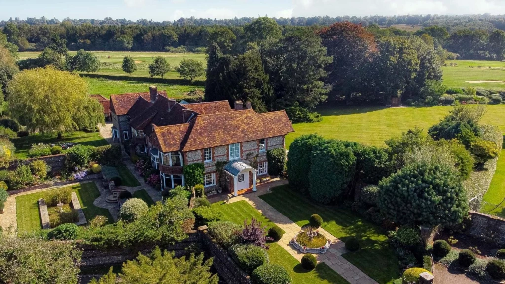
Sometimes, but not automatically.
A large, properly established curtilage can increase the area available for the 50% coverage calculation. It may also place a proposed building further from a curtilage boundary, allowing a greater Class E height.
There is an important limitation here. The whole ownership cannot simply be used as the denominator. If a house sits within two hectares but only the enclosed domestic garden is curtilage, the adjoining paddock cannot be included to enlarge the allowance.
Consider a proposed gym in a rural property. Its footprint and height may comply with Class E, and its use may be incidental to the house. If it is positioned in a paddock outside the domestic curtilage, it is not Class E development.
That, however, is only part of the picture. Moving it into the established curtilage may change the legal route, but the cumulative site-coverage, siting, height and use tests must then be checked again.
That is why permitted development should be assessed in the correct order: establish the lawful extent of the house and its curtilage, identify the applicable class, calculate the relevant limits and then confirm all conditions and restrictions.
An incidental use is a use which remains subordinate to the enjoyment of the main dwellinghouse rather than functioning as primary living accommodation or an independent dwelling. Curtilage and use are separate tests, and Class E permitted development must satisfy both.
A gym, hobby room, domestic workshop, swimming-pool enclosure, garage or garden store may be incidental where its scale, layout and purpose remain subordinate to the main dwellinghouse.
Class E does not permit normal primary residential accommodation. A detached building designed as an independent home, or containing the facilities and pattern of occupation of a self-contained dwelling, is not made permitted development by calling it a garden room or annexe.
The design evidence should therefore match the claimed use. The internal layout, kitchen and bathroom facilities, access, parking, privacy, servicing and intended occupants may all affect whether the building is genuinely incidental, ancillary residential accommodation, or a separate dwelling.

Where a proposal depends on a disputed domestic curtilage boundary or another uncertain permitted development requirement, an application for a proposed Lawful Development Certificate can secure a formal decision on whether the development would be lawful before construction begins.
The government’s Lawful Development Certificate guidance explains that the applicant must provide sufficient factual and legal evidence for the local planning authority to determine the question of lawfulness. For a curtilage-dependent proposal, architectural drawings alone may not be enough.
In practical terms, this means the application may also require a clearly defined curtilage plan, planning history, title information, historic mapping, aerial photographs, evidence of use and a reasoned planning statement.
A certificate provides substantially greater certainty than an informal email from the council or an opinion from a contractor. This can be particularly important where the proposed development involves significant expenditure, the property may be sold or the curtilage boundary is disputed.
A Lawful Development Certificate may also secure an important fallback position. If planning permission is sought for a larger or alternative scheme, the certified permitted development scheme may become a material planning consideration. The local planning authority may then need to compare the effects of the proposed development with those of the lawful fallback, rather than assessing the proposal solely against the existing condition of the site.
For constrained residential sites, particularly properties in the Green Belt, establishing the lawful permitted development baseline at an early stage can preserve a deliverable option while a more ambitious planning proposal is pursued. It may also provide a clearer basis for demonstrating how the scale, siting and effects of the planning proposal compare with development that could already take place lawfully.
This does not remove the need to assess the planning proposal against the development plan, Green Belt policy or other material considerations. Nor does the existence of a certificate automatically determine how much weight the fallback should receive. There must be a real, rather than merely theoretical, prospect that the certified scheme would be implemented if permission for the alternative proposal were refused.
This principle was considered by the Court of Appeal in Mansell v Tonbridge and Malling Borough Council [2017] EWCA Civ 1314. The judgment confirms that the prospect of implementing the fallback is a matter of planning judgement based on the circumstances and evidence of the particular case.
The strategic value and legal protection provided by a certificate ultimately depend on the development and land it precisely describes. Its wording and approved plan should therefore define the proposed scheme with sufficient clarity to establish both the scope of the certificate and the fallback position upon which the applicant may later seek to rely.
Not for every future purpose. A Lawful Development Certificate is conclusive about the lawfulness of the particular use, operation or development identified in the certificate. It does not automatically constitute a general determination of the domestic curtilage across the entire property.
The wording of the certificate and the land shown on its approved plan are therefore critical. A certificate for a particular outbuilding may confirm that the defined proposal, in the identified location and under the circumstances described, can lawfully proceed under Class E.
Under section 192(4) of the Town and Country Planning Act 1990, development carried out in accordance with a proposed certificate is presumed lawful unless a material change occurs before the development begins.
That conclusion should not be extended beyond the matter actually certified. For example, a certificate confirming the lawful incidental residential use of land does not necessarily establish that every part of that land forms part of the dwellinghouse’s domestic curtilage.
The distinction was central to the Burford judgment. In that case, land could form part of the same planning unit and benefit from lawful incidental residential use while remaining outside the curtilage of the dwellinghouse.
The accuracy and completeness of the application are equally important. Under section 193(7) of the Town and Country Planning Act 1990, a Lawful Development Certificate may be revoked if it was granted on materially false or misleading information, or if material information was withheld.
A disputed domestic curtilage boundary should be presented as an evidence-led planning conclusion, not simply as a coloured line chosen to support the proposal.
The submission should clearly distinguish:
the Land Registry ownership boundary;
the planning application red line;
the domestic curtilage asserted by the applicant;
any adjoining land in agricultural, equestrian, commercial or other use; and
the precise location of the proposed development.
The plan should be supported by a short chronology and the most relevant historic maps, aerial photographs, planning decisions, title documents, site photographs and use evidence. The planning statement should then explain how the physical layout, proximity, historic ownership, function, enclosure, relative scale and character support the claimed boundary.
Crucially, the assessment should also deal with contrary evidence. If there is evidence pointing the other way, it should be addressed directly rather than ignored. Where practical, Class A or Class E calculations should also be tested against the council's possible narrower boundary so the consequences of the dispute are clear.
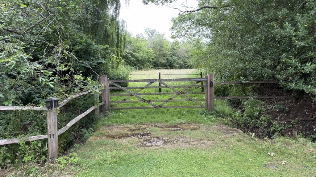
Picture a detached rural house standing within a single Land Registry title. Close to the house is an enclosed garden and a domestic garage. Beyond a post-and-rail fence lies a much larger paddock which has always been used for grazing, benefits from its own field access and contains no facilities serving the dwellinghouse.
The owner plans to build a 60 square metre gym in the paddock and assumes that Class E permitted development rights will apply because the house and paddock are held under the same title. The difficulty is that ownership does not determine curtilage.
On these facts, the enclosed garden and domestic garage have a much closer relationship with the dwellinghouse than the separately accessed grazing paddock. The proposed gym would therefore face a material risk of being outside the domestic curtilage, even if its height, footprint and intended use comply with every other Class E limitation.
A sound planning strategy would confront that risk before the design progresses. The gym could be repositioned within the evidenced domestic curtilage and reassessed against the Class E requirements. Alternatively, the owner could submit the appropriate planning application for development within the paddock, potentially including its change of use.
If a Lawful Development Certificate is still pursued, the application would need to address the evidence pointing against the paddock forming part of the curtilage and explain precisely why the claimed boundary should extend beyond the established garden.
Domestic curtilage can determine whether a proposal qualifies for the householder application route or requires a full planning application. The Development Management Procedure Order 2015 defines a householder application by reference to works to a dwellinghouse and specified development within its curtilage for a purpose incidental to its enjoyment.
If the proposed development is outside the curtilage, involves a material change of use of adjoining land or creates an additional independent dwelling, it may require a full planning application rather than a householder application.
That can alter the application form, fee, validation requirements, consultation, planning assessment and appeal procedure. It can also broaden the issues which the council must consider.
Once the correct route is established, the planning application process determines how the council validates, consults on and assesses the proposal. The overall planning timetable depends on more than the statutory determination period, so programme risk should be considered from the outset. Timing, however, is only one part of the assessment.
The planning merits of the proposal remain equally important. Curtilage status does not guarantee planning permission. A building inside the domestic curtilage can still be refused because of its design, scale, siting, neighbour impact, trees, ecology, drainage, heritage effects or conflict with the development plan. In other words, curtilage establishes the planning context rather than the outcome.
The reverse is also true. Equally, land outside the curtilage is not necessarily undevelopable. It simply means that the proposal must be assessed through the correct planning route, potentially including an application to change the use of the land.
What matters is therefore not simply where the curtilage boundary lies, but what planning route and policy tests apply on either side of it.
Bringing agricultural, equestrian or other non-residential land into domestic garden use may constitute a material change of use requiring planning permission. The assessment may include landscape character, ecology, heritage, Green Belt policy and the effects of new fencing, lighting, play equipment or other domestic paraphernalia.
If permission is sought, the application description and red-line plan should define the proposed change precisely. The intended use, boundary treatment and any restriction on future permitted development rights should also be addressed.
Even where domestic use becomes lawful, the resulting land does not automatically acquire every legal characteristic of domestic curtilage. Its physical and functional relationship with the dwellinghouse must still be assessed on the evidence.
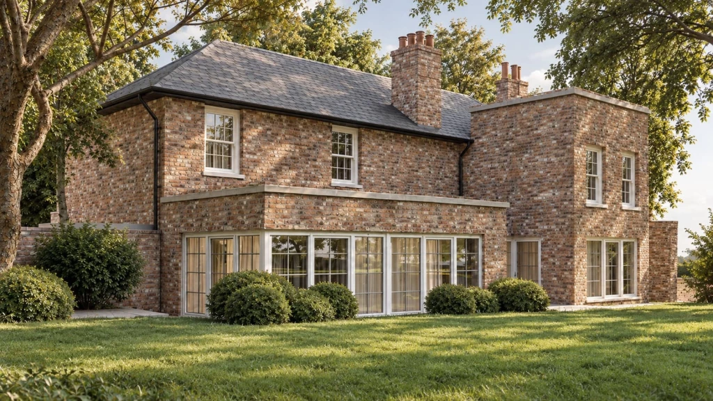
For a listed property, domestic curtilage can determine whether an apparently unlisted outbuilding, wall or other structure is treated as part of the listed building. The consequences of getting that assessment wrong can therefore be more serious.
Under section 1(5) of the Planning (Listed Buildings and Conservation Areas) Act 1990, a listed building includes certain objects or structures fixed to it. It also treats an object or structure within its curtilage as part of the listed building where that object or structure forms part of the land and has done so since before 1 July 1948, unless the list entry expressly provides otherwise.
This is commonly called curtilage listing, although the protected structure may not be named individually in the National Heritage List entry.
Historic England Advice Note 10: Listed Buildings and Curtilage identifies three useful starting factors:
the physical layout of the listed building and the relevant structure;
their ownership, historically and at the date of listing; and
their use or function, historically and at the date of listing.
The factors are not exhaustive and remain highly case-specific. For buildings listed before 1 January 1969, Historic England advises that the logical approach is to examine the position when the curtilage provisions came into effect on that date.
A historic coach house, stable, wall, gate pier, lodge, statue or garden structure may therefore be protected as part of the listed building even if it does not appear separately in the list description.
The blue line sometimes included in a modern list entry should not be treated automatically as the full statutory extent of protection. The list entry, legislation, date, physical relationship and historic evidence must be read together.
A post-June 1948 structure within the curtilage is not treated as part of the listed building through section 1(5)(b). It may still affect the setting or significance of the listed building, fall within a conservation area, qualify as a non-designated heritage asset or require planning permission in its own right.
The dates and consent regimes must therefore be separated. A building can be within the curtilage without being treated as part of the listed building, while a pre-July 1948 curtilage structure may carry statutory protection long after ownership has changed hands.
Some permitted development rights can still apply to listed buildings, but important additional restrictions must be considered.
Part 1 Class E of the GPDO expressly excludes a building, enclosure, pool or container situated within the curtilage of a listed building. A proposed garden building in that location therefore cannot rely on Class E and will normally require planning permission.
Other works must be assessed against both the relevant permitted development class and listed building legislation. Planning permission and listed building consent are separate controls, and obtaining one does not remove the need for the other.
This becomes particularly important when extending a listed building in the Green Belt, because several planning controls may operate at the same time. The proposal may need to address the significance and special interest of the listed building, the effect on its setting, the statutory listed building consent regime and the applicable Green Belt policies, including any tests relating to the scale of an extension and its impact on openness.
Unauthorised works affecting the character of a listed building, including a qualifying curtilage structure, can constitute a criminal offence. Where the extent of protection is uncertain, it should therefore be established before works begin.
Securing planning permission for listed buildings may consequently require a coordinated approach to planning permission and listed building consent, with any Green Belt considerations addressed as a separate but related part of the assessment.
No. Green Belt designation does not, by itself, remove householder permitted development rights.
Green Belt is not one of the categories of article 2(3) land listed in the GPDO. A qualifying house can therefore retain national permitted development rights unless they have been removed by a condition or Article 4 direction, or another restriction applies. The proposal must still satisfy every requirement of the relevant class.
Where development is genuinely permitted by the GPDO, it does not become a full planning application simply because the site is in the Green Belt. A Lawful Development Certificate can be especially valuable because it confirms the legal position without inviting a planning-merits assessment under Green Belt policy.
If a proposal does not fall within permitted development rights, it must be assessed against the development plan and the NPPF 2026. This is particularly important where an application remains pending following a change in national planning policy.
For development in the Green Belt, NPPF 2026's policies GB6 and GB7 are central. Extensions, alterations, replacements and the reuse of existing buildings may be treated as not inappropriate where the relevant tests are met. Otherwise, very special circumstances will be required.
Detached domestic outbuildings require separate consideration. Being within the domestic curtilage does not itself create a Green Belt exception, and the proposal must still be assessed against Policy GB7, local policy and its effect on the Green Belt openness.
For works to an existing building, the detailed Green Belt tests also matter. An extension or alteration must not result in a disproportionate increase in the size of the original building, while a replacement building must remain in the same use and must not be materially larger than the building it replaces.
These tests operate separately from the question of curtilage. Establishing the curtilage boundary is therefore important, but it does not create a right to develop. Land can form part of the domestic curtilage while still being subject to Green Belt restrictions when planning permission for development in the Green Belt.
No.
The NPPF 2026 definition of previously developed land in Annex B includes the curtilage of lawfully developed land, but expressly warns that it should not be assumed that the whole curtilage should be developed. It also excludes residential gardens in built-up areas.
This means that a large residential curtilage cannot simply be labelled brownfield and treated as fully developable. The lawful development, physical condition, character, setting and applicable exclusions all need to be assessed.
Policy L2 of the NPPF 2026 gives support to well-designed additional homes or floorspace within existing plots, including residential curtilages, subject to safeguards concerning character, amenity, site coverage and retained undeveloped land. That support does not displace Green Belt, heritage or development-plan controls, and a separate dwelling remains a full planning proposal rather than householder development.

Farmhouses and rural properties often include land and buildings within one ownership which do not all form part of the domestic curtilage. Rural titles therefore provide some of the clearest examples of why curtilage is not the same as ownership.
A farmhouse may be sold with formal gardens, a domestic garage, stables, barns, a farmyard and several fields. Some of those elements may fall within the domestic curtilage, while others remain agricultural or form a separate planning unit.
Historic England's rural examples show that farm buildings in continuing agricultural business use may fall outside the curtilage of a listed farmhouse even where they share ownership and history. Physical separation and the distinction between domestic and commercial agricultural functions may be decisive. This was central to R (Egerton) v Taunton Deane Borough Council [2008] EWHC 2752 (Admin), the Jews Farmhouse case.
By contrast, a granary or small stable physically within the farmhouse garden and used domestically at the relevant date may fall within the curtilage. A closely arranged historic farmstead may require a more finely balanced judgement.
Three practical warnings follow:
Do not include the whole holding in a Class A or Class E area calculation without clear evidence.
Do not assume that personal or incidental use of a paddock makes it domestic curtilage.
Do not treat a former agricultural building as a Class E outbuilding without checking its lawful use, history and relationship to the dwellinghouse.
Where a dwelling was created through Class Q prior approval or certain other permitted development changes of use, the GPDO may withhold the normal Part 1 householder rights. The planning history of a converted barn or rural building should therefore be checked before any extension or outbuilding is designed.
For agricultural conversions, the original Class Q barn conversion route, heritage status and proposed subsequent works should be considered together.
The most common domestic curtilage mistakes all share one cause: the legal and physical status of the land was not established before the planning strategy was chosen. Applicants often assume that ownership, an old red line boundary, or their personal use settles the question, when the council will assess the part and parcel test on the evidence. The mistakes we encounter most often are:
tracing the Land Registry title and labelling the whole area as residential curtilage;
assuming the red line on an earlier application settled the curtilage question permanently;
including a paddock or field in the Class E 50% calculation without justification;
designing an outbuilding first and investigating curtilage only after the council raises it;
treating incidental use, planning-unit status and curtilage as interchangeable;
assuming Green Belt designation removes all permitted development rights;
assuming that being inside a curtilage makes a full planning proposal acceptable;
overlooking a condition or Article 4 direction which removes permitted development rights;
treating a self-contained annexe as an incidental Class E building;
assuming a modern list-entry plan excludes unmarked historic structures from protection; and
confusing the setting of a listed building with its statutory curtilage.
Each error is best addressed by treating domestic curtilage as the first design question rather than the last planning one.
We recommend a curtilage-first review:
This sequence can change the design. It may show that an outbuilding should be repositioned, an annexe must be redesigned, a change of use should be included, or a full planning and heritage case is required.

The most important boundary on a residential project may not be the one shown on the Land Registry title. It may be the less obvious line separating the land that belongs to the property from the land that legally forms part of the house.
For a typical urban home, that distinction may be straightforward. For a listed building, converted barn, rural farmhouse, country estate or Green Belt property, it can determine the entire planning strategy.
At Urbanist Architecture, we establish the likely curtilage before relying on permitted development rights or finalising a proposal. We bring the planning history, historic development plan, ownership evidence, physical features and lawful uses together in one reasoned assessment, supported by consistent drawings and calculations.
Resolving the boundary at the beginning can prevent a proposal from being designed around rights that do not exist. In domestic curtilage cases, the right question is not simply what can be built, but where the legal right to build actually begins and ends.
We look forward to learning how we can help you. Simply fill in the form below and someone on our team will respond to you at the earliest opportunity.
The latest news, updates and expert views for ambitious, high-achieving and purpose-driven homeowners and property entrepreneurs.



We specialise in crafting creative design and planning strategies to unlock the hidden potential of developments, secure planning permission and deliver imaginative projects on tricky sites
Write us a message