Read next
The latest news, updates and expert views for ambitious, high-achieving and purpose-driven homeowners and property entrepreneurs.


The Grey Belt policy does not reward optimism. It rewards preparation.
Since the NPPF 2026 came into force on 17 August 2026, a great deal of Green Belt land has been re-described as opportunity. Some of it is.
Previously developed sites, enclosed parcels that no longer perform a strong Green Belt function, and land within walking distance of a well-connected station now have clearer routes to development than at any point in seventy years.
But the framework that opened those routes also raised the standard for using them. Evidenced need, a sustainable location tested against policy TR3, the effect on the remaining Green Belt and, for major housing, the Golden Rules all sit between the classification and the Grey Belt planning consent. The appeal record is already showing where applicants underestimate that distance.
This article explains what the NPPF 2026 genuinely makes possible on Green Belt land, which tests decide the outcome, how the Grey Belt, previously developed land and station-led routes differ, and how much of England's Green Belt is realistically developable as Grey Belt land once the tests are applied.
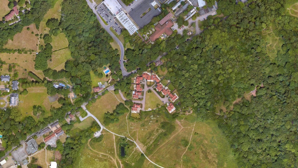
Grey Belt is land within the Green Belt comprising previously developed land and/or other land which, in either case, does not strongly contribute to any of three Green Belt purposes set out in policy GB2 of the NPPF 2026.
The definition is about the planning function the land performs, not its appearance, condition, environmental quality or previous use. That single point explains most of the confusion around the term, and most of the disappointment when a site that looked like an obvious candidate turns out not to qualify.
The three purposes that matter are:
Purpose (a): checking the unrestricted sprawl of large built-up areas.
Purpose (b): preventing neighbouring towns from merging into one another.
Purpose (d): preserving the setting and special character of historic towns.
Land does not become Grey Belt merely because it is derelict, unattractive, underused, previously developed or considered to have limited environmental value. Equally, land does not have to contain buildings or hardstanding to qualify.
For anyone seeking to secure planning permission in the Green Belt, this means Grey Belt status must be established through the policy tests rather than inferred from the land’s appearance, condition or current use.
One important change made through the Government’s new rules-based planning framework is that the Grey Belt assessment methodology now sits in Annex E of the NPPF 2026 itself, rather than in Planning Practice Guidance.
Annex E identifies the characteristics normally associated with a strong, moderate, weak or no contribution to purposes (a), (b) and (d). Giving that method policy status, rather than guidance status, raises its weight in every application and appeal.
The assessment considers matters such as the site's relationship with a large built-up area, whether development would create an incongruous pattern of sprawl, whether the land maintains the separation between towns, and whether it contributes to the setting or special character of a historic town.
Annex E also allows larger Green Belt parcels to be divided into smaller assessment areas where this is necessary to identify genuine variations. The practical consequence is that the findings of an older council Green Belt study should not simply be applied to an individual site. The methodology used, the size of the parcel assessed and the site's actual characteristics all need to be considered first.
No. Previously developed land within the Green Belt does not automatically qualify as Grey Belt.
Across the hundreds of Grey Belt planning applications and appeals we have analysed, the types of previously developed land put forward as potential Grey Belt have included:
Surface car parks.
Disused petrol stations.
Redundant bus or coach depots.
Scrap yards and scaffolding yards.
Former industrial sites and factories.
Former vehicle repair or servicing garages.
Former warehouses and distribution depots.
Redundant public houses and their associated car parks.
Vacant institutional sites, such as former schools and other public facilities.
Former utility or infrastructure sites containing permanent buildings and hardstanding.
The range is wide, but none of these sites qualifies simply because it has been developed before. Each must still be assessed against purposes (a), (b) and (d). If the land strongly contributes to even one of those purposes, it does not meet the Grey Belt definition.
A disused petrol station may fail, for example, if it occupies an important part of the gap between two towns and therefore strongly contributes to purpose (b). A former industrial site may fail if it forms an important part of the setting of a historic town and strongly contributes to purpose (d).
Previously developed land should therefore be treated as a potential Grey Belt candidate, not as land that automatically qualifies. The same logic, applied in the opposite direction, explains why undeveloped land is not automatically excluded.
Yes. Grey Belt is not limited to previously developed land. An undeveloped field, paddock or other open parcel may qualify where it does not strongly contribute to any of the three relevant Green Belt purposes.
Under the Annex E criteria introduced by the NPPF 2026, potential indicators include land that:
Is substantially enclosed by existing development.
Is contained by roads, railway lines or other durable physical features.
Would not create an incongruous extension into the Green Belt.
Does not form a substantial part of a gap between neighbouring towns.
Could be developed without removing the visual separation between towns.
Does not form part of the setting or special character of a historic town.
Has no important visual, physical or experiential relationship with the historic aspects of a town.
The distinction between Grey Belt and other Green Belt land is therefore not whether the site has previously been developed. It is the role the land performs within the wider Green Belt.
An undeveloped field may qualify as Grey Belt while a former petrol station may not. The outcome depends on the site's location, surroundings, boundaries, level of enclosure and relationship with nearby built-up areas and towns. It also depends on something less obvious: the scale at which the assessment is carried out.
Annex E should improve consistency, but it cannot remove planning judgement. Having applied the definition to live sites, we have found that the choice and subdivision of assessment parcels can materially change the conclusion, particularly where different parts of a larger tract have different relationships with towns and countryside.
Parcel boundaries should therefore follow defensible physical and functional features, not be drawn to produce a preferred result. How firmly inspectors hold that line under the new annex is still being tested.
No. Grey Belt remains part of the Green Belt. Identifying land as Grey Belt does not change the Green Belt boundary, alter the lawful use of the land, allocate the site for development or grant planning permission.
Green Belt boundaries can normally be altered only through the preparation or updating of a local plan. Grey Belt is therefore best understood as a policy classification that may provide a stronger route to development within the Green Belt, rather than a separate land-use designation or a certificate of developability.
For a developer, this distinction matters commercially. The practical value of the classification depends entirely on what can then be proposed, which is why the next question is the one that decides most cases.

Identifying land as Grey Belt is only the starting point. For development to be treated as not inappropriate under policy GB7(1)(g) of the NPPF 2026, all the following requirements must be satisfied:
The proposed development would utilise Grey Belt land.
It would not fundamentally undermine the five Green Belt purposes, taken together, of the remaining Green Belt across the area of the plan.
There is an evidenced unmet need for the type of development proposed.
The development would be in a sustainable location, with particular reference to policy TR3.
Where major development involving housing is proposed, it complies with the Golden Rules in policy GB8.
The tests are cumulative rather than alternatives. Evidenced need cannot compensate for an unsustainable location, while a sustainable site cannot avoid the Golden Rules where they apply.
For housing, evidenced unmet need exists where the local planning authority cannot demonstrate a five-year supply of deliverable housing sites, including the relevant buffer, or its latest Housing Delivery Test result is below 75%. The 2025 Housing Delivery Test measurement is now the operative figure.
Need alone is not enough. The sustainable location test is governed principally by policy TR3, which asks whether development would support sustainable patterns of movement, provide good accessibility and make effective use of existing or proposed transport infrastructure. In practice, the questions are whether the location limits the need to travel by private car, provides a genuine choice of transport modes and offers realistic access to employment and everyday services.
Policy TR3 also requires the national Connectivity Tool to be used alongside other quantitative and qualitative evidence. A bus stop or railway station is therefore not enough on its own. What matters is whether the available services are frequent, accessible and genuinely useful for the journeys the development is likely to generate.
Where major housing development is proposed, the route has a further layer. Policy GB8 requires contributions towards affordable housing, necessary improvements to local or national infrastructure, and new or improved publicly accessible green space.
Until an appropriate development plan policy is adopted, the affordable housing requirement is 15 percentage points above the highest requirement that would otherwise apply, capped at 50%, with 50% as the default where no policy exists.
For anyone pricing land, those Golden Rules should form part of the site’s due diligence and be treated as a cost to be built into the offer, not a negotiation to be opened later. The Government’s viability guidance confirms that the price paid for land is not a justification for failing to comply with planning policy.
Where all the requirements of policy GB7(1)(g) are met, the proposal is not inappropriate development in the Green Belt. It should not be treated as harmful merely by reason of inappropriateness and does not need to demonstrate very special circumstances under policy GB6.
Taken together, these requirements turn a land classification into a development case. The question is no longer simply whether the land is Grey Belt, but whether the proposed use is needed, the location is sustainable and the development can be accommodated without fundamentally weakening the remaining Green Belt. Even then, the planning assessment is not finished.
The most reliable way to establish whether your land qualifies as Grey Belt is through a site-specific assessment applying Annex E to the land’s actual characteristics and wider context. Such an assessment should not be treated as a checklist or prepared simply to support a preferred conclusion.
This is where the assessment becomes more complex. It requires professional judgement about the correct assessment area, the status of surrounding settlements, the strength of physical boundaries and the land’s visual and functional relationship with the wider Green Belt.
For this reason, the Grey Belt assessment should be prepared by experienced architects and town planners with specific Green Belt and Grey Belt expertise. The planning analysis must establish whether the land meets the definition, while the architectural and spatial assessment should test whether a realistic development can respond successfully to the site’s constraints, settlement pattern and landscape context.
This is not merely a theoretical risk. We are receiving a growing number of enquiries from landowners and developers asking us to review Grey Belt schemes after planning permission has been refused.
In some cases, the Grey Belt assessment is not sufficiently robust to establish that the land qualifies. In others, the land is accepted as Grey Belt, but the application still fails because the design, scale, landscape response, accessibility or supporting evidence is inadequate.
Either mistake can be costly, particularly where land has already been purchased or substantial consultant fees have been committed on the assumption that Grey Belt status would secure planning consent. Resolving the planning and design strategy early is far less costly than repairing a weak application after refusal.
Our detailed Grey Belt assessment guide explains how Annex E and the subsequent development tests should be applied. You can also use our Grey Belt Land Assessment Tool for an initial indication, although this should not replace a site-specific Grey Belt assessment and coordinated planning and design strategy.
Yes. Satisfying policy GB7(1)(g) does not complete the planning assessment. A site may meet the Grey Belt definition and a proposal may satisfy the relevant GB7 tests, but that does not mean planning permission will automatically follow.
The December 2024 definition took a different approach. It excluded land where policies protecting certain areas or assets provided a strong reason for refusing or restricting development, an exclusion commonly associated with footnote 7. The NPPF 2026 removes that exclusion from the Grey Belt definition.
This change matters. Land affected by a protected designation or other planning constraint may now qualify technically as Grey Belt, but the constraint itself has not disappeared. Instead, it becomes part of the wider assessment of whether development should actually be permitted.
In our advice to clients, we therefore separate two questions from the outset:
The first is primarily a classification exercise. The second requires a much broader assessment of the site, the proposal, the development plan and the other planning considerations that apply.
Policy S5(5) provides the next stage of that assessment. Where development in the Green Belt is not inappropriate under policy GB7, the decision-maker should approve it unless the adverse effects would substantially outweigh the benefits when assessed against the national decision-making policies.
That gives qualifying Grey Belt development a more favourable starting point than the traditional Green Belt balance, but it should not be confused with an automatic route to planning permission.
Our experience of assessing Grey Belt opportunities is that the strongest cases are tested against the wider planning framework from the outset, rather than relying on Grey Belt status alone. The application must still be determined in accordance with the development plan unless material considerations indicate otherwise, and the NPPF 2026 must be read as a whole. Depending on the site, relevant considerations may include:
Sustainable location and transport connectivity under policy TR3.
Highway safety, vehicular access and parking under policies TR4 and TR6.
Design, context, character, scale and layout under policy DP3.
Flood risk and drainage under policies F4 to F8.
Ecology and Biodiversity Net Gain under policy N2.
Trees and landscaping under policy N3.
Protected Landscapes under policy N4.
Protected habitats and irreplaceable habitats, including ancient woodland, under policy N6.
Heritage assets, conservation areas and archaeology under policies HE4 to HE7.
Contamination and ground conditions under policy P2.
Living conditions and pollution under policy P3.
Agricultural land quality.
Utilities and infrastructure capacity.
Residential amenity.
Affordable housing and financial viability.
The practical consequence is that a site may be correctly identified as Grey Belt yet remain unsuitable for the scale or type of development proposed. Some constraints can be addressed through design, technical evidence or mitigation. Others go to whether any viable form of development can be supported at all.
For landowners and prospective purchasers, Grey Belt should therefore be treated as a potential route towards planning permission, not confirmation that the land can or should be developed. A credible strategy combines a robust Grey Belt assessment with evidenced need, a sustainable location, an appropriate design response and convincing evidence that the site's other constraints can be resolved. The next question is who makes those judgements, and at what stage.

Because Grey Belt is a policy classification rather than a separate designation, there is no standalone application to have land formally declared Grey Belt. The issue is decided within whichever planning process it arises in.
A council’s Green Belt assessment is important evidence, but it does not conclusively determine the status or development potential of every individual site. This is made clear in Guildford’s 2026 Green Belt assessment, which identifies land as Grey Belt or provisionally Grey Belt while emphasising that this does not amount to a planning decision.
The same principle applies in reverse. Describing land as Grey Belt in a marketing brochure carries no planning weight unless the conclusion is supported by a robust site-specific assessment.
For plan-making, the NPPF 2026 prioritises previously developed land within the Green Belt, followed by Grey Belt land that is not previously developed and then other Green Belt locations, provided this supports a sustainable pattern of development. That hierarchy applies to plan-making, but it does not determine whether planning permission should be granted for an individual site.
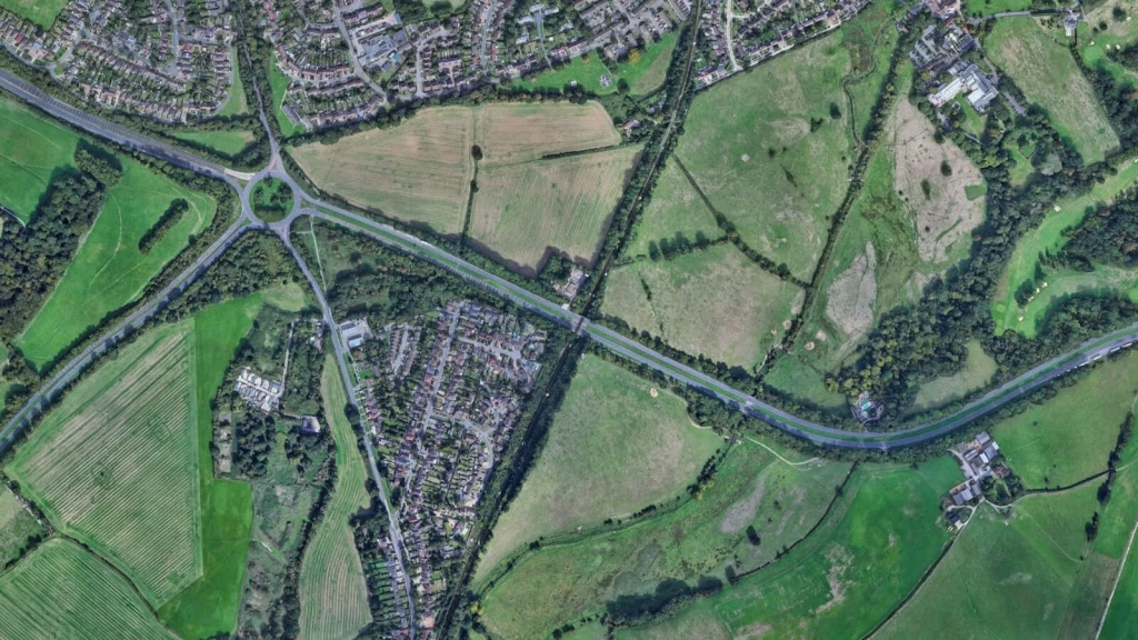
Where the Grey Belt definition and all subsequent development tests are satisfied, policy GB7(1)(g) treats the proposal as not inappropriate development in the Green Belt. It does not therefore attract harm simply by reason of inappropriateness, nor does the applicant need to demonstrate very special circumstances.
That changes the starting point for the planning decision. Rather than asking whether other considerations clearly outweigh Green Belt harm, the local planning authority must first establish whether the proposal falls within policy GB7 and, if it does, assess the development against the development plan and the NPPF as a whole.
That distinction has an important practical consequence, particularly when it comes to openness.
No, not as a separate head of Green Belt harm. Policy GB7 does not impose a separate requirement on development under GB7(1)(g) to preserve Green Belt openness. Instead, where a proposal satisfies the relevant GB7 requirements, it is not inappropriate development and should not be regarded as harmful to the Green Belt or required to demonstrate very special circumstances.
This approach is supported by Mole Valley District Council v Secretary of State for Housing, Communities and Local Government [2025] EWHC 2127 (Admin). Applying the earlier Lee Valley authority, the High Court rejected the argument that development found to be not inappropriate could then be treated as causing a separate form of Green Belt harm through its effect on openness. Although Mole Valley concerned the December 2024 NPPF, the NPPF 2026 now expresses the principle directly in policy GB7.
That does not mean the physical or visual effects of development cease to matter. Building height, massing, landscape effects, settlement character, heritage, residential amenity and design quality may all remain important under the relevant national and local planning policies.
The distinction matters in practice. In our experience, it is not yet being applied consistently by every local planning authority. On some Grey Belt applications, we have had to do more than simply set out the correct policy position in the planning case; we have also engaged directly with officers to explain why loss of openness should not be reintroduced as a separate head of Green Belt harm once the proposal qualifies under policy GB7(1)(g).
That experience reinforces the need to handle Grey Belt applications with particular care. The policy route, supporting evidence and legal reasoning should be set out clearly from the outset, while landscape, character, heritage, design and other planning effects are addressed under the policies that properly apply to them. Getting that distinction right can be critical to giving a Grey Belt application the strongest possible prospect of securing planning permission.
Yes, and the treatment of openness is precisely where the two routes diverge.
Under policy GB7(1)(e) of the NPPF 2026, redevelopment of previously developed land, including a material change of use to residential or mixed-use development involving housing, may be acceptable where it would not cause substantial harm to Green Belt openness.
That route is separate from Grey Belt. A previously developed site may strongly contribute to purpose (a), purpose (b) or purpose (d) and therefore fail the Grey Belt definition, yet still have development potential under policy GB7(1)(e).
The reverse can also apply. Where previously developed land qualifies as Grey Belt and the proposal satisfies policy GB7(1)(g), it may proceed without having to meet the separate substantial-harm-to-openness test that applies under policy GB7(1)(e).
The practical lesson for landowners is not to stop at the question of Grey Belt status. Depending on the site and proposal, other Green Belt exceptions may also be available, including a replacement dwelling in the same use. A replacement dwelling can even be larger than the building it replaces, provided the overall increase is not considered material in its particular planning context.
An experienced architect and town planner should assess every potentially relevant policy route before advising which provides the strongest case for development. A wider site review, or a detailed Feasibility Assessment and Planning Appraisal, may reveal development opportunities that do not depend on Grey Belt status, particularly where the land is located close to a well-connected station.
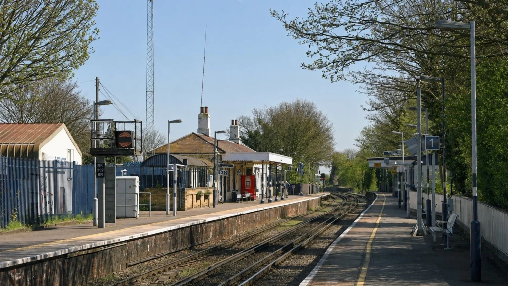
Yes, where the site meets a separate set of tests.
Policy GB7(1)(h) of the NPPF 2026 creates a distinct route for station-led development in the Green Belt, and the land does not need to meet the Grey Belt definition. It should therefore be considered even where the site strongly contributes to purpose (a), purpose (b) or purpose (d).
To qualify, residential or mixed-use development must:
Be within reasonable walking distance of a well-connected station.
Be physically well-related to the station or the settlement within which it is located.
Be of a scale that can be accommodated by existing or proposed infrastructure.
Avoid prejudicing proposals for comprehensive long-term development in the same location.
Comply with the Golden Rules in policy GB8 where major development is proposed.
Annex B defines reasonable walking distance as around 800 metres, or around ten minutes' walk where topography, route quality or physical barriers make a simple radius misleading. Only the part of a site within that distance can benefit from the route.
But distance alone is not enough. The station itself must also meet the NPPF definition of a well-connected station, including its location within a qualifying top 80 Travel to Work Area and the required level of weekday train, Underground, tram or light-rail service.
Identifying qualifying stations is therefore only the starting point. In our experience, the most common mistake is to draw an 800-metre circle around a station and assume the policy applies. In reality, the decision-maker is likely to consider three questions in sequence: does the station qualify, is the actual walking route credible, and does the site have a genuine physical relationship with the station or its settlement?
That is why we measure and photograph the real walking route before design work begins. A theoretical radius may look convincing on a plan, but gradients, crossings, poor footways, severance and indirect routes can materially change how the policy applies on the ground.
The station-led route can therefore create a valuable development opportunity, but it is not an automatic permission zone around every station. Infrastructure capacity, design, landscape, heritage, ecology, access and the development plan remain relevant, while major development must also satisfy policy GB8.
The broader lesson is the same as with Grey Belt: the policy route may open the door, but the strength of the planning case determines whether the proposal gets through it.

Yes. A clearer pattern is emerging from Grey Belt appeals, although the headline success rates only tell part of the story.
Published analyses suggest that major residential schemes have performed considerably better than smaller proposals. By early 2026, around three-quarters of major residential Grey Belt appeals were reported as allowed, compared with fewer than half of residential Grey Belt appeals overall.
Those figures are interesting, but the more useful question is why some cases succeed while others fail.
In reviewing Grey Belt schemes for our work and research at Urbanist Architecture and comparing them with published appeal decisions, we keep seeing the same pattern. Successful cases rarely depend on one favourable factor. Instead, several parts of the planning case work together.
The land is often contained by existing development or durable physical boundaries, rather than relying on a hedge or another weak feature to create a sense of containment. Its contribution to the relevant Green Belt purposes is limited, and the relationship with surrounding settlements has been analysed carefully, including the distinction between towns and villages.
Appeals in Surrey Heath, Castle Point and Tandridge demonstrate why this matters. The classification of surrounding settlements and the site’s relationship with them can materially change how the Green Belt purposes are assessed. In successful cases, that analysis is then reinforced by evidenced housing need, a sustainable location and, for major housing, appropriate affordable housing, infrastructure and publicly accessible green space.
But policy analysis alone is not enough. Design frequently becomes decisive.
Stronger schemes use their landscape structure, access, green infrastructure, building form and mitigation to respond to the site from the outset. Where landscape, heritage or other harm cannot be avoided entirely, the supporting evidence identifies it honestly and demonstrates how the design has reduced its effects.
Dismissed appeals reveal the opposite pattern. Proposals in Buckinghamshire and Elmbridge have failed where the land continued to perform an important role in checking urban sprawl. In Central Bedfordshire, the land was accepted as Grey Belt and the proposal passed the relevant tests for the principle of development, yet the appeal was dismissed because the scale and design of the houses caused unacceptable harm to landscape character.
That decision is particularly instructive. Grey Belt status established the policy route, but it could not compensate for weaknesses in the proposed scheme.
For landowners and developers, the practical message is straightforward. The strongest cases align the Grey Belt assessment, policy route, housing need, accessibility, design, landscape response and wider planning benefits before the application is submitted. The encouraging point is that many weaknesses can be identified early, while there is still time to strengthen the evidence, revise the design or reconsider the development strategy.
There is no definitive national map or official total for Grey Belt. It is a policy definition rather than a land designation, and the Government has confirmed to Parliament that identifying it is a matter for each local planning authority.
Published estimates vary widely because they measure different things. Knight Frank identified around 13,500 hectares of previously developed Green Belt land, LandTech estimated up to 150,000 hectares using automated scoring, and Searchland identified more than 30,000 potential sites. In 2026, the Greater London Authority found that around 20% of London's Green Belt could potentially meet the definition, while stressing that this did not establish development suitability.
Those figures are useful, but they indicate only how much land might meet the definition. They do not reveal how much has a realistic prospect of development.
To explore that distinction, in September 2026 we conducted a two-stage analysis of England’s Green Belt. First, we considered how the contribution criteria in Annex E could affect the amount of land meeting the Grey Belt definition. We then applied the wider development filters, including evidenced need, sustainable location, infrastructure, landscape, heritage, flood risk, ecology, the Golden Rules and the effect on the remaining Green Belt.
Based on this methodology, we estimate that 15% to 20% of England’s 1,633,220 hectares of Green Belt could potentially meet the definition. However, the proportion capable of satisfying the wider planning tests is likely to be closer to 2% to 6%. In land terms, this equates to approximately 245,000 to 327,000 hectares potentially meeting the Grey Belt definition, but only around 33,000 to 98,000 hectares having realistic development potential once the wider tests are applied.
This is a strategic estimate rather than a national parcel-by-parcel assessment, but it exposes an important gap between definitional Grey Belt and realistically developable Grey Belt. For landowners and purchasers, the relevant question is therefore not how much Grey Belt may exist nationally, but whether the individual site has a defensible planning case and realistic development potential.
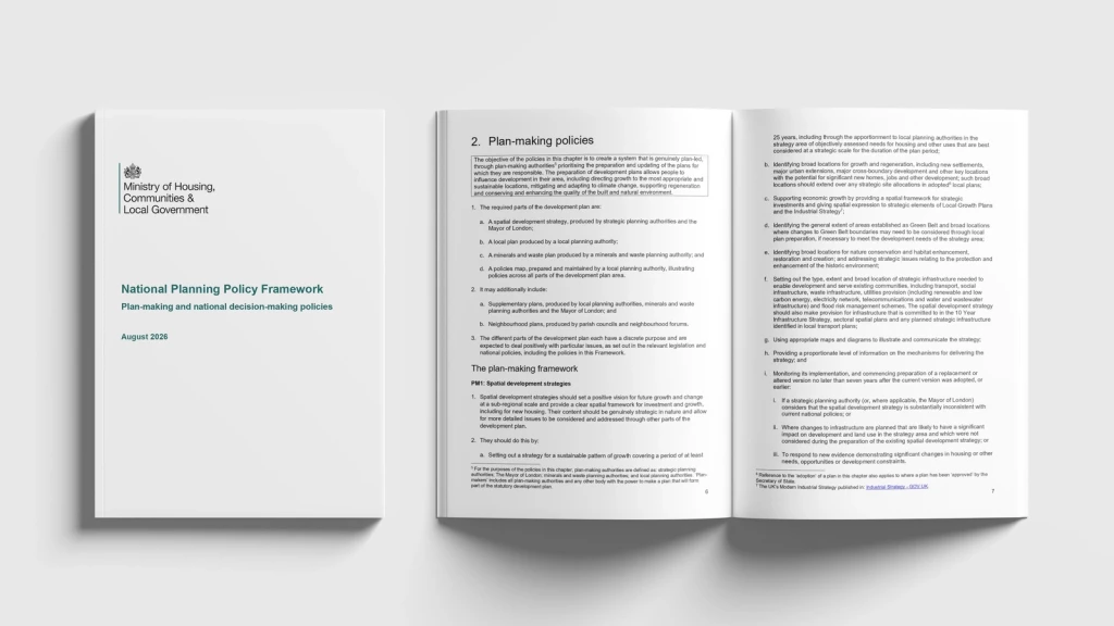
For more than a decade, our work on Green Belt projects has led us to argue that not all Green Belt land is green, environmentally valuable or equally important to the Green Belt’s strategic purposes.
Some land maintains essential gaps between settlements or provides a clear boundary against sprawl. Other areas comprise hardstanding, commercial yards, infrastructure or fragmented land that performs a much weaker function. Such land should not automatically be developed, but nor should it be protected without first understanding what it actually contributes. We explored this argument in detail in our book Green Light to Green Belt Developments.
Developers, landowners and planning practitioners who have followed our work over the past decade will know that we were making this case long before Grey Belt became part of national policy.
Before the December 2024 NPPF, there was no formal Grey Belt classification or distinct policy route for weaker-performing Green Belt land. We were already securing planning permission through more demanding routes, including policy exceptions, very special circumstances and plan-led Green Belt release.
What had required exceptional justification finally gained a defined policy route: the 2024 NPPF introduced the Grey Belt distinction, while the NPPF 2026 has made its assessment more structured through Annex E.
That evolution brings the debate back to the purpose of the Green Belt itself. It was created to check unrestricted sprawl, not to prevent every form of development regardless of housing need, sustainability or the function performed by individual sites.
In our view, this is one of the strengths of the NPPF 2026. It considers how the land actually performs alongside housing need, sustainable transport, infrastructure and development around well-connected stations, rather than treating every part of the Green Belt as equally important. Grey Belt status must still be established through Annex E, however, and appearance, dereliction or previous development alone will not determine the answer.
This is where Grey Belt may make an important contribution to addressing the relationship between Green Belt land and the housing shortage. It creates a more targeted route for directing new homes towards lower-performing land in sustainable locations while retaining stronger protection where the Green Belt continues to serve an important strategic function.
But Grey Belt classification is only the beginning. Development still needs to be planned holistically, with appropriate affordable housing, transport, utilities, community infrastructure, accessible green space and design that responds to the site and its surroundings. Ultimately, the success of Grey Belt policy will depend less on the label itself than on the quality of the assessment, planning strategy and design that follow.

Grey Belt creates a significant opportunity for landowners and developers, but the strength of that opportunity depends heavily on how the planning application is prepared, managed and negotiated from the outset. Proving that the land qualifies is only part of the task. The proposal must also respond properly to its landscape and settlement context, be sustainably located and satisfy the wider requirements of national and local planning policy.
For that reason, a Grey Belt project needs a coordinated strategy before the land value, design assumptions or planning route become fixed. As a practice bringing chartered architects and town planners together under one roof, we treat these questions as part of the same development problem. This allows the realities of land development, in-depth planning analysis and architectural creativity to inform one another from the beginning.
Our experience across Green Belt and Grey Belt projects in England, from individual homes and previously developed land to larger residential schemes, site promotion and planning appeals, has shown how differently decision-makers can interpret Green Belt purposes, Grey Belt status, openness and sustainability. What remains consistent is the need for the site assessment, planning case and design response to work together and be supported by clear evidence.
That practical experience also informed our book, Green Light to Green Belt Developments, which examines the policy, design and strategic routes available for developing Green Belt land. It reflects lessons drawn from real projects rather than policy in isolation.
Whether you already own the land or are considering purchasing it, a site-specific assessment can identify the most credible planning route before major commitments are made. A fundamental weakness is far cheaper to discover before acquisition terms and design expectations are fixed than after.
We look forward to learning how we can help you. Simply fill in the form below and someone on our team will respond to you at the earliest opportunity.
The latest news, updates and expert views for ambitious, high-achieving and purpose-driven homeowners and property entrepreneurs.





We specialise in crafting creative design and planning strategies to unlock the hidden potential of developments, secure planning permission and deliver imaginative projects on tricky sites
Write us a message