Read next
The latest news, updates and expert views for ambitious, high-achieving and purpose-driven homeowners and property entrepreneurs.


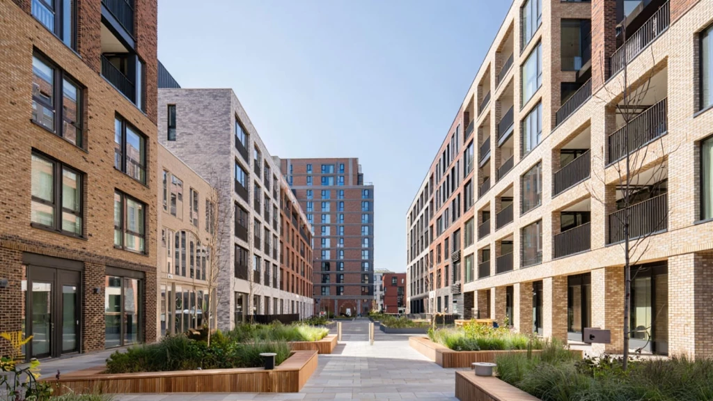
Here is the single most important thing to understand about the draft London Plan 2026, published for consultation on 16 July 2026: it is offering you a bargain.
On one side, the Mayor is opening more places to development. The draft promotes mid-rise intensification across a wider area, creates a plan-led route into the Green Belt through identified Broad Locations for Growth and allows selected industrial land to support housing. It remains brownfield first, but it is no longer brownfield only.
On the other side, these opportunities come with a heavier burden of proof, much earlier in the project. Greater development potential will need to be supported by stronger evidence on capacity, accessibility, infrastructure, design, carbon and viability. In simple terms, the draft trades breadth of opportunity for depth of evidence.
Does that bargain matter before the Plan is adopted? Yes, emphatically.
The London Plan 2021 remains the adopted development plan, and the consultation draft does not change the legal status of a current application. However, the weight given to emerging policy will grow as the draft moves through consultation and examination. A scheme being designed today may be determined, referred to the Mayor or defended at appeal when both frameworks are in play.
That makes the draft London Plan 2026 particularly important if you own land near a proposed Green Belt growth location, hold a suburban site in outer London or promote schemes that depend on density, demolition or industrial land.
The most consequential details are not always found in the headline policies. Some are buried in the growth maps, Annex C, affordable housing thresholds, viability evidence and transitional dates. Together, they may determine whether a site has gained a new opportunity or simply acquired a longer list of requirements.
Read on and I will show you which locations have made the growth map, what the Broad Locations for Growth really mean for individual sites, why Policy PV7 may collide with the national Grey Belt route and how the new density and affordable housing rules could affect development capacity and land value.
I will also identify where the drafting remains vulnerable and set out eight practical steps you can take during the 13-week consultation, which closes on 15 October 2026.

The Draft London Plan's consultation text reorganises London-wide policy into five chapters and 52 policies. It is nearly half the length of the 2021 Plan, and the GLA describes it as aligning closely with national policy except where a targeted London approach is retained, in areas such as fire safety.
Shorter sounds better. Usually it is. London does not need another layer of policy that repeats national guidance or generates reports without improving development outcomes.
But a shorter plan is valuable only if it produces clearer decisions. The real test is whether streamlining delivers faster, more proportionate decision-making or simply gives each borough greater scope for interpretation and calls it flexibility.
The structural signals are clear, but their implications emerge only when the new growth map and the competing demands for land are read together.
Draft Policies MBUL1 and MBUL3 create a more spatially selective growth map. Its principal layers are:
For developers, the practical message is that height and density are becoming more plan-led and spatially selective than under the London Plan 2021. If your scheme trades on height, you need to know which tier applies and whether your location has made the map.
Yet there is a contraction hidden within this expansion. The the draft London Plan 2026 identifies no new Opportunity Areas and removes several associated with Crossrail 2 and central London, reducing their stated housing capacity by around 84,500 homes.
That is not cartographic housekeeping. It shifts planned growth away from infrastructure projects that no longer appear sufficiently dependable and places greater pressure on Brownfield Town Centres and the new Broad Locations for Growth to replace the capacity being removed.
I can see the logic in removing housing numbers dependent on transport schemes with uncertain funding or delivery dates. But the replacement locations must demonstrate more than theoretical capacity. They need credible infrastructure commitments, realistic phasing and a development market capable of delivering the densities assumed. Otherwise, the draft becomes more honest about its old assumptions without making its new ones more deliverable.
The same spatial selectivity runs through the economic strategy. Land for the economy moves in both directions at once. The draft London Plan 2026 asks boroughs to consider releasing designated industrial land for housing in accessible locations while planning for around 350 hectares of new strategic industrial land beyond the built-up area, largely through Green Belt release within the growth locations.
Annex C shows how geographically selective this industrial strategy is intended to be. It does not open Green Belt land beside any major road to development. Instead, it ties storage, distribution and other strategic employment uses to a limited set of Broad Locations for Growth and suitable junctions on the strategic road network. The precise locations and access tests are considered below under Policy PV7.
The draft also introduces its first dedicated data centre policy. Boroughs are asked to identify suitable locations and, where they cannot, consider the Grey Belt and Broad Locations for Growth.
Read this as a quiet admission: housing, industry and data centres are competing for the same well-connected land. The draft addresses that competition in principle but leaves it to be resolved site by site.
The draft is equally clear about what it does not want. Car-dependent uses such as drive-throughs and low-density retail parks face general refusal, while existing out-of-centre retail and leisure parks are directed towards intensification.
A different pragmatism applies to older offices in the Central Activities Zone. Draft Policy PV2 creates a managed route to alternative uses where continued office use through redevelopment or refurbishment is not viable. In mixed parts of the CAZ, this may include office-to-residential conversions. That could matter for secondary stock caught between costly retrofit, weakening occupier demand and lengthy local marketing requirements. The draft does not appear to set a London-wide marketing period, although borough policies may still require one.
This is not a general office-to-residential release. Best-in-class offices remain supported, and higher residential value alone will not justify conversion. Owners should compare three options:
Market demand, floorplate efficiency, servicing, energy-upgrade costs, embodied carbon and residual value should be tested across all three options. If repurposing is the only deliverable route, the planning case must clearly explain why.
What does this mean if you own well-connected industrial land, an ageing retail park or an older office building?
Your site may now sit at the centre of a much wider contest over how London uses its limited land.
The result is what I would call a geography of permission: where your site is may now matter almost as much as what you propose.
Under the London Plan 2021, strong design and the wider planning balance could sometimes overcome an uncertain location. The draft London Plan 2026 may make that harder. A tall building outside an identified location, or a major Green Belt scheme outside a Broad Location for Growth, could begin with a much steeper policy climb, even where the local context supports it.
For site acquisition and option agreements, that changes the order of operations. Locational due diligence against the emerging designations is now a first-order task, not a background check.

Draft Policy MBUL2, supported by the Optimisation Framework and Sustainable Access Measure, reshapes the density and design approach previously handled through Policies D3, D4 and D6 of the London Plan 2021 and the PTAL-based system.
The underlying idea is strong. Rather than asking only whether a station or bus stop is nearby, the Sustainable Access Measure considers whether people can reach the services and facilities needed for daily life. That creates a better basis for deciding where London should grow and what density a site may reasonably support.
Optimisation also moves from a broad design aspiration towards an evidence-based expectation of capacity. For sites above 0.25 hectares that are not already governed by more specific design parameters, falling below the expected density may carry very significant adverse weight. Smaller sites follow a different route, with compliance with the London small site design code potentially establishing acceptability in principle.
For developers, the policy cuts both ways. It may support greater density on well-connected suburban and infill sites, but it also exposes schemes that fall below expected capacity without a properly evidenced reason. Heritage, daylight, viability and amenity constraints will need to be demonstrated, not simply asserted.
The practical response is a transparent capacity study testing at least three credible options:
The record should explain why each floor or unit is gained or lost. It can defend the scheme against an underdevelopment objection, resist pressure for unjustified maximum yield and provide appeal-ready evidence if the disagreement hardens.
At Urbanist Architecture, our experience of testing residential sites across London and securing planning permission for difficult schemes has shown that capacity is rarely determined by a single dramatic decision. Instead, it is shaped by a series of connected choices about height, setbacks, circulation, daylight, servicing, tenure and public space. Optimisation should therefore be treated as a coordinated planning and design exercise, rather than as a single density calculation.
The real test of MBUL2 will be whether its London-wide benchmarks can be translated into fair site-specific judgments. The policy allows genuine constraints to justify development below the expected minimum, but greater clarity is still needed on the evidence required and on how heritage, viability, daylight and amenity should be weighed against the pressure to optimise.
That is the central consultation issue. A framework intended to prevent underdevelopment must not become a shortcut to unjustified maximum yield.
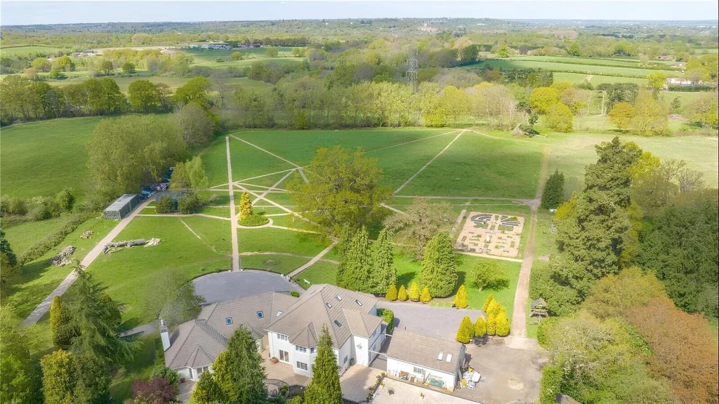
Draft Policy PV7 is, on my reading, the most consequential policy in the document and the one most likely to be fought over at examination.
To understand why, you need to hold two routes in your head at once: the plan-led route promoted by the draft London Plan and the application-led Grey Belt route already available under national policy.
PV7 seeks to channel strategic Green Belt release into identified Broad Locations for Growth. In practice, it creates a clear policy hierarchy:
In principle, I support the direction. This is Green Belt policy moving towards targeted intervention rather than indiscriminate release, steering growth towards locations where homes, transport, services and environmental improvements can be planned together.
The scale is now quantified. Roughly 10% of the ten-year housing programme is expected to come from greenfield development, principally through Green Belt release. The draft also makes provision for around 350 hectares of industrial land beyond the existing built-up area.
But this is not Green Belt development as the market has traditionally imagined it. Policy PV7 points towards average net densities of approximately 90 to 160 dwellings per hectare, with typical heights rising from three or four storeys at the outer edge of a station catchment to five or six storeys in the most accessible locations.
If your residual land value assumes executive houses on generous plots, the draft is assuming something else entirely, and your appraisal, your design team and your capacity assumptions need to catch up before your land price does.
Properly planned, this form of development could deliver homes, shops, schools, public transport, biodiversity improvements and better access to open land. But the admission criteria are demanding. Unless the site is already supported by a compliant Local Plan allocation, masterplan or designated New Town, the vast majority of homes should be within a 1,200 metre walking distance of an identified station or within 400 metres of a bus corridor meeting the service and priority standards in Box PV7C.
The 1,200 metre distance must be measured through an existing or planned walking network and confirmed with TfL, not drawn as a radius on a map. The bus alternative is equally important, but it is not satisfied by the presence of an ordinary bus route. The corridor must provide a fast and frequent connection to rail, sufficient capacity, extensive priority and predominantly dedicated right of way.
Expressing the test as walking distance is the right instinct, and the fight will be over how honestly it is measured, because a route that exists on a plan but not on the ground is not access, it is cartography.
First, a distinction. Broad Location for Growth is not simply another term for Green Belt release. The draft London Plan 2026 uses it as an umbrella designation for areas expected to accommodate higher levels of housing or economic growth, including locations within London’s existing urban area.
In the context of Policy PV7, however, the relevant group is the Green Belt Broad Locations for Growth shown on the Key Diagrams and supported by Annex C.
For the first ten years, the draft identifies ten residential-led, mixed-use Green Belt Broad Locations for Growth. Annex C identifies the stations associated with each location, rather than the individual parcels that will be developed:
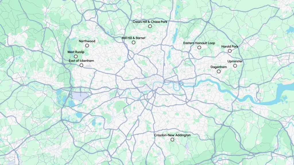
These locations were taken forward because each was considered capable, in principle, of accommodating at least 3,000 homes. That scale is intended to create sufficient critical mass to support public transport, shops, schools, healthcare, community facilities and accessible green space rather than producing isolated housing estates dependent on existing communities and infrastructure.
Together, the affected boroughs are assigned a greenfield housing component of 56,100 homes. But do not divide that figure between the ten locations and mistake the result for an allocation. The housing capacity is distributed at borough level, while the precise sites, Green Belt boundaries and development quantities must still be established through Local Plans.
Being close to one of these stations does not automatically make land developable. A Broad Location for Growth is a strategic search area, not a red-lined site allocation or planning permission. Boroughs must still decide which land should be released, how the new Green Belt boundary should be drawn and how individual ownerships will contribute to a comprehensive masterplan.
There is also a separate industrial geography. The ten-year diagram identifies Green Belt industrial Broad Locations for Growth around:
Here, the admission ticket is strategic road access. Industrial proposals are expected to fall within the relevant Broad Location for Growth and within 2,500 metres of a suitable mapped junction on the strategic road network. Where land could meet both the residential and industrial tests, Policy PV7 says residential development should take priority.
The indicative 20-year diagram identifies a second, less certain wave:
These are not present-day releases. Their future capacity remains contingent on further transport, infrastructure and environmental work. The draft London Plan 2026 seeks to safeguard this land from speculative development that could prevent its eventual optimisation. Strategic land promotion in London therefore runs on a timetable measured in plan cycles, not only application cycles.
The draft also closes an obvious escape hatch: under-delivery against brownfield targets is not to be offset by planning for increased greenfield delivery, particularly outside the identified Broad Locations for Growth. The message to boroughs and promoters alike is that the greenfield route is rationed, sequenced and supervised.
For landowners, the distinction between strategic identification and site-level deliverability is critical. A Broad Location for Growth establishes where the draft plan wants development to happen. It does not establish that every parcel within that geography can deliver it.
Your due diligence must therefore answer two separate questions:
The answer to the first question may be yes while the answer to the second remains uncertain.
Here is the difficulty: national policy already provides a second, application-led route.
Under paragraph 155 of the current National Planning Policy Framework, development on Grey Belt land should not be regarded as inappropriate where the tests on Green Belt purposes, unmet need, sustainable location and the Golden Rules are met. Paragraphs 156 to 159 then set the Golden Rules for major housing, covering affordable housing, infrastructure and accessible green space.
PV7 appears to add a London-specific locational preference on top of that national framework. Can a spatial development strategy lawfully and soundly attach adverse weight to a Grey Belt proposal that complies with national policy, simply because it sits outside a Broad Location for Growth? That is a genuinely open question.
And here is the detail that sharpens the tension: the draft London Plan 2026 does not ignore Grey Belt, but it avoids creating a standalone Grey Belt route for housing. Its preference is to release well-connected Green Belt through a coordinated plan-led process rather than allow dispersed Grey Belt sites to come forward application by application. The rationale to PV7 goes further, arguing that this strategic approach should supersede national provisions for ad hoc release because piecemeal development may require more land and create cumulative infrastructure and environmental impacts that cannot be planned coherently.
The draft then creates a curious exception. Its new data centre policy expressly points boroughs towards the Grey Belt when no other suitable locations exist. A plan that declines to use the Grey Belt for homes, yet volunteers it for servers, has handed housing appellants a line of argument that inspectors will hear more than once.
It is likely to be tested through consultation representations, at examination, and eventually through Grey Belt appeals.
Until that question is resolved, the answer is not to pick a side. If you are seeking planning permission in the Green Belt, run both cases at once.
Track one is the full national case under NPPF paragraphs 155 to 159: Grey Belt status, the effect on the remaining Green Belt purposes, demonstrable unmet need, sustainability of the location, and the Golden Rules on affordable housing, infrastructure and accessible green space. For housing, unmet need is tied to five-year housing land supply or Housing Delivery Test performance.
Track two is a considered response to emerging PV7: your site's relationship to any Broad Location for Growth, strategic infrastructure effects, landscape-led design and cumulative impacts.
A site outside a growth location is not automatically lost. But your application should explain, in terms, why permission would not prejudice the strategic locations, the transport investment behind them, or environmental capacity.
One caution deserves emphasis. Metropolitan Open Land (MOL) is not Green Belt. It is a separate London designation protecting strategically important open land within the urban area, including land valued for recreation, landscape, biodiversity, heritage, public access and green infrastructure.
Under the adopted London Plan, however, Policy G3 gives MOL the same status and level of protection as Green Belt and directs decision-makers to apply the national Green Belt tests to inappropriate development.
That policy bridge became important in the 2026 Greenwich appeal at Angsamus, Weigall Road, where the inspector treated a defined parcel of former tennis-court land and hardstanding within MOL as Grey Belt for the purposes of NPPF paragraph 155 and granted permission in principle for four homes.
The decision matters because it shows that a Grey Belt argument is not automatically unavailable on MOL. But the interpretation must remain narrow. The inspector did not decide that MOL is Green Belt, that all MOL can be treated as Grey Belt or that the designation had been removed. The conclusion depended on the wording of Policy G3, the characteristics of that particular parcel, its limited contribution to the relevant Green Belt purposes, the borough’s housing shortfall and the sustainability of the location.
It is equally important to understand what the appeal did not establish. Because it concerned permission in principle, only location, land use and amount were determined. Layout, design, access, flood risk, ecology and the wider technical case remained unresolved. Greenwich therefore demonstrates a possible route through the first policy gate, not a guaranteed route to a deliverable permission. Eligibility is not consent.
The draft London Plan 2026’s decision to give MOL its own policy should be read in that context. It reinforces the difference between MOL and Green Belt and may weaken or remove the policy bridge on which the Greenwich reasoning depended. Even where a Grey Belt case remains available, an MOL proposal must still address openness, recreation, ecology, flooding, heritage, access, playing-field protection and any overlapping local designations.
The practical lesson is not that MOL has become easy to develop, but that a carefully defined and well-evidenced site may have more than one planning route, each of which must be tested on its own facts.
The housing chapter is where ambition meets arithmetic. Three issues stand out: the target, the affordable housing framework, and the cumulative cost of compliance.
Draft Policy HN1 sets capacity-based borough housing targets, described in the supporting material as minimum figures with higher delivery expected where viability improves.
The scale of the gap is stark. The draft makes provision for 558,000 homes between 2027 and 2036, against the roughly 850,000 that the government’s standard method implies for London over the same ten-year period. The Integrated Impact Assessment likewise describes the programme as sitting below the need generated by the national standard method.
There is a defensible logic to the lower number. A credible target grounded in land availability, viability and infrastructure capacity is more useful than an impressive figure that cannot be delivered. Numbers that flatter are not numbers that build.
Hold two framings in your head at once, because both are true. Against assessed need, and against the far larger ambition floated a year earlier, this target is a substantial cut. Against the adopted 2021 Plan's roughly 52,000 homes a year, it is a modest increase, and you should expect both framings to be deployed at examination depending on who is speaking.
But realism must not become managed under-delivery. City Hall itself presents the 558,000 as conditional: on economic recovery, on a materially larger affordable housing grant settlement, and on transport investment of the order of the West London Orbital, the Bakerloo line extension and suburban rail upgrades.
A target that is honest about its conditions is still a target that fails if the conditions do not arrive. The full 850,000 is pushed to a longer horizon, towards 2047, which makes the coming decade a period of planned undersupply with a known cost in affordability.
Realistic or not, the gap is the draft's central soundness exposure. A planning inspector will ask whether a strategy below assessed need is positively prepared, whether the identified brownfield and Green Belt capacity is realistic and infrastructure-led, and what happens to the unmet remainder.
The supporting text also indicates that boroughs with a greenfield component initially rely on their brownfield annualised target, reflecting Green Belt lead-in times. Fair enough. But it invites an awkward question: if the strategic locations slip, is the ten-year trajectory deliverable at all?
One more pressure point sits above the examination. The draft London Plan 2026 ultimately needs the Secretary of State's approval, and the government has already signalled that it will scrutinise whether the strategy maximises delivery.
A plan built on candour about constraints must persuade an approver whose stated interest is the number, so the draft London Plan 2026's most demanding critic may turn out to be the person who signs it off.
Beneath the headline number, the borough targets have been redistributed, and the redistribution is not cosmetic. Outer boroughs such as Hillingdon, Enfield and Havering take substantially higher targets, with Ealing carrying an outsized share of the overall increase. Meanwhile, parts of inner and east London that have historically delivered at volume, including Barking and Dagenham, Tower Hamlets and Lewisham, see their targets fall.
Why does this matter to you?
Because, in practice, weight follows targets. In a borough whose target has fallen, the familiar argument that the numbers demand greater density loses force, and the planning balance shifts against the more ambitious scheme. In a borough whose target has risen, that argument becomes stronger, but it will often be made to authorities with weaker recent delivery records and, in some cases, less appetite for growth.
Remember, though, that the targets are floors, not ceilings. A reduced target is not a cap on ambition, and a well-evidenced case for more can still succeed. It just has to work harder, and it has to be built on capacity evidence rather than rhetoric.
Draft Policy HN3 recasts the London approach to affordable housing in the context of the national Golden Rules. The threshold, tenure and viability drafting will need clause-level verification before firm conclusions are drawn.
Even so, the direction is pragmatic. A willingness to vary affordable housing requirements recognises a basic truth: an undeliverable percentage produces no affordable housing at all.
The published detail confirms the direction. The strategic ambition remains 50%, but eligibility for the Fast Track Route depends on the site’s location and land profile:
For schemes of 10 to 35 homes, the threshold is 20% on non-Green Belt land and 50% on Green Belt land.
Notice what this means: planning geography now extends directly into viability policy. Affordable housing is no longer governed by a single London-wide threshold. It depends on the site’s location, land type and scale, making the applicable band a critical due diligence question with direct consequences for land value.
There is also a paradox within the bands. The highest threshold, 50%, applies to Green Belt land, where infrastructure costs are often greatest, with relief only where significant transport infrastructure is provided. The draft London Plan 2026 therefore asks the most from sites that may already have to carry the heaviest costs.
The supporting viability evidence is less reassuring than the headline figures. The GLA’s testing finds the higher thresholds achievable only with grant funding and Community Infrastructure Levy relief. It also identifies a six-storey tipping point in mid-value outer London and no viable tested scenario in the lowest-value band, where the 20% threshold appears to function more as a route towards subsidy than evidence of market viability.
That matters because a fast-track threshold should be broadly deliverable without scheme-specific viability testing. If it relies on unsecured public funding, the distinction between fast-track and viability-tested schemes becomes uncertain.
The examination question is therefore whether the assumed funding and relief will be available at the necessary scale. Otherwise, a policy intended to unlock development may create another threshold that projects cannot cross.
The same thinking informs the optimisation framework, which connects height, density, character and accessibility and measures capacity through habitable rooms rather than dwelling numbers alone. This is more intelligent than simple arithmetic, but flexibility must not justify poor design or unnecessarily low provision.
And here is what you need to hold onto: viability pressure in this plan is cumulative, not singular. Your development appraisal should bring together:
A scheme can comply with every individual policy and still be undeliverable if each requirement is priced in isolation. Your appraisal should therefore carry a single cumulative policy-cost schedule, with realistic phasing and sensitivity testing, prepared before the land price is fixed, not after.
A scheme can comply with every individual policy and still be undeliverable if each requirement is priced in isolation. So price them together: your development appraisal should carry a single cumulative policy-cost schedule, with realistic phasing and sensitivity testing, prepared before the land price is fixed, not after.
Watch the calendar, too: the current London housebuilding emergency package includes a time-limited route for qualifying schemes providing at least 20% affordable housing, available where applications are validated by 31 March 2028, close to when the draft plan is expected to be adopted. Two regimes, one handover date. For a marginal scheme, the difference between a 20% route and a 35% band may be the difference between proceeding and not. Your submission programme is therefore a viability decision, not an administrative one.
One detail worth flagging: the supporting text indicates that purpose-built student accommodation counts towards borough housing targets at a ratio of 2.5 bedspaces per home.
The bigger shift is spatial. Borough-level targets for purpose-built student accommodation, totalling a little over 31,000 bedspaces across most of London, replace the old pan-London approach, while specialist accommodation, including large-scale co-living, is brought together under a single policy.
For the sector, that is a map where there used to be fog. A borough with a published target and a shortfall against it is a very different conversation from a borough with neither. If that framework survives consultation, it deserves early market analysis, not a footnote.

Across the draft London Plan 2026, requirements that were once late-stage technical exercises appear to become planning-critical workstreams.
Draft Policy MBUL4 treats power, water and digital capacity as development-enabling constraints. Translation: talk to the utility providers at RIBA Stage 1 and RIBA Stage 2, not at technical design. Draft Policy GHR3 links demolition and retention choices to whole-life carbon assessment and a pre-redevelopment audit, meaning the case for knocking a building down should be evidenced before the preferred massing is fixed, not defended afterwards.
Draft Policy GHR2 requires major schemes to justify their heat solution through a Low Carbon Heat Appraisal, while GHR1 moves energy policy towards measurable performance and in-use monitoring. GHR4 brings overheating, shading and passive design into the masterplanning process, with direct consequences for building orientation, façade design and massing.
Parking standards are also reframed under GHR11 through the Sustainable Access Measure and the character of the location, with car-free or car-lite development remaining the starting point.
Taken together, the pattern is unmistakable: the emerging Plan moves technical evidence to the front of the project programme. Transport, utilities, ecology, landscape, energy and carbon consultants will need to be appointed earlier, while the point at which the design is fixed will need to move later.
Across hundreds of projects we have delivered in London and across the UK, the same lesson has repeated itself: the earlier a decisive constraint is identified, the more freedom the design team retains to respond intelligently. When access, heritage, utilities, ecology, carbon and viability are tested before the scheme hardens, they can shape a stronger and more coherent proposal. When they emerge after the design has been fixed, they become reasons for redesign, delay and, too often, refusal or appeal.
The planning statement may therefore begin to resemble an evidence matrix, with each policy requirement mapped to a drawing, assessment or supporting document. On strategic sites, that approach is manageable and may improve the final scheme.
The greater risk lies with small and medium-sized projects, where importing major-development evidence expectations wholesale could make otherwise sound proposals disproportionately expensive to promote. Proportionality for smaller schemes is therefore an issue that consultation responses should address directly.
There is also an evidence-timing problem within the draft itself. When consultation opened, the official evidence-base register listed the Urban Greening Factor implementation and target review and the Clean and Healthy Waterways Plan as forthcoming in summer 2026, while several other studies were listed without directly retrievable documents.
A policy threshold is not justified simply because the title of a supporting study appears on a register. Applicants, boroughs and those responding to the consultation are entitled to see and test the evidence behind the requirements they are being asked to accept.
Several of the draft London Plan 2026’s load-bearing terms are not yet fully defined in the published draft: optimise, mid-rise, sustainable location, strategic need and significant adverse weight. Each carries decisive consequences, and each is capable of materially different interpretation from one borough to the next.
The glossary work and any future guidance will matter as much as the policies themselves. Expect borough variation in the early years of the adopted plan, and draft planning cases that do not depend on a single favourable reading of an undefined term.
There is a further moving part. The current NPPF is the December 2024 framework, amended in February 2025, but the consultation on draft NPPF published in December 2025 closed on 10 March 2026, with the government’s response and final framework still awaited. The draft London Plan 2026 refers in places to that emerging national context.
Our detailed comparison of the draft NPPF 2025 against the NPPF 2024 shows that the proposed changes are not merely technical, but could materially alter the national policy tests against which the London Plan will be examined. Both policy baselines could therefore shift before adoption.
One divergence is already declared. The draft holds London's energy standards above the levels the draft NPPF would standardise nationally, on the stated basis that retreating would undermine progress towards net zero in the capital. Expect that to become a named battleground at examination, because it tests how much London-specific ambition a national framework will tolerate.
On my assessment, five issues are most likely to dominate examination:
None of this means the draft London Plan 2026 will fail. It means the version that is adopted may differ in important respects from the version now out for consultation. It also means that well-evidenced representations made now have a realistic prospect of shaping the final wording.
The consultation runs until 15 October 2026, with examination expected in 2027 and adoption in early 2028. It is not a formality. For landowners with strategic interests, it is the cheapest planning work you will ever commission relative to its potential effect.
The right response to an emerging plan is neither to ignore it nor to redesign around it wholesale. It is to price the range of outcomes and keep your application robust across all of them. Here are the eight moves that matter:
A feasibility assessment should begin with the policies that currently determine the application: the London Plan 2021, the relevant borough plan and the current NPPF. The draft London Plan 2026 should then be overlaid as a separate layer, identifying which emerging policies may materially alter the site’s capacity, affordable housing position, evidence requirements or route to permission.
Do not blend the two frameworks into a single policy summary. Record clearly which policies are adopted, which are emerging, where they point in the same direction and where they conflict. That distinction becomes particularly important if an application is submitted under the current Plan but determined after the emerging Plan has gained greater weight.
A good appraisal should remain usable at acquisition, pre-application, submission and planning appeal, rather than becoming obsolete each time the policy balance changes.
Ask your architects and planning consultants to identify, at the outset, which technical studies could change the layout, massing or development principle. These commonly include transport and sustainable access analysis, utilities capacity enquiries, flood and drainage constraints, ecological and arboricultural baselines, landscape sensitivity, heritage assessment and an initial whole-life carbon comparison between retention and redevelopment.
The purpose is not to appoint every possible consultant before there is a scheme. It is for the design team to identify the few technical matters that could make the initial concept impossible, materially reduce its capacity or require a different approach.
A utility constraint may affect phasing and density. A genuine pedestrian-access problem may change the entrance strategy and the internal layout. A heritage or landscape constraint may alter building heights and setbacks. A retention-led carbon case may change the demolition strategy entirely.
Bringing these matters into the design conversation early allows the architects to respond through the scheme, rather than leaving the planning consultants to explain away an avoidable conflict after submission.
Where you work with a multidisciplinary practice like ours, combining chartered architects and planning consultants within one team, this coordination can begin from the first feasibility exercise. Planning constraints can be translated directly into design decisions, while emerging architectural proposals can be tested against policy before they become fixed.
That joined-up approach reduces gaps between advice and design, allows technical risks to be identified earlier and produces a scheme that is easier to justify because the planning case and architectural response have been developed together.
Do not allow the first attractive massing study produced by the design team to become the project by default. For a significant site, your architects and planning consultants should test at least three credible options together: a policy-baseline option, an optimised preferred scheme and a higher-capacity stress test.
Each option should use the same site information and clearly record the assumptions behind building heights, setbacks, site coverage, dwelling mix, access, servicing, daylight, amenity and public realm. Your planning consultant should explain the policy basis for each option, while your architect should demonstrate its spatial and design consequences.
The exercise is not about producing artificial alternatives to justify a predetermined answer. It should show where capacity is genuinely gained and where it is lost. If one additional floor creates unacceptable heritage, daylight or townscape harm, record that conclusion and the evidence behind it. If a lower-density option fails to make proper use of a highly accessible site, record that as well.
This creates an evidence trail capable of answering both sides of the planning argument. It demonstrates why the proposal is not underdeveloped, while allowing the design team to resist pressure for a maximum yield that the site cannot reasonably support.
It also ensures that the preferred scheme emerges from coordinated planning and architectural judgement, rather than from a unit target fixed before the site has been properly understood.
For Green Belt sites, prepare a single evidence schedule divided into two clearly separated workstreams:
Keep the conclusions distinct in the planning statement so that the application remains coherent if the relative weight of national and emerging London policy changes during determination.
Where a site falls outside a proposed growth location, explain why granting permission would not undermine the delivery, infrastructure funding or environmental capacity of the identified locations.
Do not test affordable housing, carbon, biodiversity, greening and infrastructure obligations in separate compartments. They are paid for by the same development value and should be modelled as one cumulative policy-cost schedule.
The appraisal should include affordable housing, Golden Rules requirements, transport and utilities infrastructure, Biodiversity Net Gain, urban greening, energy and whole-life carbon measures, public realm, drainage, abnormal ground conditions and realistic professional and finance costs.
On strategic Green Belt sites, phasing and the cost of early infrastructure may be as important as the headline affordable housing percentage.
Sensitivity testing should then show what happens when sales values, build costs, grant assumptions, interest rates or programme periods move. The purpose is not simply to demonstrate that one appraisal balances. It is to identify which obligations are genuinely deliverable, which depend on external funding and which assumptions should inform the land price before it is agreed.
Establish at the outset which affordable housing regime may apply at submission and determination. Compare the site’s position under the current time-limited Support for Housebuilding route with the borough band and land-specific threshold proposed by the draft London Plan 2026.
This is not merely a policy comparison. It may change the residual land value, tenure mix, design, funding strategy and timing of the application. On a marginal scheme, moving from a 20% route to a 35% threshold may require a different land price or a materially different development proposition.
The programme should therefore work backwards from the critical policy dates and allow realistic time for pre-application engagement, design development, technical surveys and validation. Rushing an incomplete application to meet a policy deadline may be as damaging as missing the deadline altogether.
An application prepared under the London Plan 2021 may be determined, referred to the Mayor or appealed when the draft London Plan 2026 carries materially greater weight. The planning case should therefore be capable of surviving a shift in policy during the application process.
Where the emerging plan introduces a new test, address it proportionately rather than pretending it does not exist. Where the emerging policy conflicts with adopted policy or national guidance, identify that conflict expressly and explain the weight that should be applied at the relevant stage.
The same principle should run through the drawings and technical documents. Avoid fixing the application around one policy interpretation where a modest adjustment could keep it compliant under both. A scheme with a clear capacity record, flexible phasing and evidence addressing both frameworks is far easier to defend than one designed around a single moment in the policy cycle.
Where a proposed policy, threshold, designation or undefined term could materially affect a landholding, submit a representation while the wording remains open to change. The strongest representations do more than object. They identify the precise soundness or deliverability issue, support the concern with site-specific or market evidence and propose alternative wording that the examination could realistically adopt.
For example, a representation may challenge the mapping of a sustainable location, the treatment of a site outside a Broad Location for Growth, an affordable housing threshold that does not reflect abnormal infrastructure costs, or an optimisation benchmark that fails to recognise a demonstrable heritage constraint.
Commercial frustration rarely changes a strategic plan. A focused representation that connects the site evidence to legal compliance, soundness and deliverability may do so. The consultation is therefore not simply an opportunity to comment on the draft London Plan 2026. For landowners with long-term interests, it is part of the planning strategy for the site itself.

The draft London Plan 2026 is more realistic than its predecessor about where London’s future homes will actually come from. It accepts that brownfield optimisation alone will not meet need, creates a managed route for Green Belt release and expects outer London to accommodate more mid-rise development.
At the same time, it is unusually candid about the fact that its housing strategy depends on funding, infrastructure, public-sector capacity and market conditions that are not yet guaranteed.
For well-located and well-advised landowners, these changes create substantial opportunities. They also transfer more risk to the applicant. The evidence burden becomes heavier, moves earlier in the process and reaches into areas that many development teams have historically addressed only after a scheme has been designed.
Capacity, accessibility, viability, heritage, infrastructure, affordable housing, design quality and environmental performance will increasingly need to be tested together before the development proposition is fixed.
That change is particularly important in relation to climate policy. An increasing number of London borough local plans now contain ambitious requirements on operational net zero, whole-life carbon and circular construction. Yet progress on retrofitting existing buildings, delivering viable heat networks and closing the gap between modelled and actual energy performance remains painfully slow. The problem is no longer simply a lack of policy ambition. It is the continuing distance between what is promised at planning stage and what is delivered, occupied and measured in practice.
Against that background, the draft London Plan 2026’s move away from a system heavily dependent on carbon offsetting and towards measurable energy-use intensity and space-heating demand targets, supported by five years of post-occupation reporting, is a significant and overdue correction. It recognises that London does not suffer from a shortage of climate commitments on paper; it suffers from a shortage of verified performance. That distinction becomes harder to ignore when only a limited proportion of the carbon-offset contributions already collected has been spent or firmly committed.
However, measurement alone will not resolve the underlying problem. The real test will be whether boroughs have the technical expertise, resources and institutional willingness to scrutinise buildings after occupation and to act where performance falls short. Without that capacity, London may simply replace one form of paper compliance with another. Applicants may submit more sophisticated energy models and monitoring strategies, while the sustainability commitments that justified permission continue to weaken during procurement, construction and occupation.
The same concern runs through the draft plan more broadly. Its direction is often persuasive, but its success will depend on whether its policies can be translated into decisions, funding commitments and deliverable schemes. Four difficult issues remain:
My judgement is that the draft London Plan 2026’s broad direction is likely to survive, but that important parts of its Green Belt, density, affordable housing and environmental policies may be amended through consultation and examination. Some changes may improve clarity. Others may expose the gap between strategic ambition and what the development market, planning authorities and infrastructure providers can realistically deliver.
The safest approach during this transition is to prepare for both sets of rules. The draft London Plan is not adopted yet, so it should not be treated as though it already governs your application. But it would be equally risky to design a scheme around the 2021 Plan while ignoring the direction London is taking.
Aim for a proposal that works under current policy while anticipating the evidence, performance and delivery standards likely to matter by the time it is determined.
Over the next two years, the greatest mistake will be to make irreversible decisions on the assumption that either the existing or emerging policy framework will prevail unchanged. Before fixing a land price or freezing a design, the site should be tested against both.
As residential architects working predominantly in London, we believe the draft London Plan 2026 could support a better form of growth, provided optimisation is understood as better use of land rather than simply more development. The real test will be whether it produces more homes without losing the qualities that make London’s neighbourhoods successful.
Good design is not what remains after the housing numbers have been achieved. It is what makes those numbers worth achieving. The strongest schemes will therefore prove not only how much development a site can accommodate, but why the resulting place deserves to be built.
The draft London Plan 2026 should therefore be judged not by how much land it releases or how many homes it allocates on paper, but by whether it helps good schemes move forward and weaker ones improve before they are built. If it can do that, the bargain at the heart of the draft London Plan 2026 may be worth taking: more opportunity, more evidence and, ultimately, a better London.
We look forward to learning how we can help you. Simply fill in the form below and someone on our team will respond to you at the earliest opportunity.
The latest news, updates and expert views for ambitious, high-achieving and purpose-driven homeowners and property entrepreneurs.




We specialise in crafting creative design and planning strategies to unlock the hidden potential of developments, secure planning permission and deliver imaginative projects on tricky sites
Write us a message