Read next
The latest news, updates and expert views for ambitious, high-achieving and purpose-driven homeowners and property entrepreneurs.



“Between the idea and the reality, between the motion and the act, falls the Shadow,” wrote the poet T. S. Eliot.
Few descriptions better capture the challenge facing planning reform. National policy can change almost overnight. Turning that policy into new homes takes much longer.
A ministerial announcement must first become operative policy. That policy must influence land decisions, shape a viable application and result in an implementable planning permission. The scheme must then overcome technical, infrastructure, financial and construction constraints.
Since July 2024, the Government has introduced substantial changes. These include restoring mandatory housing targets, creating the Grey Belt route, reforming local plans and publishing the NPPF 2026.
Together, these measures have expanded the range of sites on which a credible case for housing may be made. But new planning opportunities do not necessarily become new homes. Many of the physical and financial barriers to delivery remain.
In this article, I will explain what has changed since July 2024, how the NPPF 2026 builds on earlier reforms and where new opportunities are emerging for developers.
I will then cover practical strategies for assessing site capacity and overcoming barriers to delivery, while distinguishing the opportunities available today from those that depend on further reforms or new local plans.

The changes arrived through different instruments with different effects. A consultation signals direction; operative policy can influence an application; an Act may create powers for later regulations; and a programme may remain a proposal until the government confirms it.
Labour took office in July 2024, succeeding the Conservative government, with an ambition to deliver 1.5 million homes in England during the Parliament.
In her 8 July 2024 statement, Chancellor Rachel Reeves set out the first planning measures and promised consultation on restoring mandatory housing targets. That consultation opened on 30 July. It established the Government’s direction, but did not itself change the rules for deciding applications.
The Government’s first major policy changes took effect through the NPPF 2024, published on 12 December 2024. Mandatory housing targets returned under a new method that identified a national need of about 370,000 homes annually. The framework also established Grey Belt as a formal category and required relevant major housing developments in the Green Belt to meet the Golden Rules.
The consequences extended beyond the higher figures councils had to plan for. Some landowners gained a route to apply for housing on Grey Belt land without waiting for a local plan review to change the Green Belt boundary. That route still required evidence of unmet need, a suitable location and an assessment of the remaining Green Belt.
For major schemes, affordable housing, infrastructure and accessible green space also had to be accounted for. Those requirements could strengthen the public benefits of development while changing its capacity, costs and land value.
The Planning and Infrastructure Act 2025, which received Royal Assent on 18 December 2025, operates at a different level. It provides statutory powers for spatial development strategies, a national scheme for delegating planning functions and the Nature Restoration Fund, among other measures.
Its practical effect depends on later regulations and guidance. The national scheme of delegation, for example, was enabled by the Act but does not take effect until 31 October 2026.
The new local plan-making system came into force on 25 March 2026. Its structured gateways and expected 30-month programme aim to accelerate plan production. The clock starts with the Gateway 1 self-assessment, so earlier evidence gathering sits outside it.
The two systems are running in parallel. Legacy plans can generally be submitted until 31 December 2026, while other authorities use the new route. Its effect on allocations will emerge as new plans reach examination and adoption.
The NPPF 2026, published on 17 August 2026, did more than replace the NPPF 2024. It recast national planning policy into a more structured, rules-based format, replacing continuous paragraph numbering with coded policies and clearly separating plan-making from national decision-making.
It also made the annexes part of policy and introduced clearer development routes outside settlements and around well-connected stations.
More importantly for live pending planning applications, the NPPF 2026’s decision-making policies became material considerations as soon as it was published. Annex A also makes clear that very limited weight should be given to local policies that are materially inconsistent with the new framework, subject to the stated exceptions.
However, a local policy does not become inconsistent simply because it is old, and the development plan remains the statutory starting point for decision-making.
The early appeal decisions under the NPPF 2026 show how these changes are working in practice. Stronger national support can overcome restrictive local policies, but a qualifying location and substantial housing benefits do not settle the outcome. Design, landscape harm and whether mitigation is legally secured can still determine whether permission is granted.
As of October 2026, the position can be reduced to four categories:
• operative policy, including the NPPF 2026 decision-making policies that can affect an application now;
• a process already in force, including the new local plan system whose effect will appear as plans pass through the gateways;
• enacted measures still being implemented, including the delegation scheme, spatial development strategies and the Nature Restoration Fund; and
• a proposal that is not yet final policy, including the draft New Towns Programme.
That distinction is not merely procedural. For a landowner or developer, a route available to a current application has a very different value from one that depends on a future plan or regulation. Treating them alike risks converting policy expectation into land price before the route actually exists.

The first signals are mixed. More homes are appearing in outline applications, but fewer are reaching detailed permission, and completions have barely moved. That does not yet prove success or failure, because each dataset captures a different stage of schemes often begun under earlier rules.
The latest housing supply indicators estimate that England added 437,900 net homes between 9 July 2024 and 20 September 2026. That is about 29% of the Government’s 1.5 million ambition.
For 2025-26, the provisional estimate is 196,900, around 6% below the 208,600 recorded in 2024-25. It uses Energy Performance Certificate data adjusted for demolitions and will be replaced by the annual net-additions series.
Most homes completed in 2025-26 were allocated, permitted or started before December 2024. The 2026 framework was six weeks old at the date of this article. Current completions cannot fairly be credited to, or blamed on, either framework.
The planning applications statistics for the year to June 2026 show outline applications proposing 246,000 homes, up 41%. Detailed applications proposed 274,000 homes, down 8%, while the provisional number of homes granted detailed permission fell 12% to about 212,000.
Ten outline applications of at least 2,000 homes accounted for 47,700 units, almost one fifth of the total. A few strategic submissions can therefore move the series without indicating a broad recovery.
The 87% overall grant rate covers all planning decisions, many unrelated to housing. It is not the proportion of proposed homes approved, and an outline application is not an outline permission.
My reading is that the outline increase is consistent with promoters seeking optionality under the new routes, while the weaker detailed figures describe the nearer-term pipeline to build. This is an interpretation, not proof: the series do not track the same schemes.
Building control data recorded 35,910 seasonally adjusted starts between April and June 2026, 20% higher than a year earlier. The release cautions that the increase was affected by much higher reporting from the Building Safety Regulator, which recorded 5,758 starts in the quarter. Completions, at 35,800, were only 1% higher.
Across the year to June 2026, starts rose 15% and completions were unchanged. The 2024 reforms may already influence promotion and applications; the newer 2026 framework should appear first in advice and decisions, then later in starts and completions. A fair judgement must follow the same sites.
They can evidence unmet need for particular routes, but measure different weaknesses. Five-year housing land supply asks whether enough deliverable sites exist for the next five years. The Housing Delivery Test compares delivery with the previous three years’ requirement. One looks forward; the other looks back.
Our September 2026 review found 153 councils reporting less than five years of housing land supply, represented by 156 council and joint plan-area entries. Separately, the 2025 Housing Delivery Test recorded 93 entries below 75%. Of these, 61 appear in both datasets, while 32 fall below 75% without appearing on our supply-shortfall list.
The two measures tell us different things. The 61 entries appearing in both show a combination of weak recent housing delivery and a limited forward supply. The 32 that fall below 75% only show that past under-delivery may provide evidence of unmet need even where no five-year supply shortfall has been recorded.
The reverse is just as important. Of the entries in our supply review, 63 achieved at least 95% in the 2025 Housing Delivery Test. In other words, they kept pace with their recent housing requirement but still reported an inadequate future pipeline, often when measured against a newer or higher requirement. Strong past delivery does not guarantee an adequate future supply.
These figures also need to be read carefully. A joint plan area counts as one entry rather than an additional council, and absence from our supply-shortfall list does not necessarily mean that an authority can demonstrate five years of supply. For any individual site, the latest published position, base date, applicable buffer and relevant plan geography should still be checked.
Annex D of the NPPF 2026 sets out a stepped response. Delivery below 95% requires an action plan. Below 85%, a 20% buffer is added to the supply requirement. Below 75%, evidenced unmet housing need is deemed to exist for the outside-settlement housing route in policy S5(1)(j).
Within the Green Belt, S5 is not the decision route. GB7(1)(g) asks for evidenced unmet need for the development proposed, alongside the Grey Belt, strategic Green Belt, sustainable-location and Golden Rules tests. A five-year-supply shortfall or a Housing Delivery Test result below 75% supplies the housing evidence for that limb.
The evidence also has different durability. Supply may change with a new statement or plan. A Housing Delivery Test result normally remains until the next measurement, although it may be recalculated after a new housing requirement. The route can change while the land does not.
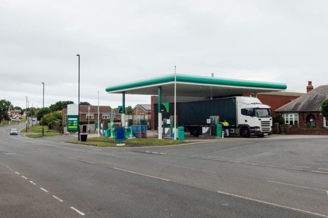
For more than a decade, our work on Green Belt projects has led us to argue that not all Green Belt land is green, environmentally valuable or equally important to the designation’s purposes. Some land maintains a critical gap or a clear boundary against sprawl. Other areas contain hardstanding, commercial yards, infrastructure, golf courses or fragmented land that performs a weaker role.
That weaker role does not justify automatic development, but it does justify honest assessment. We developed this argument in Green Light to Green Belt Developments, which I co-authored with Ufuk Bahar, managing director of our practice Urbanist Architecture. The book examined the gap between stated purposes and sites such as distribution yards or inaccessible scrubland.
Before December 2024, national policy contained no formal Grey Belt classification or distinct route for weaker-performing Green Belt land. Applicants relied on existing exceptions, very special circumstances or plan-led release. What had required a more exceptional case gained a defined policy route in 2024.
The NPPF 2026 has made the assessment more structured through Annex E. Assessment areas must be small enough to reveal meaningful differences in their contribution to Green Belt purposes (a), (b) and (d), while the effect on the remaining Green Belt across the plan area must also be considered. Appearance, dereliction and previous development alone do not decide the answer.
Grey Belt is not a licence to build anywhere. It directs growth towards less harmful land and recognises where the designation performs a weaker role. That can strengthen Green Belt policy when classification is followed by serious assessment of location, infrastructure, design and delivery.
This is where the difference between planning opportunity and development reality becomes clear. Grey Belt classification can apply to land that remains a poor housing prospect because it tests Green Belt function, not whether a workable scheme can be delivered. The first question is which parts qualify; the more important one is what can realistically be built on them.
Consider an illustrative 2.5-hectare site beside a town: a commercial yard and an adjoining field, a station apparently 700 metres away, mature trees along one edge and one possible vehicle access through a narrow lane. A promoter may see a ready-made Grey Belt opportunity.
Treating yard and field as one area could conceal the field’s role in checking sprawl or preventing settlements from merging. A boundary drawn tightly around the yard solely to obtain a favourable answer is equally weak. Annex E requires a defensible scale, while GB7 also tests the remaining Green Belt across the plan area.
Suppose the yard and a contained part of the field pass that assessment, and the relevant Housing Delivery Test result is 68%. The unmet-need element may be satisfied. The scheme still needs a sustainable location, with particular reference to the policy TR3, and major housing must comply with the Golden Rules.
The national Connectivity Tool can inform the accessibility evidence. It does not prove that the lane, crossing, footway or local services can support the scheme.
An early sketch may show 60 homes. Access widening takes frontage; trees, drainage and biodiversity reduce the developable area; green space takes land; and utility or junction works add cost. Once designed rather than listed, the workable capacity might be 38 homes.
The figures are illustrative, but the lesson is real. Without safe access or a funded connection, favourable classification may add little value. An unconditional purchase based on the first image can create a viability problem.

Grey Belt status, a qualifying station or unmet need can increase competition before capacity is known. Policy opportunity becomes land value only after its obligations, costs, and risks are accounted for. If price assumes the highest unit count, later design is pressured to defend a number the site may not sustain.
The Golden Rules direct value towards affordable housing, necessary infrastructure and accessible green space. They should shape land price before agreement, not appear as deductions after acquisition.
Until an applicable development-plan policy is in place, the affordable housing requirement is generally 15 percentage points above the highest existing requirement that would otherwise apply, capped at 50%. Where no requirement exists, 50% applies by default. A local requirement of 25% would ordinarily become 40%; one of 35% would become 50%.
GB8 of the NPPF 2026 permits a viability case only in defined circumstances, including qualifying legacy costs, strategic sites and a wholly different development model. The maximum possible contribution is still expected. National viability guidance is clear that a high land price does not justify a policy shortfall.
Return to the illustrative site. At 60 homes and 25% affordable housing, a buyer might initially assume 45 open-market homes. At 38 homes and 40% affordable housing, there would be about 23. The total unit count has fallen by just over a third, but the open-market homes that largely support land value and infrastructure have fallen by roughly half.
That difference can matter more to price than the label attached to the planning route. A layout that ignores access overstates capacity; an appraisal that ignores the Golden Rules overstates value. Planning, architecture and the transaction must therefore be tested together.
A conditional option, promotion agreement or price linked to capacity and infrastructure milestones may handle uncertainty better than an unconditional purchase. The most valuable consent is the one most likely to remain viable and buildable.

The new ‘default yes’ for development near railway stations includes a separate Green Belt route under GB7(1)(h) of the NPPF 2026. Qualifying residential or mixed-use development is treated as not inappropriate in the Green Belt without having to establish Grey Belt status or unmet need. Major development must still meet the Golden Rules in policy GB8.
The station must lie within one of the top 80 Travel to Work Areas by economic output and normally provide four trains or trams an hour during the weekday daytime, or two an hour in one direction. The site must be well related to the station or settlement, supportable by infrastructure and compatible with comprehensive development.
Reasonable walking distance is around 800 metres, or about ten minutes where topography, route quality or barriers discourage the longer walk. A radius is insufficient: tracks, major roads, steps or an unusable path may change the answer.
Our research assessed 83 station-and-place pairs and shortlisted 20 after considering access, land, constraints and delivery. The service threshold identifies an opportunity, not a good site.
The NPPF 2026 supports greater housing density where suitable land, existing buildings and infrastructure can be used more effectively.
Around a well-connected station, L3 normally requires at least 35 dwellings per hectare across the net developable area, rising to 45 where service frequency is at least twice the qualifying minimum. Those figures are a starting point for design, not a substitute for it.
The homes must still work in terms of daylight, living conditions, access, servicing and landscape, and the density calculation must reflect the land the scheme can actually develop.
This changes the commercial assessment. A Grey Belt case that depends on unmet housing need may weaken if supply is restored. The station route has no equivalent unmet need test, so its policy basis may prove more durable, provided the station service, walking route, infrastructure and design support the proposal.
There is also a distinct opportunity through plan making. Under GB3(4), where a development plan’s spatial strategy identifies suitable land around a well-connected station, exceptional circumstances need not be demonstrated to justify altering the Green Belt boundary. The boundary still has to be changed through the plan process; the policy does not itself grant planning permission for an application.
They should where the evidence identifies a better-connected extension and enduring boundary. Grey Belt is a classification, not a spatial strategy. The easiest land to classify is not necessarily best able to support homes and infrastructure.
A previously developed yard reached mainly by car may be straightforward to classify. Land that makes a stronger contribution to a Green Belt purpose could still form a more coherent extension around a station, with connected streets and a defensible landscape edge. If that alternative is to be considered, the proper forum is plan-making, where locations and cumulative infrastructure can be compared.
The policy GB4 prioritises previously developed Green Belt land, then other Grey Belt, then other Green Belt locations, provided the pattern is sustainable, and the remaining Green Belt is not undermined. Plans must still compare transport, landscape, ecology, infrastructure and assembly.
This strategic choice is separate from the tests for an individual application. A promoter cannot use a theoretically better alternative to redraw a boundary or rely on a plan-making provision as though it were consent. The plan chooses between locations; the application tests one site and one scheme.

Several reforms act after policy support is established. Faster plans, strategic planning and delegation may shorten the process; the Accelerator, new towns and Nature Restoration Fund intervene more directly. All still depend on infrastructure, land control, technical approval and finance.
A 30-month plan process should reduce the wait for an up-to-date plan. It cannot secure a grid connection, enlarge a sewer, assemble ownerships or fund a school. An allocation dependent on an unnamed third party may remain years from construction.
Spatial development strategies can coordinate growth above local plans. The policy PM1 identifies broad growth locations and infrastructure, but cannot allocate individual sites. Local plans must convert that strategy into allocations and a credible sequence.
The delegation scheme may reduce inconsistent call-ins from 31 October 2026. Yet 97% of district-level decisions in April to June 2026 were already delegated. Its greatest effect may be on the smaller group exposed to local call-in rules.
Delegation can shorten the decision stage. It does not complete a section 106 agreement, discharge a condition or obtain a technical approval.
The New Homes Accelerator uses brokerage and technical support on stalled sites. Government reported that it had helped progress more than 48,500 homes and addressed wider barriers affecting another 76,500. Those are homes affected, not completions caused by the programme.
The draft New Towns Programme proposed seven locations in March 2026, but final locations were unconfirmed in October 2026. New towns may coordinate long-term supply and infrastructure, although delivery extends well beyond one Parliament.
The Nature Restoration Fund would replace some project-by-project mitigation with Environmental Delivery Plans and developer payments. The first draft plan, covering nutrient pollution in Norfolk, entered consultation on 17 September. Existing duties remain until an approved plan covers the impact and area.
Planning permission is only part of the due diligence required to establish whether a scheme can actually be delivered.
Access rights, utilities, drainage, highway agreements and land assembly all sit outside the planning process. For new higher-risk buildings, the Building Safety Regulator reported a median Gateway 2 approval time of 22 weeks between June and August 2026.
Finance adds another filter. Higher construction and borrowing costs put pressure on viability, prompting developers to seek savings through changes to design, specification and phasing. Those changes must preserve the quality and infrastructure commitments on which planning permission depends.
Government coordination may help unblock a stalled scheme, but a stronger planning case alone cannot close the gap between development costs and expected returns.

A planning permission with an unfunded junction, unobtainable access or unaffordable utility connection may have no credible start date. A refusal on a better located site may identify a correctable design or evidence problem. This is a judgement about particular schemes, not a preference for refusal.
The commercial question is whether realistic capacity can reach construction sooner and with less risk than a larger consent. Lenders, purchasers and contractors value an implementable permission, not a theoretical maximum.
Outline permission may establish the principle of development without resolving reserved matters, conditions, section 106, highways or utilities. Its value depends on whether those steps have owners, costs and realistic programmes.
At a station site, a new public route can shorten the real walk, organise a legible street and support the required density. The drawings and transport evidence must also establish its width, gradient, crossings, land control, funding and opening phase. A line across land outside the applicant’s control is not an access strategy.
At a Green Belt edge, a landscape corridor may retain trees, manage drainage, support habitats and create an enduring boundary. Those functions must work in the engineering and management evidence. A route without rights or a swale without maintenance will not deliver the promised benefit.
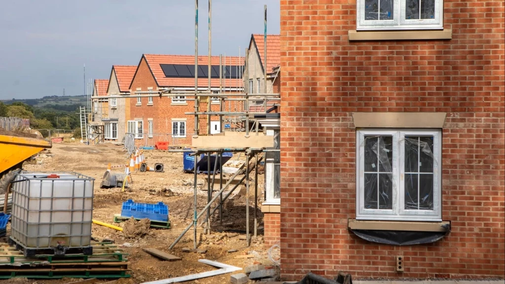
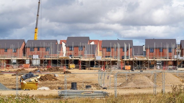
The true test is not how many sites enter the planning system, but how many emerge from it as completed homes. Success should therefore be judged by following the same sites from allocation or outline stage through to construction and completion.
As our analysis of why planning permissions alone will not solve the housing crisis explains, applications indicate intent, permissions establish an acceptable proposition, starts show construction, and completions provide homes.
A more useful national dataset would track each cohort through:
• allocation or outline application and decision, including the capacity first proposed;
• detailed consent or reserved matters, showing how much capacity survives design development;
• section 106 obligations, infrastructure agreements and pre-commencement conditions;
• starts on site and the time from implementable permission to construction; and
• completions measured against the number, tenure and phasing originally approved.
That would reveal where attrition occurs. If outline schemes lose homes at reserved matters because access or design parameters were unrealistic, the problem began early. If complete schemes wait for utilities or funding, the blockage lies elsewhere. Slow completions may point to phasing or market absorption.
The same evidence would evaluate reforms more clearly. The Accelerator should be judged by time saved and homes started, faster plans by funded allocations reaching applications, and Grey Belt and station policies by the places they deliver.
Before buying a development site or promoting land, separate the route available today from one dependent on a future plan. Before fixing price, test a credible range of homes after access, drainage, landscape, infrastructure and affordable housing.
Before treating permission as realised value, give every reserved matter, condition, obligation, right, approval and utility connection an owner, cost and date. That exercise may show that a different access, phase boundary or housing mix is worth more than a few additional units. It also produces the delivery information that national monitoring currently lacks.

Since taking office in July 2024, the Labour Government has materially changed the planning landscape in England. Housing need carries greater weight, Grey Belt and station-led development provide clearer routes for suitable sites, and strategic planning is returning.
More importantly, land is increasingly being judged by its actual function, location and potential contribution, rather than being ruled out by designation alone. To me, that is one of the most significant shifts in the current reforms.
The wider challenge, however, remains unresolved. Housing crises have been smouldering across much of the high-income world for more than a decade. In the UK, successive waves of targets and reform have raised political ambition, but that ambition has yet to be matched by housing delivery.
There is good reason for cautious optimism about the NPPF 2026, but a wider route to planning permission is not the same as a housing recovery. Planning reform may create opportunity, yet permissions can still stall over infrastructure, viability, land ownership, utilities and finance.
There is also a less discussed consequence: policy can change land expectations faster than development reality. A site may appear more valuable because of Grey Belt status, station-led policy or stronger housing need, only for its realistic capacity to fall once access, infrastructure, affordable housing and design are properly tested.
That is why the highest possible unit number is not always the greatest development value. A smaller, viable and deliverable scheme may ultimately be worth more than a larger permission that exists mainly on paper.
The real test of planning reform is not how many opportunities it creates on paper, but how many viable schemes reach construction and become homes.
New policy can strengthen a site’s planning case, but it may not resolve the reason an earlier scheme stalled or was refused. At Urbanist Architecture, we examine both: what the current framework now supports and which design, access, infrastructure, or evidence problems still need an answer.
As a multidisciplinary team of architects and town planners, we test alternative layouts, scales and housing mixes against those constraints. Where the first proposal assumed too much capacity, a revised scheme may offer a stronger route to permission and construction. Where a policy change creates genuine additional potential, we can establish what evidence is needed to make use of it.
This helps you decide whether to revise an application, promote the land through a plan or redirect investment elsewhere.
We look forward to learning how we can help you. Simply fill in the form below and someone on our team will respond to you at the earliest opportunity.
The latest news, updates and expert views for ambitious, high-achieving and purpose-driven homeowners and property entrepreneurs.






We specialise in crafting creative design and planning strategies to unlock the hidden potential of developments, secure planning permission and deliver imaginative projects on tricky sites
Write us a message