Read next
The latest news, updates and expert views for ambitious, high-achieving and purpose-driven homeowners and property entrepreneurs.

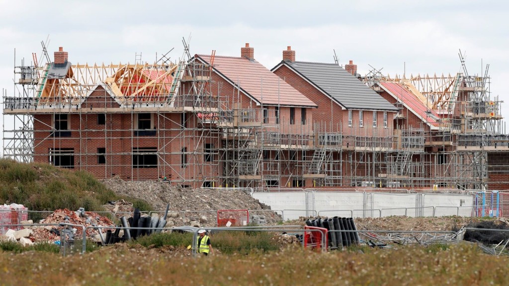
Mandatory housing targets are back, meaning councils across the country will need to significantly ramp up their housing delivery in the coming years.
But you can't ignite a housebuilding boom without land.
That's where the call for sites comes in—a crucial process that helps councils identify the land needed to meet the nationally imposed targets.
In this Q&A, our expert in-house planning consultant, Nicole Guler, answers every question you've ever had about the call for sites, from understanding what the process is to how it’ll be impacted by the updated NPPF.
Let’s dive in.

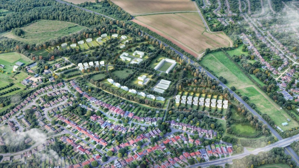
A call for sites is an essential phase in the local plan making process where councils invite landowners, developers, and other stakeholders to propose land that could be developed for future use.
It’s a valuable tool in identifying potential land for housing, commercial developments, or other uses, ensuring that all possible sites are considered in shaping a sustainable and inclusive urban environment.
Councils undertake a call for sites when they are engaging in the process of updating or making a new local plan. The process aims to strategically align land development with the needs of the community, particularly in the context of meeting housing targets and supporting economic growth.
By gathering a comprehensive list of potential sites, councils can prioritise developments that align with their broader vision for the area, ensuring that growth is balanced, sustainable, and responsive to both current and future demands.
To find out which councils are currently running a call for sites process, you can check the planning sections of local authority websites or consult regional planning news.
For example, a quick search will show you that at the time of writing (February 2025), Southwark Council is running a call for sites as part of its new Local Plan.
In a nutshell, the return of mandatory housing targets will require local planning authorities to identify and allocate sufficient land for homebuilding, which the call for sites can help them do.
Moving forward, councils must proactively seek out more potential development sites, including revisiting previously rejected sites or considering Green Belt land, to ensure they can accommodate the required housing numbers. This intensifies the urgency and scope of the call for sites process, as councils work to align their local plans with national housing requirements.
Labour's planning reforms, including the reinstatement of housing targets mentioned above, as well as the various adjustments to Green Belt rules, will push councils to prioritise housing, making the identification of viable land via the call for sites process more urgent.
These reforms also emphasise the development of brownfield and ‘grey belt’ sites, influencing how local plans are shaped.
Yes, Peterborough City Council has reopened their call for sites process due to proposed reforms to the NPPF. They've updated their local plan timetable, delaying the draft plan publication to February 2025. This allows time to incorporate anticipated national policy changes, particularly regarding housing need calculations.
The council has reopened its call for sites until 4th October 2024, inviting submissions for potential residential, commercial, and renewable energy developments. This decision enables them to review site selection work and update their evidence base in light of the proposed changes to national planning policy.
Yes, councils invite submissions for a wide range of land uses during the call for sites, including residential, commercial, industrial, and sometimes even green infrastructure. This helps to make sure that the local plan is comprehensive and meets various community needs.
Furthermore, councils may encourage submissions for other specific uses like mixed-use developments or renewable energy projects, further supporting their strategic goals for sustainable and inclusive growth.
Councils assess the suitability of sites based on criteria such as the constraints of the site (things like risk of flooding, land contamination, and the impact development could have on heritage assets), the site’s opportunity and market attractiveness, its planning history, infrastructure capacity, and alignment with the local plan's objectives.
Additionally, when councils consider a site’s potential to meet housing targets and other strategic priorities, they evaluate whether the site can deliver the necessary number and type of homes, such as affordable or family housing, that align with local needs. They also assess how quickly the site can be developed to contribute to housing supply within the required timelines.
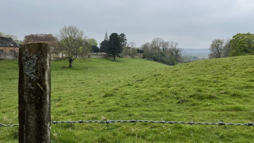
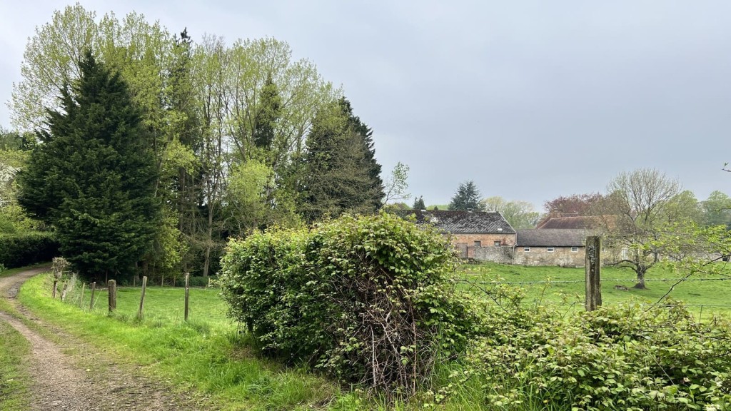
When it comes to evaluating Green Belt land releases, the assessment process is more specialised. It focuses on how well each parcel of land fulfils the intended purposes of the Green Belt. Planners use a three-tier scale - significant, moderate, or limited/no contribution - to rate land parcels against specific criteria. These criteria take into account both strategic goals and spatial variations in the Green Belt's function.
Green Belt reviews under the updated NPPF can potentially open up more Green Belt land for development, especially in areas where housing needs cannot be met elsewhere.
This change increases the importance of the call for sites process, as councils may now consider previously protected sites for development.
As a result, landowners and developers have more opportunities to promote their land within the Green Belt, provided they can demonstrate that it meets the new criteria for development.
To promote your site through the call for sites, you need to make sure it aligns with local and national planning priorities, such as sustainability and infrastructure readiness.
Submitting a well-documented proposal, including technical assessments and demonstrating the site's suitability for the intended use, can also strengthen your case.
Common pitfalls include submitting incomplete or poorly documented proposals, ignoring local planning policies, and failing to demonstrate the site's deliverability.
I would also say overlooking environmental constraints or infrastructure needs can weaken your submission.
When promoting and submitting a site, you typically need to provide clear masterplans and drawings that outline the site's boundaries, proposed land uses, and any existing features the council should know about.
A handy tip: Including technical assessments, such as environmental impact studies or access and infrastructure plans, can also enhance your submission.
Recruiting the help of RIBA chartered architects and RTPI chartered planning consultants can improve your chances in the call for sites process by making sure your submission aligns with local planning objectives and addresses key technical requirements.
Chartered architects can create compelling designs that enhance site potential while planning consultants provide strategic guidance on policy alignment and site deliverability.
A successful masterplan should include clear, context-sensitive design principles, efficient land use, and well-integrated infrastructure that supports sustainability and community needs.
It should also demonstrate how the site contributes to meeting housing targets and other local plan priorities, ensuring it’s both practical and visionary.
Demonstrating that your site has the potential to align with broader planning goals, such as reducing carbon footprints, protecting biodiversity, and promoting green infrastructure can significantly boost a site’s appeal during the call for sites process.
Ultimately, proposals that include energy-efficient designs, low-impact development practices, and strategies for preserving natural resources are often viewed more favourably by councils.
Landowners can prepare for potential challenges to their submissions by thoroughly researching local planning policies, engaging with the community early, and addressing potential concerns in their submission.
Collaborating with planning consultants to anticipate objections and developing strong, evidence-based responses can also help mitigate risks and improve the chances of a successful submission.
Landowners can align their site promotion strategies with housing targets in updated local plans by closely analysing these targets and demonstrating how their site can contribute to meeting them.
This includes providing evidence of the site's capacity to deliver the required number and type of homes, as well as its ability to support sustainable development and infrastructure.
To demonstrate that Green Belt or grey belt land is suitable for development, landowners should present compelling evidence that the development will have minimal environmental impact, fulfil critical local housing needs, and enhance the surrounding landscape.
Justifying how the proposed development aligns with the purposes of the Green Belt while offering innovative design solutions that respect the character of the Green Belt and provide necessary housing can also strengthen the case.
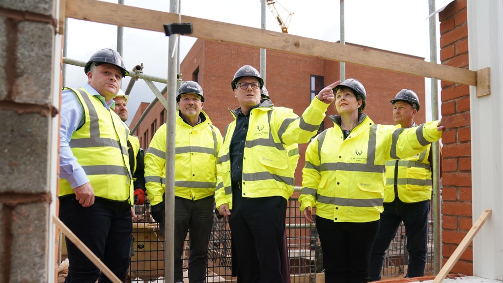
A planning promotion agreement is a strategic partnership between a landowner and a promoter, where the promoter takes on the responsibility of securing planning permission for the land. The promoter covers all the associated costs, engaging with architects, planners, consultants, and local authorities to navigate the complexities of the planning system.
If successful, the land—now with planning permission—is marketed for sale at a significantly enhanced value, which is particularly valuable for building on the Green Belt. The profits from the sale are then shared between the landowner and the promoter, reflecting the risks and contributions of both parties.
The introduction of the grey belt significantly increases its potential for inclusion in the local plan.
To be clear, the government’s definition of grey belt land is:
‘Land in the Green Belt comprising Previously Developed Land and any other parcels and/or areas of Green Belt land that make a limited contribution to the five Green Belt purposes… but excluding those areas or assets of particular importance listed in footnote 7 of this Framework (other than land designated as Green Belt).’
Those areas of importance mentioned are places like Areas of Outstanding Natural Beauty, National Parks or Sites of Special Scientific Interest.
While brownfield land is still the priority for development according to the NPPF, where more land is required to meet housing targets, building on the newly defined grey belt will be acceptable.
Sites can be submitted by individuals, developers, or landowners during the call for sites process.
Councils typically encourage submissions from anyone with a legitimate interest in promoting land for development, which helps to see that a diverse range of potential sites are considered.
If a person is submitting a site they do not own, the council will require landowner consent or support during the evaluation process.
Without this consent, the site is unlikely to be considered further, as ownership and deliverability are key factors in the assessment.
If multiple parties submit competing proposals for the same site, the council will assess each submission based on its merits, considering factors like alignment with planning policies, deliverability, and community impact.
The council may choose the proposal that best meets local needs or, in some cases, they might even encourage collaboration between the parties to develop a unified plan.
Councils generally give sites that offer social benefits higher consideration during the assessment process. These sites are often seen as crucial to meeting community needs and aligning with local plan objectives, making them more likely to be included in the final development plans.
One of the government’s ‘golden rules’ for major development in the Green Belt is that 50% of it be affordable housing, so sites that can demonstrate that social benefit will no doubt have a higher chance of being accepted.
Councils ensure that the plan-making process remains fair and transparent by following established procedures, making the process and criteria publicly accessible, and engaging in community consultations.
They also assess all submissions based on clear, objective criteria and often provide feedback to participants, fostering an open and accountable planning process.
Timelines can vary between councils but typically span several months, often starting with a formal announcement and followed by a period of several weeks to a few months for submissions.
After submissions close, councils review and assess sites, which can take additional months depending on the complexity and volume of submissions.
Submitting a site does not guarantee its inclusion in the local plan. Each site undergoes a rigorous assessment process to determine its suitability, and only those that meet the council's criteria for sustainability, deliverability, and alignment with local planning objectives are included.
Additionally, even if a site passes the initial assessment, it may still face public consultation and further scrutiny before it is confirmed as part of the final local plan.
After a site is selected through the call for sites, it typically progresses to more detailed assessments, including feasibility studies, environmental impact assessments, and public consultations.
If it passes these stages, the site is then included in the draft local plan, which undergoes further scrutiny before being formally adopted.
If a site is rejected during the call for sites process, the landowner or proposer can seek feedback from the council to understand the reasons for rejection.
They may then revise and resubmit the proposal in future calls for sites or explore other planning avenues, such as applying for planning permission outside of the local plan process.
Yes, previously rejected sites can be resubmitted in a future call for sites. If circumstances or local planning priorities have changed, a previously rejected site may be reconsidered, especially if improvements or additional supporting information are provided in the new submission.
Given the return of local housing targets, if you feel your site has good potential despite being rejected in the past, then it's worth resubmitting.
The call for sites is a critical early step in the preparation of local plans, helping councils identify potential development sites that will be assessed for inclusion in the local plan.
As we’ve already discussed, the selected sites will then be subjected to detailed analysis and public consultation as the local plan evolves, ultimately shaping the strategic development framework for the area.

So there you have it — a comprehensive guide to the call for sites process, expertly explained by Nicole.
If you need help with your project or have a site you'd like to submit in a current call for sites, our friendly team is here to assist.
At Urbanist Architecture, we specialise in crafting detailed masterplans, particularly for residential developments facing stringent planning conditions and restrictions. Our expertise ensures that you can confidently navigate the complexities of land promotion through the call for sites process, ultimately achieving successful outcomes that align with your goals.
As you might have concluded from this Q&A, when it comes to the Green Belt (and to the English planning system in general) things are rarely black and white. It’s a deeply nuanced policy and is one we’ve spent over a decade working with.
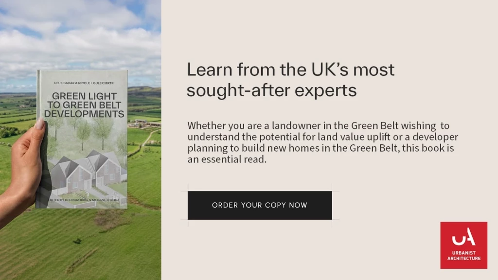
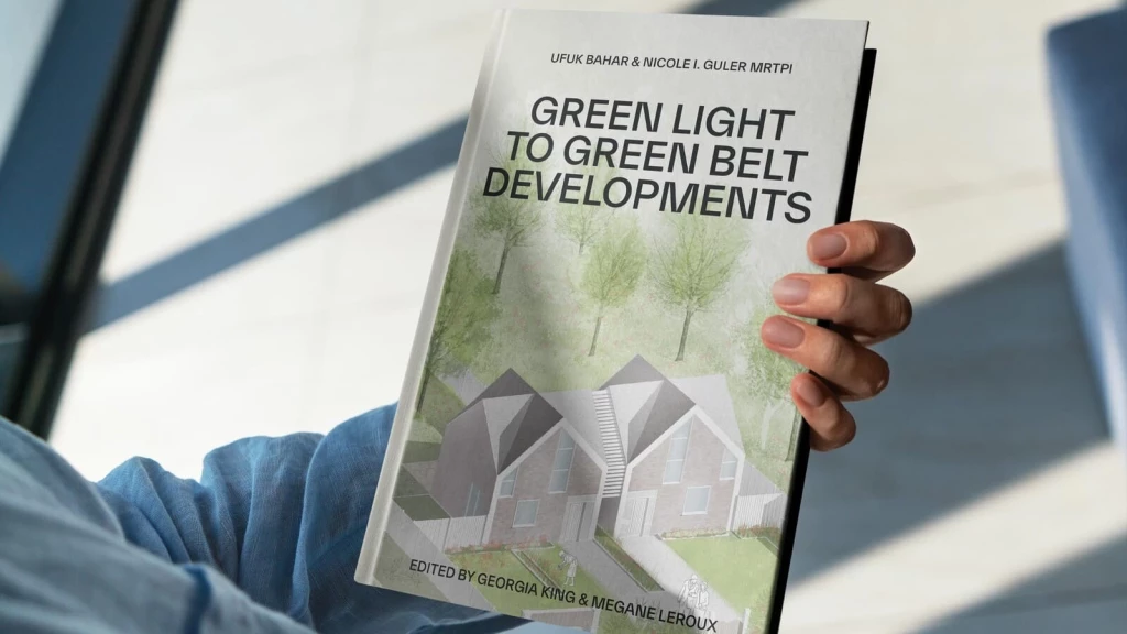
With this in mind, we decided to pool our knowledge on the Green Belt and write our debut book, ‘Green Light to Green Belt Developments’.
'Green Light to Green Belt Developments’ investigates the policy's biggest winners and losers, explores its connections to climate change and the housing crisis, as well as what the future might hold, particularly now a new Labour government is in power. It also looks at the history of the policy and how it’s managed to endure while other policies have evolved and adapted with the times. Of course, it also identifies the Green Belt exceptions and special circumstances that exist for permitting development in the Green Belt, so you can better your chances of gaining planning permission.
We’ve written this book for anyone seeking a more rounded understanding of one of England's most debated urban planning issues, making it accessible to both industry professionals and the general public.
Whether you are a landowner in the Green Belt wishing to understand the potential for land value uplift or a developer planning to build new homes in the Green Belt, this book is an essential read. Order your copy now.
We look forward to learning how we can help you. Simply fill in the form below and someone on our team will respond to you at the earliest opportunity.
The latest news, updates and expert views for ambitious, high-achieving and purpose-driven homeowners and property entrepreneurs.


We specialise in crafting creative design and planning strategies to unlock the hidden potential of developments, secure planning permission and deliver imaginative projects on tricky sites
Write us a message