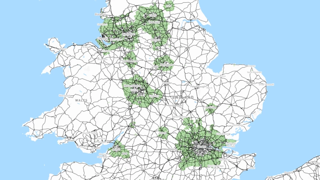
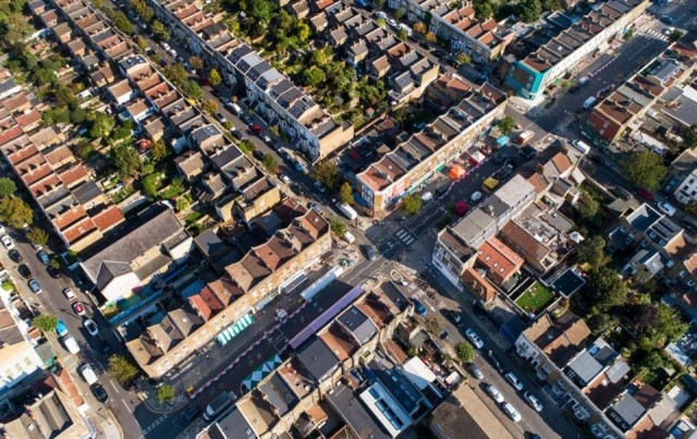
New changes to the NPPF mean that the Green Belt is being overhauled, with a significant amount of Green Belt land soon to be released for housing development.
Why is Green Belt land being released?
In a nutshell, the reallocation of Green Belt land and the introduction of ‘grey belt’ is part of the government’s ambitious goal to build 1.5 million homes over the next parliamentary term.
You might be wondering: Now that Green Belt land is being opened up for development, what will the process of allocating land look like?
In this article, we’re going to explain exactly this, diving deep into how councils will assess land based on how it measures up to the Green Belt’s five key purposes.
By the end, you’ll be able to better forecast which land in your area might be reallocated for housebuilding, even identifying potential sites for building in the Green Belt that that you may have thought were strictly off-limits.
To begin, let’s remind ourselves of exactly what the Green Belt’s purposes are.
What are the Green Belt's key purposes?
The NPPF lists the five purposes of the Green Belt as follows:
- To check the unrestricted sprawl of large built-up areas
- To prevent neighbouring towns from merging into one another
- To assist in safeguarding the countryside from encroachment
- To preserve the setting and special character of historic towns
- To assist in urban regeneration by encouraging the recycling of derelict and other urban land
Despite the government’s substantial Green Belt reforms, these key purposes remain the same.
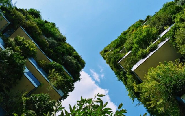
Though there has been a long-held belief by the wider public that the Green Belt is for environmental protection, that is little more than a myth. Instead, as you can see above, the policy is much more focused on reducing urban sprawl.
How are Green Belt purposes assessed?
The assessment of Green Belt land is guided by specific criteria, each purpose with distinct benchmarks that consider strategic and spatial variations in the Green Belt's function.
To evaluate how well parcels of land support these intended goals, town planners and urban designers employ a three-point scale: significant, moderate, or limited/no contribution to the Green Belt land purposes.
This allows for a nuanced evaluation of each land parcel's unique contribution to the overall Green Belt function and ensures the right land is being allocated for protection against development.
Now we know broadly how land is assessed for Green Belt designation, let’s explore how it works in practice, purpose by purpose.
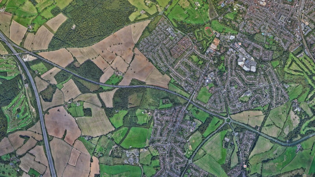
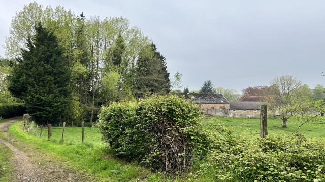
Purpose 1: To check the unrestricted sprawl of large built-up areas
The first purpose of the Green Belt is to check the unrestricted sprawl of large built-up areas, which is the fundamental reason the policy was created back in 1938.
This goal is designed to manage urban growth by maintaining a clear boundary between urban and rural areas, thus preventing cities and towns from expanding uncontrollably into the countryside.
Let’s break down exactly how the value of land is measured when it comes to the contribution to the first purpose of the Green Belt.
A significant contribution to the Green Belt's first purpose
- Proximity to large built-up areas: The land is located immediately adjacent to or in close proximity to a large built-up area. This close proximity means the land acts as a critical buffer zone, directly preventing the spread of urban development into rural areas.
- Open and undeveloped character: The land remains largely open and undeveloped, maintaining its natural or agricultural use. The land serves as a clear demarcation between urban and rural zones, preserving the countryside’s openness.
- Strong physical boundaries: The presence of strong, defensible boundaries such as rivers, major roads, or ridgelines can effectively prevent urban expansion. These natural or man-made features act as robust barriers, making it difficult for urban sprawl to penetrate these areas.
- Vulnerability to urban encroachment: Areas under high development pressure due to their location and lack of natural barriers to prevent expansion are particularly important. Protecting these areas is crucial, as they are most susceptible to being overtaken by urban growth if not safeguarded.
A moderate contribution to the Green Belt's first purpose
- Intermediate proximity: The land is near but not immediately adjacent to large built-up areas. While not directly on the urban fringe, these areas still play a role in buffering urban expansion.
- Partial development: The land may have some existing development but retains significant open areas. These partially developed areas can still function to prevent complete urban takeover if managed properly.
- Weaker physical boundaries: Boundaries exist, but are less effective at preventing urban sprawl compared to those in the significant category. These areas might include smaller roads or less prominent natural features that offer some resistance to urban growth.
- Lower development pressure: The area may face moderate development pressure, often due to its distance from urban centres or existing land uses. These areas are less immediately threatened but are still important in a broader strategy to manage urban expansion.
Limited or no contribution to the Green Belt's first purpose
- Distant from urban areas: The land is positioned away from any large built-up area, reducing the role it could play in preventing urban sprawl. These remote areas are also less likely to be directly impacted by urban growth.
- Highly developed: The area is already significantly developed or contains urban characteristics that diminish its role in maintaining openness. These areas have already lost much of their rural character and are less effective in preventing further sprawl.
- Lack of effective boundaries: There are no natural or man-made boundaries that could prevent the expansion of urban areas into this land. Without these barriers, the land cannot effectively serve as a check on urban growth.
- Minimal development pressure: The land is not under significant threat from urban development, either due to its remote location or existing land uses that are not conducive to large-scale development. These areas are less critical in the immediate strategy to manage urban sprawl.
Purpose 2: To prevent neighbouring towns from merging into one another
The second purpose of the Green Belt is to prevent neighbouring towns from merging into one another, which is vital for preserving the distinct identity and character of individual towns and villages by maintaining clear physical separation between them.
Let’s take a look at the following considerations that assess whether or not land makes a significant, moderate or limited/no contribution to the Green Belt’s second purpose.
Significant contribution to the Green Belt's second purpose
- Strategic location: The land is situated directly between two or more towns, playing a crucial role in maintaining their separation.
- Wide and open space: The land offers a wide buffer zone that remains largely open and undeveloped, effectively preventing the physical merging of towns.
- Clear boundaries: The presence of distinct natural or man-made boundaries, such as rivers, large parks, or infrastructure like railways, which reinforce the separation between towns.
- High development pressure: The area is under significant development pressure, making its protection vital to prevent urban areas from encroaching towards each other.
Moderate contribution to the Green Belt's second purpose
- Intermediate buffer: The land provides a buffer zone that is not as extensive but still serves to separate neighbouring towns.
- Partially developed: The land may have some development but maintains sufficient open space to prevent towns from merging completely.
- Weaker boundaries: Boundaries exist but are less prominent, such as smaller roads or less significant natural features that still contribute to separation but with less impact.
- Moderate development pressure: The area experiences moderate development pressure, necessitating some level of protection to maintain town separation.
Limited or no contribution to the Green Belt's second purpose
- Remote location: The land is not situated between neighbouring towns, thus having little relevance in preventing them from merging.
- Highly developed: The area is already extensively developed, offering no effective buffer to maintain town separation.
- Lack of boundaries: There are no significant boundaries present that would help in maintaining the distinct identities of towns.
- Minimal development pressure: The land faces little to no development pressure, making it less critical in the strategy to prevent towns from merging.
Purpose 3: To assist in safeguarding the countryside from encroachment
The third purpose of the Green Belt is to assist in safeguarding the countryside from encroachment. The objective is to preserve natural landscapes, agricultural land, and the rural character of areas surrounding urban settlements.
Let’s take a closer look at how land is measured against this purpose.
Significant contribution to the Green Belt's third purpose
- Open and undeveloped character: The land is predominantly open and free from substantial built development, maintaining its natural or agricultural state.
- Lack of urban influence: The land has minimal visual or physical influence from nearby urban areas, preserving its rural character.
- Strong physical boundaries: The presence of robust natural or man-made features such as rivers, woodland, or major roads that effectively demarcate and protect the countryside from urban encroachment.
- High sensitivity to development: Areas that are highly sensitive to development due to their ecological, agricultural, or landscape value, where any encroachment would significantly undermine the rural character.
Moderate contribution to the Green Belt's third purpose
- Partially developed or influenced: The land may have some development or urban influence but still retains significant areas of openness and rural character.
- Weaker boundaries: Boundaries exist but are less prominent or effective in protecting the countryside from encroachment compared to those in the significant category.
- Moderate sensitivity: The area has moderate sensitivity to development, where some urban influence is present, but the land still plays a role in safeguarding the rural environment.
Limited or no contribution to the Green Belt's third purpose
- Highly developed: The area is already extensively developed or significantly influenced by urban characteristics, diminishing its role in maintaining a rural environment.
- Lacks openness: The land lacks significant open spaces, reducing its effectiveness in safeguarding the countryside.
- No effective boundaries: There are no significant boundaries present to protect the land from urban encroachment.
- Minimal sensitivity: The land faces little to no threat from urban development due to its existing use or location, making it less critical in the strategy to safeguard the countryside.
Purpose 4: To preserve the setting and special character of historic towns
The fourth purpose of the Green Belt is to preserve the setting and special character of historic towns. As you would imagine, this goal is all about maintaining the unique identity, historical integrity, and visual appeal of towns with significant heritage.
This is how land is measured against this purpose.
Significant contribution to the Green Belt's fourth purpose
- Proximity to historic towns: The land is located adjacent to or within close proximity to historic towns, playing a crucial role in maintaining their setting.
- Visual and physical separation: The land provides a clear visual and physical buffer that protects the historic town from the encroachment of modern development.
- High landscape quality: The land possesses high landscape quality, enhancing the overall setting and visual appeal of the historic town.
- Historical significance: The area includes features or landscapes of historical significance that contribute to the town’s heritage and character.
Moderate contribution to the Green Belt's fourth purpose
- Intermediate proximity: The land is near historic towns but not immediately adjacent, still playing a role in protecting their setting.
- Partial development: The land may have some modern development but retains enough open or historically significant areas to contribute to the town’s setting.
- Weaker boundaries: Boundaries exist but are less effective in protecting the historic setting compared to those in the significant category.
- Moderate landscape quality: The land has moderate landscape quality, contributing somewhat to the visual appeal and character of the historic town.
Limited or no contribution to the Green Belt's fourth purpose
- Distant from historic towns: The land isn’t near any historic towns, reducing its relevance in preserving the town’s setting and character.
- Highly developed: The area is already significantly developed with modern characteristics that diminish its role in maintaining the historic setting.
- Lack of significant boundaries: There are no significant boundaries present to protect the historic town from modern encroachment.
- Low landscape quality: The land lacks landscape quality, offering minimal contribution to the visual appeal and character of the historic town.
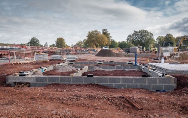
Purpose 5: To assist in urban regeneration by encouraging the recycling of derelict and other urban land
The fifth and final purpose of the Green Belt is to assist in urban regeneration by encouraging the recycling of derelict and other urban land. This objective centres on promoting sustainable development and reducing the need to encroach on greenfield sites by prioritising the redevelopment of previously used land.
Significant contribution to the Green Belt's fifth purpose
- Presence of derelict or underused land: The area includes substantial amounts of derelict, vacant, or underused urban land that can be recycled for new development.
- Proximity to urban areas: The land is located close to existing urban areas where regeneration is needed, facilitating easy integration into the urban fabric.
- High potential for redevelopment: The land has high potential for redevelopment due to its size, location, or existing infrastructure, making it attractive for new urban projects.
- Support for urban regeneration initiatives: The area aligns with local urban regeneration initiatives and plans, enhancing its strategic importance for redevelopment efforts.
Moderate contribution to the Green Belt's fifth purpose
- Some derelict or underused land: The area contains some derelict, vacant, or underused land, but not as extensive as those in the significant category.
- Moderate proximity to urban areas: The land is relatively close to urban areas but may face some barriers to integration.
- Moderate potential for redevelopment: The land has moderate potential for redevelopment, with some existing infrastructure and connectivity.
- Partial alignment with regeneration plans: The area partially aligns with urban regeneration initiatives but may require additional investment or planning to realise its full potential.
Limited or no contribution to the Green Belt's fifth purpose
- Lack of derelict land: The area lacks significant amounts of derelict, vacant, or underused land, offering little opportunity for recycling.
- Remote from urban areas: The land is not located near existing urban areas, reducing its relevance for urban regeneration efforts.
- Low potential for redevelopment: The land has low potential for redevelopment due to size, location, or lack of infrastructure.
- Misalignment with regeneration goals: The area does not align with local urban regeneration initiatives or plans, making it less strategic for redevelopment.
How Urbanist Architecture can help you
While the path to planning permission in the Green Belt is undoubtedly challenging, it's not impossible. A lesser-known fact is that exceptions and special circumstances exist which can allow for securing planning permission. However, these opportunities are typically leveraged only by a select group of opportunistic and strategic developers.
At Urbanist Architecture, we are a multidisciplinary architecture and planning practice rapidly earning a reputation as one of the country's leading firms, particularly in Green Belt planning permission. We excel at producing results that meet council expectations while exceeding those of our clients.
If you would like to learn more about the Green Belt, want to stay abreast of the latest updates or to discuss your project in the countryside, please get in touch with us today.
Read our Green Belt book
So there you have it, an expert’s opinion on exactly what local planning authorities will be looking for when it comes to choosing which Green Belt land to open up, and which to keep protected.
As you might have concluded from this article, when it comes to the Green Belt (and to the English planning system in general) things are rarely black and white. It’s a deeply nuanced policy and is one we’ve spent over a decade working with.
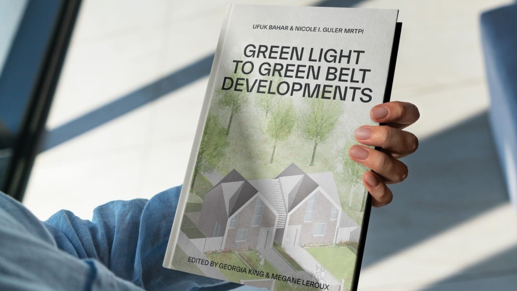
With this in mind, we decided to pool our knowledge on the Green Belt and write our debut book, ‘Green Light to Green Belt Developments’.
'Green Light to Green Belt Developments’ investigates the policy's biggest winners and losers, explores its connections to climate change and the housing crisis, as well as what the future might hold, particularly now a new Labour government is in power. It also looks at the history of the policy and how it’s managed to endure while other policies have evolved and adapted with the times. Of course, it also identifies the Green Belt exceptions and special circumstances that exist for permitting development in the Green Belt, so you can better your chances of gaining planning permission.
We’ve written this book for anyone seeking a more rounded understanding of one of England's most debated urban planning issues, making it accessible to both industry professionals and the general public.
Whether you are a landowner in the Green Belt wishing to understand the potential for land value uplift or a developer planning to build new homes in the Green Belt, this book is an essential read. Order your copy now.