Read next
The latest news, updates and expert views for ambitious, high-achieving and purpose-driven homeowners and property entrepreneurs.


Every new planning framework arrives with a promise. Faster decisions. Clearer rules. More homes. Less argument.
The National Planning Policy Framework 2026 (NPPF 2026) arrives with more substance behind those promises than most. Its significance lies not simply in the number of policies that have changed, but in the attempt to make planning decisions more predictable, more evidence-led and harder to resist without a clear policy basis.
The real test, however, is not the announcement. It is what happens when an application reaches an officer's desk, when a consultee replies late, when a viability argument opens up or when a planning committee wants to intervene.
On that test, my assessment is broadly positive but qualified. The framework should make an unevidenced refusal harder to sustain, but it should also make a weakly prepared application easier to dismiss where the relevant policy route or supporting evidence has not been properly established.
That cuts both ways, and it should.
This article looks beyond the headline reforms to explain what the NPPF 2026 means in practice for applicants, developers, landowners and local planning authorities, where the most important opportunities and risks now lie, and how planning strategies may need to change in response.
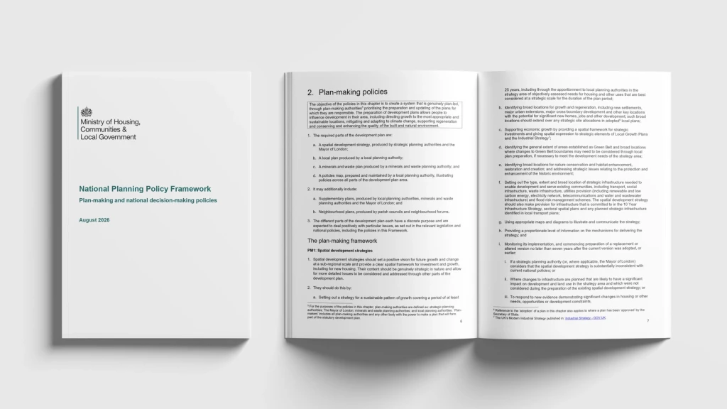
The NPPF 2026, published on 17 August 2026. It is a wholly restructured framework, replacing the earlier NPPF editions.
The new framework sets out the government’s national planning policies for England. It explains how those policies should guide the preparation of local plans and decisions on planning applications.
At the centre of the new framework is a more rules-based planning system, with clearer national tests for determining applications and a more defined relationship between those tests and local plan policy.
In practice, that shift is most visible in Policies S4 and S5, the treatment of materially inconsistent local policies under Annex A, the new routes for station-led and Green Belt development, and the stronger requirements around housing delivery, density and supporting evidence.
These changes do not remove planning judgement, but they place tighter parameters around where that judgement is exercised and what must be demonstrated to justify either approval or refusal.
Before turning to the detailed analysis, I set out the key changes most likely to affect how development proposals are promoted, assessed and determined. The points below provide the practical context for the policy discussion that follows.
The new version of the NPPF carries a clearer and more structured approach into policy. It separates plan-making from decision-making and prevents policies designed for preparing plans from being repurposed as tests for individual applications.
The central question is whether these reforms create a more predictable, pro-development planning system or simply relocate planning judgement into clearer national tests. My view is that they do both.
The framework creates clearer and more predictable routes to development and makes some forms of refusal harder to sustain. Planning judgement remains, but it is now exercised through more specific tests, thresholds and evidential requirements, which many applicants may underestimate.
I reached this conclusion after spending several hours reading all 130 pages of the new framework from beginning to end and comparing its final provisions line by line with the NPPF 2024 and the December 2025 draft. I considered not only what had changed on paper, but also how those changes relate to the planning issues we encounter in practice every week.
In this article, you will learn what the most important changes mean in practice, how they reshape planning decisions and where new development opportunities may emerge.
For readers who want to examine the detailed wording changes alongside this analysis, I have also prepared an NPPF 2024 vs NPPF 2026 comparison table.
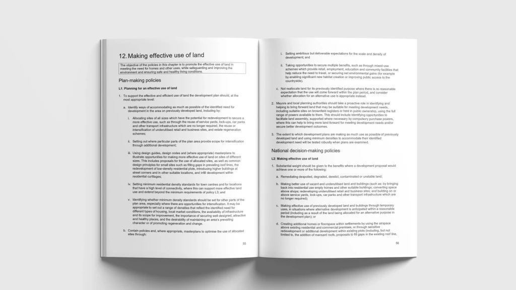
That structural shift is now embedded in the final framework. The NPPF 2026 separates policies for preparing local plans from the national policies used to determine planning applications, reducing the scope for plan-making policies to become substitute decision tests.
It does not remove planning judgement, but relocates it within clearer national gateways and makes the reasoning behind approvals and refusals easier to follow.
The old framework allowed strategic aspiration and development-management tests to sit side by side. In practice, authorities often repeated national policy in their local plans, added qualifications and then applied the combined wording with varying degrees of consistency.
The NPPF 2026 is designed to stop that. Policy PM6 tells plan-makers not to duplicate, substantively restate or create inconsistency with national decision-making policy.
The intended result is shorter plans focused on genuinely local choices: site allocations, infrastructure, spatial strategy and justified local standards.
The legal foundation is unchanged. Under section 38(6) of the Planning and Compulsory Purchase Act 2004, applications must still be determined in accordance with the development plan unless material considerations indicate otherwise. National decision-making policies are material considerations of critical importance, operating alongside rather than replacing the plan.
The main change is what happens when local and national policy conflict. Annex A states that a development plan policy, or part of one, that is materially inconsistent with the NPPF 2026 should be given very limited weight unless the plan was examined and adopted, or made, under the new framework. A local policy does not lose weight simply because it is old, but it may do so if it conflicts with the new national policies.
For planning applications, the change is immediate because the new decision-making policies are already in force. By contrast, plan-making moves over more gradually, depending on the type of plan and how far it has progressed.
Under these arrangements, the NPPF 2026 applies to new-system local plans, minerals and waste plans, supplementary plans and spatial development strategies.
Neighbourhood plans submitted by 17 August 2026 may, however, continue under the NPPF 2024 or be withdrawn and updated, while those submitted later must follow the new framework. Meanwhile, some other plans already in progress may also continue under the NPPF 2024 where the transitional arrangements allow.
For a live application, this does not mean simply replacing every policy reference in the Design and Access statement. You must identify which adopted policies remain consistent with the NPPF 2026, which national decision-making policies apply and whether the evidence meets their tests.
This may create opportunities where a proposal has been held back by inconsistent local policy, but it also creates scope for avoidable mistakes. Plan-making policies may provide useful context, but they cannot be used as decision tests. The correct approach is to cite the relevant national decision-making policy and explain how it works alongside the development plan.
Three of the consultation's central propositions survived largely intact, and they set the tone for everything that follows.
Under the NPPF 2024, plan-making and decision-making sat within one integrated framework. The NPPF 2026 confirms the separation and stops plan-making policies being used as decision tests.
Under the NPPF 2024, the presumption operated through the established plan-led balance and tilted balance. Those routes remain in substance, while proposals affecting Green Belt and Local Green Space must still pass their own policy tests before any positive balance applies.
Accessible-home requirements previously depended principally on locally evidenced plan policies. The NPPF 2026 retains a 40% plan-making expectation, subject to stated exemptions, with M4(3) provision responding to evidenced need.
The consultation did change the Government's mind in several places, and the final drafting is more workable for it.
My earlier comparison of the NPPF 2024 and the December 2025 draft argued that the proposals would narrow the room for unsupported refusal. The final framework confirms that direction. Several of the mechanisms, though, are drawn more carefully than the draft suggested.
Under the NPPF 2024, weight depended on the consistency of the development plan with national policy.
The NPPF 2026 makes material inconsistency, including within part of a policy, the trigger for giving it very limited weight. Age alone does not have that effect.
The NPPF 2024 contained no national definition of a well-connected station and no density floor.
The NPPF 2026 expands the geography to the top 80 Travel to Work Areas, applies no floor to non-qualifying stations and sets tiered minima of 35 or 45 dwellings per hectare rather than the higher figures proposed during consultation.
The NPPF 2024 used a general 15-year strategic-policy horizon and encouraged at least 30 years for larger-scale development.
The NPPF 2026 sets a horizon of at least 25 years, with alteration or replacement beginning by year seven, or earlier if a stated trigger occurs.
Under the NPPF 2024, plans could pursue measurable biodiversity gains and were expected to prefer poorer-quality agricultural land where significant development was necessary.
The NPPF 2026 confines higher biodiversity net gain standards to specific, justified and deliverable allocations. It also retains the preference for poorer-quality agricultural land rather than imposing an alternatives test on every scheme.
Two of the draft's more ambitious ideas did not survive, and their absence is as instructive as the reforms that made it through.
The NPPF 2024 had no formal medium housing category. The category now exists, but remains a form of major development. The broader payment route was dropped and on-site affordable housing remains the starting point.
Unlike the NPPF 2024, the NPPF 2026 includes DM5, which explains when a site-specific viability review may be justified. The planned standardised annex was not adopted, so the recommended inputs remain in Planning Practice Guidance (PPG).
The new structure in the NPPF 2026 matters because it draws a clearer line between national decision rules and genuinely local planning choices. Local plans remain central to allocations, infrastructure, character and place-making. They should not be used to restate a national policy in a way that changes the test an application must meet.
I prefer the final material-inconsistency test because it directs attention to substance. The relevant question is not whether a local policy differs from the national wording, but whether it would lead to a materially different decision. That is a more useful discipline for officers, committees and inspectors.
This should make decisions clearer without making them mechanical. Applicants still need to show that their proposal falls within the relevant NPPF 2026 route and that its effects can be made acceptable. Authorities can still refuse where unacceptable harm remains. But where a concern can be properly addressed through evidence, design changes, a condition or a planning obligation, it should not be treated as a reason to resist development in principle.
With that structure in place, the next issue is where the framework now supports development most clearly.
Under the NPPF 2026, the presumption in favour of sustainable development works through defined routes for development inside settlements, outside settlements and within specially protected land.
Inside settlements, the balance starts in favour of development. Outside settlements, support depends on whether the proposal falls within a listed category. Green Belt and Local Green Space proposals must still pass their own policy tests before any positive balance applies.
This makes the policy route clearer, but it does not make consent automatic. Location, infrastructure, design and site-specific constraints still decide whether a scheme is acceptable.
Policy S4 says development inside a settlement should be approved unless its adverse effects would substantially outweigh its benefits when assessed against the national decision-making policies.
However, S4 also identifies circumstances in which that outcome is likely. These include substantial harm to allocated or safeguarded land, recreational land, Local Green Space, important biodiversity or geodiversity, Protected Landscapes and development within residential curtilages.
The same applies to the loss of undeveloped cemetery or burial land, or land used for water storage or flood-risk management without suitable replacement. A proposal should also be refused where another national policy expressly requires it.
These constraints should be checked before applying the balance because they show where a proposal is likely to face the greatest scrutiny.
Whether a site is inside a settlement cannot be assumed from a postcode, a nearby built-up edge or the way the site appears on a location plan.
The glossary includes cities, towns, villages and other predominantly built-up areas, together with allocated or permitted land that will form part of that built-up area once development is complete. It also preserves the role of a development plan which defines settlement extent by a boundary or an equivalent criterion.
The exclusions are just as important. Hamlets and scattered groups of houses outside predominantly built-up areas are not settlements unless the development plan specifically defines them as such. Villages which lie within, and are defined as part of, the Green Belt are also excluded for this purpose.
If you want to rely on the S4 route, do not assume that a site is within a settlement because it sits near existing homes. Identify the precise policy basis for that conclusion, including any relevant allocation or permission. Where the answer is unclear, build the application around the S5 or Green Belt route that may apply instead.
Outside settlements, policy S5 supports development only where it falls within a defined category. These include rural businesses, development that requires a rural location, the reuse or replacement of buildings, previously developed land, limited infilling, exception and traveller sites, station-related growth, allocated land and proposals addressing unmet need.
For housing under the unmet-need route, the trigger is the authority's failure to demonstrate a five-year supply of deliverable housing sites, or a Housing Delivery Test result below 75%.
The proposal must then be physically well related to an existing settlement, unless its nature makes that inappropriate, and be of a scale that existing or proposed infrastructure can support. Major freight and logistics development that complies with the economic policies has a separate route.
The transitional arrangements also protect recently adopted plans. For five years after adoption, a higher local housing need figure will not by itself establish an unmet need where the authority can show a five-year housing supply with the appropriate buffer and housing delivery above 75%.
Where a proposal falls within an S5 category, permission should be granted unless its adverse effects would substantially outweigh its benefits. Outside those categories, approval requires exceptional circumstances and benefits that substantially outweigh the adverse effects, including harm to the countryside and sustainable patterns of movement.
S5 does not override Green Belt or Local Green Space policy. A Green Belt proposal must first follow the routes in chapter 13, including the previously developed land, Grey Belt and station-led exceptions in policy GB7. The relevant positive balance applies only after the proposal is found not to be inappropriate development.
Outside settlements, the NPPF 2026 makes an important distinction. S5 does not mean that every protective policy prevents development automatically. Its refusal test applies only where your proposal conflicts with a national policy that expressly says development should be refused.
Other policies may still weigh heavily against the scheme. The difference is that they should normally be considered within the planning balance, rather than treated as an automatic disqualification. That is particularly relevant where your site affects a protected landscape, ecology or another important constraint.
You should therefore read the relevant policy closely. Ask what harm it is intended to prevent and whether it requires refusal or requires the harm to be weighed against the benefits. Any refusal should show the same analysis.
Earlier decisions, including Monkhill, may still be relevant, but the answer must come from the new NPPF 2026 wording and the emerging decisions under it.
Neighbourhood plans retain protection for housing proposals where they became part of the development plan no more than five years before the decision and contain allocations meeting their identified housing requirement. The previous three-year housing supply condition no longer applies.
Two questions are likely to recur.
The first is how much weight S4 or S5 should carry where a proposal conflicts with a recently adopted plan. The second is whether “substantially outweigh” creates a different threshold from the NPPF 2024 wording, “significantly and demonstrably outweigh”.
The new framework does not provide a mathematical answer. You need to explain the benefits, the harms and the evidence supporting each. S4 and S5 identify the policy route, but they do not decide the application alone. Location, infrastructure and protected interests should be tested before the design is fixed, because a missed gateway cannot be rescued later by pointing only to housing need.
That leads to the next question. How much housing does national policy now say is needed?
Annex D calculates local housing need from a baseline of 0.8% of an authority’s dwelling stock, adjusted where its five-year average workplace-based affordability ratio exceeds five. The result is a minimum annual figure for plan-making, not a site allocation or an entitlement to planning permission.
Authorities must still decide where new homes should go, whether infrastructure can support them and whether the chosen sites are deliverable. For applicants, a high figure may strengthen the case for housing, but it cannot overcome a poor location or an undeliverable proposal.
The calculation begins with 0.8% of the authority’s most recent dwelling stock estimate. This is adjusted using the mean of its five latest median workplace-based affordability ratios.
No adjustment applies where the ratio is five or below. Above five, the stock baseline increases by 0.95% for every 1% by which the ratio exceeds five. Annex D illustrates this with an affordability ratio of 10, which produces a 95% increase in the annual baseline.
The method is deliberately more stable than a system driven solely by household projections. Because the baseline grows with existing stock, it becomes much harder to argue that suppressed household formation or a projected fall in population justifies very low growth.
That matters most in high-cost areas. Poor affordability does not simply reflect demand. It also suppresses the formation of households that would exist if suitable homes were available. A supply-oriented method recognises that feedback instead of treating the symptoms of shortage as evidence that fewer homes are needed.
This is the right instinct, and it is a genuine improvement on the arithmetic that preceded it. But a stock-based figure still cannot determine tenure, type or programme, and mandatory housing targets have never built a house on their own.
A housing requirement is only the starting point. Where a spatial development strategy has set the strategic number, local plans should focus on the harder task: distributing growth, securing infrastructure and identifying sites that can genuinely come forward.
Where an authority cannot meet its need alone, that shortfall should be addressed through strategic planning rather than left unresolved. Housing need does not disappear because it crosses an administrative boundary.
The better question is not how large the requirement looks on paper. It is whether the plan provides for the households excluded from the market, and whether its sites can be built out in time. A large target without deliverable land is not evidence of progress. It is precisely why the NPPF 2026 now places greater emphasis on delivery.

When housing delivery fails, the NPPF 2026 applies progressively stronger consequences through the five-year supply position and the Housing Delivery Test. Delivery below 95% requires an action plan, below 85% brings the 20% buffer, and below 75% establishes evidenced unmet housing need for the relevant S5 route.
That last threshold may strengthen the principle of housing in suitable locations. It does not make every site acceptable. Access, infrastructure, Green Belt, flood risk, design and the other policy gateways still have to be resolved.
Every local planning authority should update its supply of deliverable housing sites annually. The supply must cover at least five years and is measured against the development-plan requirement, or local housing need where that requirement is more than five years old.
A 5% buffer normally applies. Delivery below 95% requires an action plan, while delivery below 85% adds a 20% buffer. Below 75%, evidenced unmet housing need is deemed to exist for the housing route in S5(1)(j).
A separate 20% decision-making buffer applies where a housing requirement was adopted within the past five years but examined against a framework predating December 2024, and its annual average is no more than 80% of the latest local housing need figure. The policy also covers certain reviewed requirements more than five years old.
A Housing Delivery Test result below 75% does not make every local policy out of date or establish that a particular site is suitable. The proposal must still satisfy the settlement, infrastructure, Green Belt, Local Green Space and national policy tests.
The 2025 Housing Delivery Test measurement, published on 17 August 2026, supersedes the 2024 result and is the operative figure for decision-making, with its policy consequences applying from 18 August 2026. Where an authority has since adopted a new housing requirement, the delivery figure may need to be recalculated in line with the official notes.
If your application depends on a housing-delivery shortfall, make sure the evidence is current. Use the latest Housing Delivery Test result, the authority’s most recent supply position and clear evidence that the site can come forward. Relying on an outdated position is easy for an authority to challenge and expensive to put right later.
A site does not become deliverable simply because it appears in a housing trajectory. Permission status, conditions, infrastructure, ownership, developer commitment, lead-in times and realistic build-out rates all matter.
Equally, a site should not be dismissed merely because it is absent from an authority’s preferred pipeline where the evidence shows that it can contribute.
Policy HO13 requires major housing proposals to bring homes forward within a reasonable period, taking account of tenure, market absorption and the site’s delivery history. Annex D also requires authorities to monitor permitted development and address substantial build-out shortfalls.
For larger schemes, the application should explain delivery, phasing and the measures supporting a resilient rate of completion. Where a council cannot demonstrate a five-year supply of deliverable housing sites, evidence of site control, funding, infrastructure and market demand may materially strengthen the case.
A genuine delivery failure may therefore open development routes on some of England’s most contested land. This is where the framework’s Green Belt reforms become critical.

Building on Green Belt land remains difficult, but the NPPF 2026 makes the available routes more explicit.
Previously developed land, qualifying Grey Belt and certain station-led schemes may provide a route, but only where the detailed policy tests are met.
The Green Belt has a spatial purpose. It seeks to prevent urban sprawl by keeping land permanently open and is not a general environmental designation.
A Green Belt site may also have landscape, ecological, agricultural, recreational or heritage value, but those qualities require separate evidence and policy assessment.
For London sites, do not assume that a Green Belt route applies in exactly the same way to Metropolitan Open Land (MOL). Planning permission on MOL is assessed through the London Plan as well as the national framework.
Policy G3 gives MOL the same status and level of protection as Green Belt, but MOL remains a separate strategic open-land designation. A proposal may therefore need to address openness and the national Green Belt tests alongside the particular recreational, ecological, public-access or green-infrastructure functions that justify the MOL designation.
As expected, NPPF 2026 retains the principle that inappropriate development is harmful and should not be approved except in very special circumstances.
Policy GB7 identifies the development that is not inappropriate. The established routes include appropriate agriculture, forestry and nature uses; the reuse, extension or replacement of existing buildings within defined limits; limited infilling in villages; certain affordable housing; the redevelopment of previously developed land; and specified engineering, infrastructure and other operations where openness and Green Belt purposes are protected.
For previously developed Green Belt land, redevelopment, including a material change of use to residential, is not inappropriate where it would not cause substantial harm to openness.
That wording creates genuine potential for responsible intensification of compromised sites. It gives no licence to ignore the spatial effect of additional height, mass, spread or activity.
Grey Belt means Green Belt land, whether previously developed or not, that does not strongly contribute to Green Belt purposes (a), (b) or (d): checking unrestricted sprawl, preventing neighbouring towns from merging and preserving the setting and special character of historic towns.
The test applies either way. Previously developed status does not settle it, and neither does visual appearance.
Annex E provides an assessment method using strong, moderate and weak contribution. A moderate score may still fall within Grey Belt, provided the site does not strongly contribute to any of purposes (a), (b) or (d). The complete site context, and the effect on the Green Belt as a whole, remain part of the exercise.
Annex E should improve consistency. It cannot remove judgement, and this is one of the clearest places where judgement has simply changed address.
The choice and subdivision of assessment parcels can materially affect the conclusion, particularly where a large tract contains edges with very different relationships to towns and countryside.
My view is that parcel boundaries should follow defensible physical and functional features, and should never be drawn to produce a preferred Grey Belt result. The assessment should then explain both the site's contribution and the effect of development on the remaining Green Belt across the plan area.
To use GB7(1)(g), a proposal must be on Grey Belt, must not fundamentally undermine the purposes of the remaining Green Belt across the plan area, must respond to evidenced unmet need and must be in a sustainable location, assessed with particular reference to the national transport policy. Major housing must also satisfy the Golden Rules in GB8.
A separate route in GB7(1)(h) supports residential or mixed-use development on Green Belt land within reasonable walking distance of a well-connected station.
The scheme must be physically well related to the station or the settlement it serves, be of a scale that existing or proposed infrastructure can support, and not prejudice longer-term comprehensive development nearby. Major housing schemes must also meet the Golden Rules in GB8.
Reasonable walking distance will usually be about 800 metres, although the catchment may be smaller where the actual route is steep, indirect, unsafe or otherwise discourages walking. Only the part of a site that falls within that qualifying area benefits. This matters because a station-led Green Belt case is separate from a Grey Belt case. A site does not need to be Grey Belt to use GB7(1)(h), but it must meet each of the station-based requirements.
There is also a separate, plan-led mechanism in GB3. GB7 asks whether a particular proposal can be treated as not inappropriate development when an application is being decided. GB3 asks whether a local plan can alter the Green Belt boundary. Where a spatial strategy identifies suitable land around a well-connected station, the authority does not have to demonstrate exceptional circumstances to justify that boundary change.
That is a significant opportunity, but it is not an automatic route to planning permission. The boundary change must still form part of a sound spatial strategy, promote sustainable development, give appropriate priority to previously developed land and Grey Belt, avoid fundamentally undermining the remaining Green Belt, and secure the Golden Rules for major housing through the plan.
In practice, land near a qualifying station may require two linked cases: a GB7 application case where development can proceed without changing the boundary, and a GB3 and GB4 plan-promotion case where release from the Green Belt is required. Treating those routes as interchangeable is likely to weaken the strategy.
The Golden Rules require affordable housing, infrastructure and publicly accessible green space.
Until an appropriate development-plan policy is adopted, the affordable housing requirement is 15 percentage points above the highest requirement that would otherwise apply, capped at 50%. Where no relevant policy exists, the default is 50%.
The rules do not apply to land released through plans adopted before 12 December 2024, permissions granted before that date or traveller sites. Green Belt viability is also deliberately limited, as section 15 explains.
In our book, Green Light to Green Belt Developments, we explain how Green Belt land should be assessed and how robust planning, design and public-benefit cases can be assembled for appropriate development.
The book is built around a central principle: a Green Belt map may show the designation, but it does not explain the land’s function. That must be assessed by what the land actually does, not merely by its colour on a policies map.
The NPPF 2026 has carried national policy further in this same direction, providing a clearer framework for identifying Grey Belt land and assessing whether it can accommodate development.
This change is already influencing decisions in practice. A growing number of Grey Belt applications initially refused by local planning authorities have subsequently been allowed by the Planning Inspectorate where the evidence demonstrated that the site and scheme satisfied the relevant policy tests.
Success rates for Grey Belt appeals remain considerably stronger for major developments than for smaller schemes, but the growing body of allowed appeals shows that Grey Belt has become a meaningful planning route rather than a theoretical policy category.
It should nevertheless be treated as a demanding route, not as discounted Green Belt consent. New development opportunities come with substantial obligations. The Golden Rules seek affordable housing, essential infrastructure and accessible green space, while the remaining policy tests continue to protect the purposes and integrity of the wider Green Belt.
The success of this approach will therefore depend on maintaining a careful balance between development and public benefit, with both evidenced to the same standard. Individual applications and appeals will continue to test that balance, but the longer-term effectiveness of the reform will ultimately depend on the local plans and strategic decisions that guide where and how development takes place.

Plan-making will become more strategic, selective and time-bound. Spatial development strategies must provide long-term direction, while local plans translate that strategy into allocations, infrastructure and justified local standards without repeating national decision-making policy.
The aim is to produce shorter, clearer plans more quickly. The test will be whether those plans lead to deliverable sites and real infrastructure investment.
Spatial development strategies should establish the scale and broad distribution of development and major infrastructure over at least 25 years. They are not intended to function as detailed site-allocation documents.
Work on an altered or replacement strategy should begin no later than seven years after adoption, or earlier where a stated trigger applies. The longer horizon is intended to coordinate housing, employment and infrastructure across authority boundaries.
New-system local plans should cover at least 10 years from adoption and longer where justified. They should be adopted within 30 months of Gateway 1, with work on the next plan generally beginning within five years of adoption.
The Town and Country Planning (Local Planning) (England) Regulations 2026 came into force on 25 March 2026 and provide the procedural framework for the new system. The NPPF 2026 supplies the national policy those plans must apply.
Local plans should concentrate on matters that genuinely vary by place, including settlement strategy, allocations, infrastructure, design, heritage and justified local standards.
Local quantitative standards remain possible but require evidence. Standards duplicating the Building Regulations are restricted, while accessibility, water efficiency and energy requirements may be used within defined limits. The nationally described space standard remains available, but other internal-layout standards require a cost justification.
Strategic distribution remains the main pressure point. Where one authority cannot meet its housing need, spatial planning and infrastructure coordination should address the shortfall rather than allow it to disappear.
The transition may also place two frameworks in play at once. A plan may continue under the NPPF 2024 while a planning application must be decided with the NPPF 2026 taken into account.
The older plan does not become irrelevant. Its policies must be assessed individually for material consistency, with a clear explanation of the role each document performs.
London has an additional layer of transition. The draft London Plan 2026 is now under consultation, but it is not operative policy. The adopted London Plan 2021 remains part of the statutory development plan until a replacement is adopted.
For a live London application, the case should therefore apply the NPPF 2026 and the current London Plan, while explaining what weight should be given to the emerging draft under the usual tests of stage, unresolved objection and consistency with national policy.
The success of the reform will depend on whether long-term strategies translate into allocated sites, funded infrastructure and completed development. Without that connection, the new system will merely relocate planning disputes rather than resolve them.
Plans decide where growth goes. The new framework is equally clear about the kind of growth it now expects.
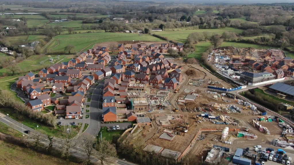
The NPPF 2026 supports economic growth by requiring substantial weight to be given to commercial development that enables businesses to invest, expand or adapt, particularly in nationally important sectors.
It also recognises the specific spatial needs of data centres, laboratories, freight, logistics, energy infrastructure and modern rural businesses.
That support is not a blank cheque: grid capacity, water, transport, landscape, noise and neighbouring uses may still decide whether the location works, so a persuasive growth case must explain both why the development is needed and why it belongs on that site.
Policy E2 requires substantial weight to be given to the economic benefits of commercial development that allows businesses to invest, expand or adapt, particularly where it supports the area's economic strategy, the Industrial Strategy, freight and logistics, Industrial Strategy Zones or AI Growth Zones.
Substantial weight is a direction within the planning balance. It is not a waiver of location, design or environmental tests.
The strongest growth cases will quantify the need and the benefit, explain why the use requires that particular location and show how infrastructure and operational effects will be addressed. The adjective cannot do the evidential work on its own.
The NPPF 2026 recognises that a modern economy has specific spatial needs. Plan-makers should consider knowledge, creative, high-technology and data-driven clusters; laboratories and campus facilities; data centres and associated generating capacity; electricity-network infrastructure; freight; logistics; and the modernisation of important rural and agricultural businesses.
None of that amounts to a generic permission for any commercial building. Location may be constrained by grid capacity, water and wastewater, power generation, transport networks, round-the-clock operation, noise and landscape.
Treat those matters as part of the development concept rather than as technical details added at the end. On a data centre or a large logistics scheme, they usually decide the site before they decide the design.
Market signals can evidence an undersupply of particular business land or premises, and locational requirements matter just as much. A proposal has a strong case where existing allocations genuinely cannot provide the grid connection, catchment, freight access, cluster relationship or co-location opportunity the use needs.
Freight and logistics proposals should demonstrate suitable network access, secure vehicle parking and an acceptable relationship with neighbouring uses. Rural businesses are supported where their location is necessary and their scale and effects are acceptable.
Policy TC2 also gives substantial weight to town-centre vitality and viability. This supports diversification, residential uses and mixed-use intensification where servicing, heritage, amenity and active frontages are properly resolved.
Planning for growth is also planning for place. The same principle becomes critical around stations, where national policy now links accessibility directly to development intensity.
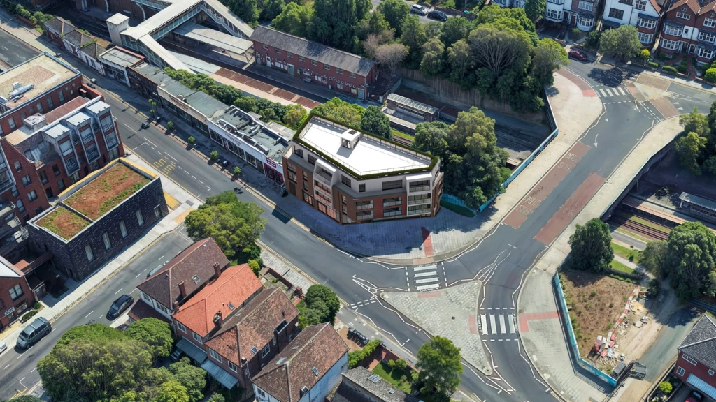
Under the NPPF 2026, suitable housing and mixed-use developments around well-connected train, tram and Underground stations will receive a “default yes”, creating a more supportive route to planning permission near stations.
This policy support is not limited to existing settlements. It also applies beyond settlement boundaries and within the Green Belt where the station-led exception and relevant safeguards are met.
Qualifying sites are generally expected to achieve at least 35 dwellings per hectare, rising to 45 where services operate at twice the minimum frequency.
A timetable and an 800-metre catchment do not prove that a site is genuinely accessible. The walking route, transport capacity, local services and infrastructure must support the proposed development intensity.
This stronger policy position is already encouraging developers, landowners and investors to look again at land around qualifying stations. The early interest in our research into qualifying stations and the best locations for new homes near stations suggests that the development industry is moving quickly to identify where new opportunities may arise.
A well-connected station is defined by both its location and service frequency. The definition covers railway, Underground, tram and light-rail stops.
The station must be within one of the top 80 Travel to Work Areas wholly or partly in England, ranked by gross value added. It must also provide at least four daytime services per hour overall, or two per hour in one direction, under the normal weekday timetable. Planned improvements may qualify where there is a reasonable prospect of delivery, including through an agreement with the operator.
Travel to Work Area rankings are fixed in five-year blocks, giving landowners and plan-makers a more stable basis for investment. Where qualification relies on a future service improvement, the evidence should identify the scheme, programme and commitment supporting it.
Policy L3 then applies the national density floors over the net developable area. The final thresholds are lower than the 40 and 50 dwellings per hectare proposed in the December 2025 draft, and no national floor applies around stations that fail the well-connected test.
Sites below the major development threshold may justify a lower density where the standard is inappropriate or impossible. Otherwise, proposals that fail to use qualifying land efficiently should be refused.
Reasonable walking distance is normally around 800 metres. A shorter catchment of approximately 10 minutes may apply where topography, poor route quality or physical barriers discourage walking. Where only part of a site qualifies, the policy applies only to that part.
The evidence should measure the publicly usable route between the station entrance and the site entrance residents would actually use. Large sites may require more than one route and a plan identifying the qualifying land.
A straight-line radius may help with initial screening, but it is not a final accessibility assessment. Where barriers affect the route, a repeatable audit should record the path, assumptions and walking speed.
The Department for Transport's Connectivity Tool can inform that evidence, but it does not replace site observation. Assess the actual route, crossings, gradients, lighting, legibility, accessibility and the services people need to reach.
A station can satisfy the Travel to Work Area and timetable tests while still having poor step-free access, unsafe crossings or an indirect route to homes and services. Qualification as a well-connected station does not prove that a scheme is inclusively accessible.
In my interpretation, the transport and design policies still require evidence about gradients, surfaces, lighting, personal safety, seating, wayfinding, wheelchair access and the everyday destinations that make reduced car use realistic.
Policy TR3 requires a vision-led transport approach. The starting question is the pattern of movement a place should enable, not a forecast that assumes existing car dependency must continue unchanged. The proposal must still address safety, network effects, public transport, walking, wheeling, cycling, servicing and parking.
Station qualification is not the same as accessibility. A station may meet the national geography and service-frequency tests yet still offer a poor step-free connection, an unsafe crossing or an indirect route to homes, services and everyday destinations. The evidence must therefore test the route as people will actually use it, including gradients, surfaces, lighting, personal safety, seating, wayfinding and wheelchair access.
That is why TR3’s vision-led approach matters. The starting point is the movement pattern a place should enable, rather than a traffic forecast that assumes car dependency must continue.
Public transport, walking, wheeling, cycling, servicing and parking must be considered together. Otherwise, a site can meet a timetable test without functioning as a genuinely sustainable neighbourhood.
The draft London Plan makes the distinction sharper. Its 90+ dwellings per hectare expectation for Green Belt growth is a plan-led approach for broad locations where density can be coordinated with masterplanning, transport, social infrastructure and services. It is not a target to be transferred mechanically to an isolated application.
The national station route can support individual proposals, but a sound case must still demonstrate real accessibility, infrastructure capacity and that the scheme will not prejudice comprehensive development.
TR6 retains a hard backstop. Development should be refused where it would cause a severe effect on the transport network or an unacceptable impact on highway safety, including through construction and cumulative effects.
The opportunity is therefore not simply to build more near stations, but to use well-connected locations to create places where everyday life depends less on the car and works better for people.
That takes the discussion from transport policy to design.
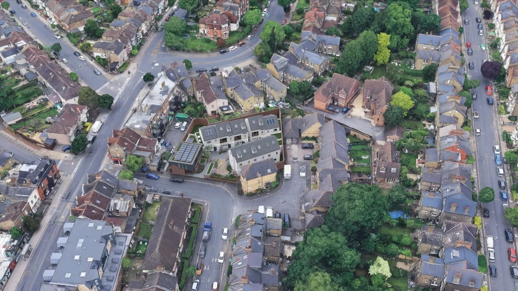
The NPPF 2026 connects design, character and density rather than treating them as competing objectives. It supports the efficient use of sustainable land, including minimum densities around qualifying stations, while retaining firm standards for context, movement, living conditions and climate resilience.
A higher housing number does not prove good design, just as existing character does not justify resisting all change. The task is to show how the proposed development intensity improves the place without causing unacceptable harm.
Policy L2 gives substantial weight to remediating and using vacant, underused or previously developed land. It also supports new homes through airspace development, mansard roofs, corner sites and appropriate development within residential curtilages.
Curtilage development has a national safeguard. New buildings should occupy no more than twice the footprint of all buildings on the site as they stood on 17 August 2026, while at least half of the existing undeveloped curtilage should remain. Larger schemes require evidence that they can be accommodated without harming local character, infrastructure or sustainability.
Policy L3 expects density to increase within settlements unless there is clear justification otherwise. However, density is measured over the net developable area, which excludes strategic infrastructure, parks, public squares and significant green infrastructure, biodiversity and drainage features.
Policy DP3 covers context, liveability, climate, nature, movement, built form, public space and identity. Poor design should be refused where it conflicts without justification with these principles or explicit development-plan standards.
Substantial weight applies to compliance with relevant local design policies. Outstanding or innovative design may also receive substantial weight where its form and layout remain appropriate to its surroundings.
The refreshed Building for a Healthy Life 2026 toolkit reinforces the same approach. Its 12 considerations cover integrated neighbourhoods, distinctive places and streets for all, with a stronger emphasis on active travel, green and blue infrastructure and the efficient use of land.
One comparison with the NPPF 2024 deserves attention. The earlier direction to apply daylight and sunlight policy flexibly where necessary for efficient land use is not repeated. Policy P3 instead requires acceptable light for occupiers and acceptable daylight and sunlight for neighbours.
My reading is that the station-density minima establish an important starting point, but they do not justify a scheme that falls below an acceptable living-environment standard. If anything, the removal of that flexibility makes the daylight case harder to win by pointing at a density floor.
A chartered architect's role is not simply to add design quality after the planning case has been made. It is to use density, daylight, movement, landscape, servicing and infrastructure to shape the planning case from the beginning.
The NPPF 2026 expects efficient use of land, but it also requires proposals to create good places. Drawings, visual material and technical evidence should therefore make the design logic visible.
Character should be treated as evidence, not as a veto. A proposal may sit comfortably within an existing pattern, repair a fragmented street or establish a new character where change is justified. The strongest schemes explain how their scale, form, streets, landscape and public spaces respond to the wider place, rather than relying on a superficial comparison of building styles.
In a sustainable location, a low-density scheme may need to explain why it does not make better use of land. Equally, higher density must still provide good living conditions and an appropriate relationship with neighbours.
The NPPF 2026 does not ask decision-makers to choose between density and design. It requires them to judge whether the proposed density is achieved through good design.
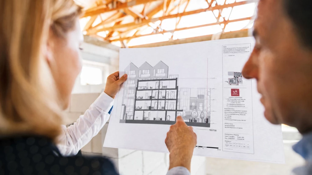
The NPPF 2026 is intended to make local planning decisions more proportionate, transparent and closely tied to the policy test that determines the application.
Its decision-making policies seek to reduce unnecessary information requests and avoidable delay, while requiring authorities to consider whether lawful conditions or planning obligations can make a proposal acceptable.
The framework does not remove professional judgment. It requires that judgment to be explained. A sound decision should identify the relevant policy route, the evidence on the material issues, any harm that remains after mitigation, and why that harm can or cannot be addressed through conditions or obligations.
Policy DM1 requires major applications to include a concise planning statement explaining policy compliance, engagement, responses to key concerns and the proposed use of planning obligations. Other applications should provide only the information needed for a sound decision.
DM2 reinforces that approach. Additional validation requirements should be supported by development-plan policy, proportionate to the scale and likely effects of the proposal, and tailored to major, medium and other development.
The policy challenges a report-by-default culture in which documents are commissioned because they appeared on previous applications rather than because the site raises the issue.
DM3 requires authorities to work positively and proactively, and to consider planning matters in a way that reflects the scale, complexity and likely effects of the proposal. Consultation should be limited to what is necessary. A decision should not wait indefinitely for consultee advice beyond the statutory deadline unless information is insufficient, public safety is at risk, or further advice could enable approval.
Before refusing an application, the authority should consider whether a lawful condition or planning obligation can make the proposal acceptable. DM7 also requires decision-makers to assume that other regulatory regimes will operate effectively, rather than duplicate controls without good reason.
This is one of the most important changes in the framework. A refusal should identify a real and unresolved planning harm, not a political difficulty, an incomplete consultation response or a general preference against development.
That does not mean an authority must repair an incomplete scheme. A material design flaw, unsafe access or unresolved protected-species issue may be incapable of being conditioned. The discipline works both ways: the application must be coherent, and the authority must distinguish between a fatal harm and a solvable issue.
Having spent more than 15 years in the built environment sector, I know that architects and planning consultants value a planning process that makes its reasoning transparent. The NPPF 2026 gives that expectation firmer support: decisions should be evidence-led, proportionate to the issues raised, and clear about whether conditions or obligations can make a proposal acceptable.
After prolonged planning permission timelines and inconsistent decision-making have frustrated applicants and practitioners alike, the real test will be whether those principles are applied consistently in practice.
Our experience as residential architects and town planners is that most applications turn on a small number of connected issues, rather than a single favourable headline policy. More often, the outcome turns on a small number of interlocking matters that need to be identified early, with a clear explanation of the evidence required to resolve them.
The essential distinction is between a concern that can be addressed through targeted information, a condition or an obligation, and a genuine planning harm that warrants refusal. Unless officers apply that discipline consistently, applicants will continue to look to appeal for the clarity and judgement that should have been provided at application stage.
Where unauthorised development was intentional, policy DM8 requires that fact to receive substantial weight. Retrospective permission should not be treated as a neutral fallback strategy.
The exception allowing more time for consultee advice will need careful use. In my view, it should relate to a defined issue, a realistic timetable and a genuine prospect of securing approval. It should not become a general reason to leave a complete application undetermined.

Appeals under the NPPF 2026 should focus more sharply on the correct policy route, the development plan and the evidence each gateway demands.
A broad claim that the framework supports growth will carry less force than a structured case addressing location, need, infrastructure, design, harm and mitigation in sequence.
A chartered planning consultant can map the case against the relevant national decision route, the development plan and the evidence required at each gateway. This means the argument is organised around the tests an authority or inspector must actually decide, while the contested issues are supported by site-specific evidence rather than a general claim that development should be supported.
Inspectors will still begin with the development plan and assess the material considerations. What has changed is that the consistency of local policy with the NPPF 2026 is now explicit, and national routes such as S4, S5, L3 and GB7 carry defined gateway tests.
For housing outside a settlement, that means proving an S5 category and the positive balance. For Grey Belt, it means the site assessment, the plan-area effect, unmet need, sustainable location and the Golden Rules. For station growth, it means the service, Travel to Work Area, walking distance, density and infrastructure evidence.
Our analysis of Grey Belt appeal decisions since the route was introduced in December 2024 shows inspectors working through each limb in sequence rather than reaching a general conclusion about housing need. I expect the same discipline under the renumbered tests, and appeal decisions remain illustrative of that approach rather than binding precedent.
Design and technical evidence remain decisive. A policy-compliant principle may still fail because the scheme causes unacceptable highways harm, substantial heritage or landscape harm, unsafe flood risk, ecological damage or a poor living environment.
Authorities should also frame refusals with more discipline. A reason should identify the policy, explain the specific harm and show why a condition, an obligation or mitigation cannot resolve it.
Generic character objections and reliance on materially inconsistent local wording are now considerably more vulnerable, and a well-judged planning appeal remains the proper corrective where a refusal cannot identify demonstrable harm.
During transition, the development plan may have been prepared under the NPPF 2024 while the decision and appeal must take the NPPF 2026 into account. Material inconsistency may reduce the weight of a local policy, but age alone does not.
An appeal should identify the precise conflict and explain its effect. Asking an inspector to discount an entire plan is weaker than showing why a specific policy produces a result inconsistent with the national rules.
Appeal should not be used to redesign an application or replace missing technical work. Late evidence adds cost and delay. The strongest appeal continues a coherent application and focuses on a genuine planning dispute.
Environment, climate and flood risk remain central to whether development is sustainable under the NPPF 2026. The framework supports climate mitigation and adaptation while still requiring proposals to manage flood risk, drainage, biodiversity, trees, agricultural land and long-term resilience.
These are not reports to add once capacity has been fixed. They may change the developable area, the layout, the levels and the number of homes.
Climate policy supports mitigation and adaptation, including renewable and low-carbon energy, sustainable drainage, overheating control, green infrastructure and measures responding to future flood and wildfire risk.
Flood policy is more precise than some summaries of the December 2025 draft suggested. A site at risk only from surface water flooding is not automatically exempt from the sequential test. The exception applies where a site-specific flood-risk assessment shows that layout, design and mitigation keep occupiers safe for the lifetime of the development without increasing risk elsewhere.
Sustainable drainage should follow the National Standards and be integrated into the place. Storage, exceedance routes, water quality, maintenance and long-term management should be established early enough to influence levels, streets and landscape.
Policy F8 now adds a more specific direction for sites containing or affecting watercourses: proposals should not enclose an existing watercourse unless there are compelling reasons, and should, where possible, remove existing culverts and renaturalise river channels unless that would increase flood risk or cause environmental or heritage harm.
This is not a narrow engineering point. A watercourse can alter the developable area, access position, drainage hierarchy, landscape structure and therefore the value assumed for the land. On a constrained site, the correct question is not whether the channel can be engineered around after the housing number has been set.
It is whether the scheme can use water as part of a credible drainage, biodiversity and place-making strategy from the beginning. A late culvert solution may now be harder to defend, while a well-designed restoration proposal may resolve several policy objectives at once.
At plan-making stage, policy N1 allows Biodiversity Net Gain standards above the statutory requirement only for specific site allocations where the higher standard is fully justified and deliverable.
For applications, N2 says decision-makers should not give weight to other local policies seeking more than the statutory framework, and higher local standards should not apply to development exempt from the statutory regime.
Policy N2 requires proposals to minimise biodiversity harm, strengthen ecological networks and incorporate features for priority or threatened species. Integrated nest boxes, commonly known as swift bricks, should be incorporated unless compelling technical reasons would prevent their use or make them ineffective.
Trees and landscape should be treated as structure rather than decoration. New streets should be tree-lined unless there are strong reasons otherwise, and schemes should address canopy growth, utilities, drainage, rooting volume, long-term management and climate resilience.
Agricultural land quality must also be considered. Where significant development of agricultural land is necessary, poorer-quality land should be used where possible. Best and most versatile land remains grades 1, 2 and 3a.
The framework disperses environmental control across climate, energy and water, flood, pollution, transport and nature policies. My interpretation is that compliance should be demonstrated as one integrated strategy rather than a stack of independent reports.
A drainage solution that removes usable landscape, or a density response that leaves no viable rooting or habitat space, may solve one policy while creating a failure under another.
Let the environmental strategy generate the layout instead of decorating it once the design is fixed. Drainage levels, tree retention, habitat connections, energy demand and overheating all alter capacity and form, and addressing them early tends to increase certainty as well as environmental performance.
Late technical reports and unsupported local targets produce the same outcome: redesign, without a dependable answer at the end of it.
The same instinct, designing around a requirement rather than retrofitting it, runs through the framework's accessibility expectations.

The NPPF 2026 places accessible and specialist housing within mainstream housing delivery rather than treating it as an afterthought. For new plans, major developments are generally expected to provide at least 40% of homes to M4(2), subject to stated exemptions, while M4(3) provision should respond to evidenced wheelchair-user need.
That 40% figure is a plan-making expectation, so it should not be imposed mechanically on every current application without regard to the adopted plan and the transitional position. Real accessibility also extends well beyond the dwelling, to step-free routes, parking, entrances, lifts, refuse facilities and the wider neighbourhood.
Policy HO5 treats the M4(2) requirement as a site-level expectation for major development rather than a plan-wide average.
Crucially, HO5 is a plan-making policy. Its application to a current proposal will depend on the adopted plan, transitional position, any exemption and the available evidence. It should not be presented as a national decision-making condition that applies mechanically to every application.
In my experience, that distinction is easy to state but often mishandled in planning statements.
Local plans should also respond to evidenced need for M4(3) wheelchair-user dwellings. The required mix should reflect need, viability, site suitability and the relationship between planning policy and the Building Regulations.
The framework continues to require homes for older and disabled people, families, students, renters, self-builders and those requiring specialist or supported accommodation.
Substantial weight should be given to proposals meeting evidenced housing needs. The application should explain the need, tenure, management model, accessibility specification and residents’ access to services and public transport.
Accessible design begins beyond the front door. Step-free routes, gradients, thresholds, parking, drop-off, refuse, cycle storage, lifts, communal spaces, lighting and landscape all affect whether a home can be used comfortably over time.
Inclusive design is easiest and cheapest when it is resolved before cores, levels, parking and external routes are fixed. The 40% expectation should improve consistency, but the specification of a dwelling is only part of the test.
A home is not genuinely accessible if the route from the pavement, the parking space, the refuse store or the station remains difficult to use. That is the same argument the station policies raise, applied at the scale of a single household.

The NPPF 2026 defines medium housing development as between 10 and 49 homes on a site of up to 2.5 hectares. This creates a clearer middle category for planning and validation, but medium schemes remain major development unless a policy states otherwise.
The objective is to diversify housing delivery and allow information requirements and local delivery strategies to respond more proportionately to schemes between small infill and large strategic development. It does not lower standards for design, transport, drainage, ecology or affordable housing, create an automatic fast track, remove policies applying to major development or establish a general right to provide affordable housing off site.
Policy HO6 requires local plans to identify at least 10% of the housing requirement on sites no larger than one hectare, and a further 10% on sites between one and 2.5 hectares, unless there are strong reasons this cannot be achieved.
That dual allocation requirement should diversify supply. Large strategic sites remain essential, but they can be delayed by infrastructure, land assembly, market absorption and complex phasing.
The economics of developing small sites and medium sites are different. They may enter the market more quickly and support SME builders, different design approaches and a wider range of locations.
Proportionality means matching evidence to the site’s risks rather than lowering the substantive standard. A medium scheme may still require detailed transport, drainage, ecology, design or viability evidence where those issues arise.
Policy HO8 retains on-site affordable housing as the default. Off-site provision may be accepted where it would improve the quality or quantity of affordable housing, while a cash contribution requires robust justification and must support mixed and balanced communities.
The broader cash-in-lieu flexibility proposed for medium sites in the December 2025 draft was not retained. I think the Government was right to remove it. Mixed communities are built on sites, not in contribution ledgers.
Medium sites matter because they provide another credible route to delivery, not because they avoid the obligations applied to major development. Whether those obligations can be reduced through viability is a separate question.
Under the NPPF 2026, viability is an exceptional mechanism for dealing with a material difference between the site and the assumptions tested in the plan. A review may be justified where abnormal costs, unusual site characteristics or changed economic circumstances genuinely alter the position.
The price paid for land is not a reason to reduce policy compliance. Any appraisal must be transparent and should seek the maximum reasonable contribution, and public benefits matter only when they are specific, deliverable and capable of being secured.
Policy DM5 begins from the assumption that development complying with plan requirements is viable, and confines site-specific appraisal to defined circumstances: a development type or site characteristics materially different from those the plan's viability evidence tested, demonstrable costs that evidence did not take into account, and significant changes in site or economic circumstances, such as a recession.
Even then, the purpose of the appraisal is to secure the maximum possible contribution to affordable housing and infrastructure. The price paid for land, including through an option agreement, is not a justification for failing to comply with plan policies.
The proposed annex of standardised viability inputs consulted on in December 2025 has not been carried into the final framework itself. Instead, DM5 requires every appraisal to be based on the assessment that informed the relevant plan policies, to follow the recommended viability approach including the standardised inputs it sets out, to evidence all assumptions fully, to explain any departures and to be made publicly available.
Green Belt housing has a tighter regime under GB8. A viability review is available only for the specified categories: previously developed land with abnormal costs related to its former development, a strategic site, or a development type wholly different from that tested in the plan.
Even where a review is justified, the objective is the maximum reasonable contribution. A result significantly below the Golden Rules requires exceptional and fully evidenced justification.
One related discipline is easy to miss. Reusing or redeveloping a vacant building earns a proportionate floorspace credit against affordable housing contributions, but the credit does not apply to abandoned buildings, or to major housing development on land within or released from the Green Belt, where the Golden Rules govern instead.
That has direct consequences for development-site acquisition. Bids, options and promotion agreements should reflect policy costs before the price is fixed. A developer who overpays cannot expect the planning system to convert that commercial decision into fewer affordable homes or weaker infrastructure.
Those viability disciplines protect a wider principle: public benefit should shape the proposal from the outset, rather than become the residual outcome after costs and land value have been fixed. A development’s benefits may include market and affordable homes, remediation, infrastructure, improved access, green space, biodiversity, economic activity and placemaking. Their relevance to the planning balance depends on whether they are real, proportionate to the proposal and capable of delivery.
Public benefit is also a question of design quality. A successful scheme should support daily living through convenient access to public transport and community services, while creating places in which people can feel connected and at home. The draft Design and Placemaking Planning Practice Guidance (PPG) points in the same direction, emphasising a balanced mix of housing types and tenures that responds to local need, market conditions and the needs of people at different stages of life.
The planning balance should therefore do more than list possible benefits. It should identify what will be delivered, when it will be delivered and how it will be secured. A promised health contribution, public route, affordable home or green space has limited weight if its delivery is uncertain. Conditions and planning obligations matter because they turn a claimed benefit into a dependable outcome.
For applicants, this means bringing layout, tenure, infrastructure, access and delivery into one coherent proposal. For authorities, it means testing the benefits that can actually be relied upon, not merely those presented in a planning statement. The final question is practical: what public outcome can this development credibly fund, secure and build?

The first task is to identify the exact decision route and the evidence capable of satisfying it. Everything else follows from that choice, and getting it wrong is now more expensive than it used to be.
Is the site inside a settlement under S4, within an S5 category outside it, on previously developed land, on Grey Belt or near a well-connected station? If the Green Belt applies, use GB7 and GB8 rather than relying on the general unmet-need route.
Instruct planning appraisal and commission evidence in the order that may change the design: transport and walking routes, Green Belt contribution, landscape and heritage, access, flood risk and drainage, ecology, trees, utilities, housing need and viability.
The purpose is not to accumulate reports. It is to find the design the evidence can support.
On a complex or strategically sensitive site, pre-application planning advice may help test the policy route and the information the authority is likely to need before the design for RIBA Stage 3 is fixed.
Landowners should also revisit value expectations. Affordable housing, infrastructure, green space, biodiversity, remediation and design quality all need to be reflected in acquisition and promotion terms.
A headline policy opportunity is not a consented, serviced site.
Authorities should audit development-plan policies for material inconsistency, remove duplicated validation requirements and keep housing supply and delivery evidence current.
Officers and committees will need to understand the national decision-making routes and distinguish between matters that justify refusal and those that may be resolved through conditions or obligations. A local policy that unnecessarily restates a national test may now create vulnerability at appeal.
The NPPF 2026 applies to decisions from 17 August 2026, while the framework governing plan preparation depends on the plan’s type and stage.
Draft wording is not operative policy. Planning statements should identify the applicable final policy and explain how it works alongside the development plan.

My support for the NPPF 2026 is clear. It is the most serious attempt since 2012 to make national planning policy operate as a decision-making framework rather than a collection of aspirations.
Much of the public attention for this new version of the NPPF has focused on Grey Belt, station-led housing, housing delivery and accessible homes.
Yet, as I noted in my interview with the Royal Institute of British Architects (RIBA) when the December 2025 draft was published, its real significance lay not in any single policy amendment but in its attempt to re-engineer the decision-making environment.
That is why I support the final framework. It places responsibility where it belongs. Applicants must identify the correct route and provide the evidence needed to satisfy it. Local authorities must identify any remaining harm and explain why mitigation, conditions or obligations would not resolve it. That is healthier than allowing outdated settlement boundaries, duplicated local policies or unanswered consultations to stand in for planning judgement.
The final framework is also better judged than the December 2025 draft. The material inconsistency test is more workable, the station geography is broader, the density floors are more realistic and the untested viability annex has been removed. The Government listened without abandoning the pro-development direction of the reform.
The most important reform is structural. Separating plan-making from decision-making should make it harder for local policies to quietly recast national tests or introduce additional barriers to otherwise acceptable development.
The new routes for development within settlements, on previously developed land, on qualifying Grey Belt and around well-connected stations should also move debate away from whether growth is acceptable in principle and towards the quality, effects and deliverability of the proposal.
I particularly support the move towards assessing Green Belt land by the strategic function it performs. That is not a weakening of Green Belt policy. It is a more honest form of protection that directs development towards less sensitive land while requiring affordable housing, infrastructure and accessible green space in return.
The recognition of small and medium sites is equally important. A resilient housing pipeline cannot depend entirely on a handful of strategic allocations that may take years to deliver. Smaller sites, underused urban land and well-designed intensification must be treated as part of the housing strategy rather than an administrative inconvenience.
The first weakness is timing. The decision-making policies took effect immediately, but important guidance on viability, review mechanisms, model conditions, Section 106 agreements, neighbourhood plans and specialist housing remains unfinished.
Removing the untested viability annex was sensible, but leaving the replacement guidance unresolved creates another risk. Viability must remain a genuine exception for unusual sites and changed circumstances, not a routine second negotiation over affordable housing and infrastructure. Clear national assumptions and transparent evidence are still needed. Without them, the NPPF 2026 risks reproducing the unpredictable planning system it is intended to improve.
The larger problem is that planning permission is not housing delivery. The NPPF may make the principle of development easier to establish, but it cannot reduce borrowing costs, provide contractor capacity, finance a new school, increase water supply or move a scheme through the Building Safety Regulator. A larger stock of permissions will mean little unless those permissions become serviced sites and completed homes.
The minimum ten-year local-plan period also looks short when reservoirs, hospitals, railway improvements, utilities and new settlements require much longer investment horizons. Strategic planning may look 25 years ahead, but local allocations and infrastructure programmes must be capable of carrying that strategy through.
Station-led growth presents a similar concern. Expanding the policy to the top 80 Travel to Work Areas was an improvement, but the service-frequency test may still exclude sustainable locations where housing growth could help justify better services.
As I argued in my earlier analysis of the draft, the Government should avoid trapping places in a cycle where development is refused because train services are limited and services remain limited because growth is refused.
The 35 and 45 dwellings per hectare requirements should therefore be treated as minimums, not design targets. In highly accessible urban areas, stopping at the national floor may underuse scarce land. Equally, density must be earned through daylight, amenity, landscape, movement and coherent townscape rather than imposed as a numerical exercise.
Environmental policy also needs greater precision. A pro-development framework does not require weaker environmental safeguards. It requires earlier, clearer and more measurable requirements so that flood risk, drainage, biodiversity, trees and climate resilience shape the design without becoming unpredictable obstacles late in the process.
The Government should publish the remaining guidance to a fixed timetable, provide worked examples for the most contested terms and establish a formal implementation review. That review should examine how “materially inconsistent”, “reasonable prospect”, “physically well-related” and “reasonable walking distance” are being interpreted before inconsistent local practice hardens into appeals and litigation.
Local planning authorities should audit their policies, retrain officers and committees and adopt a consistent structure for decision reports. Each report should identify the relevant national route, the development-plan position, the evidence for each gateway and any harm that remains after mitigation.
Statutory or internal consultation should not operate as a silent veto. Where advice is genuinely critical, the authority should identify the outstanding question and set a timetable for resolving it. Where the issue can be addressed through a lawful condition or obligation, refusal should not be the safer institutional choice.
Local democracy still matters, but localism is not the same as inconsistency. Communities should shape growth through current plans, site allocations, infrastructure priorities and design expectations. They should not be able to avoid national housing need indefinitely through an obsolete plan or an unexplained preference for no change.
The success of the NPPF 2026 should ultimately be judged by completed homes, affordable housing, infrastructure and better places rather than the number of permissions granted or policies cited. The framework has made support for development clearer. The remaining task is to ensure that the planning system can finance, service, design and deliver that development.
Our work as a multidisciplinary firm of residential architects and town planners places us at the point where national policy, site constraints and development design meet. Through our experience of urban housing, Green Belt and station-led schemes, we have found that success increasingly depends on identifying the correct policy route before the design and the land assumptions harden. The framework can create opportunity, but only a scheme that resolves these connected questions can turn that opportunity into a robust application or appeal.
We look forward to learning how we can help you. Simply fill in the form below and someone on our team will respond to you at the earliest opportunity.
The latest news, updates and expert views for ambitious, high-achieving and purpose-driven homeowners and property entrepreneurs.
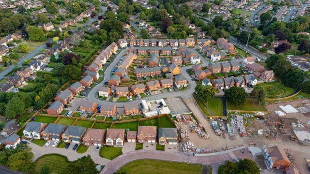

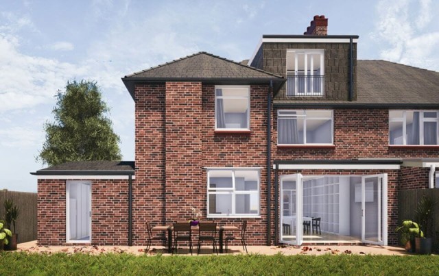




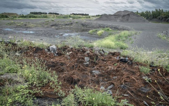
We specialise in crafting creative design and planning strategies to unlock the hidden potential of developments, secure planning permission and deliver imaginative projects on tricky sites
Write us a message